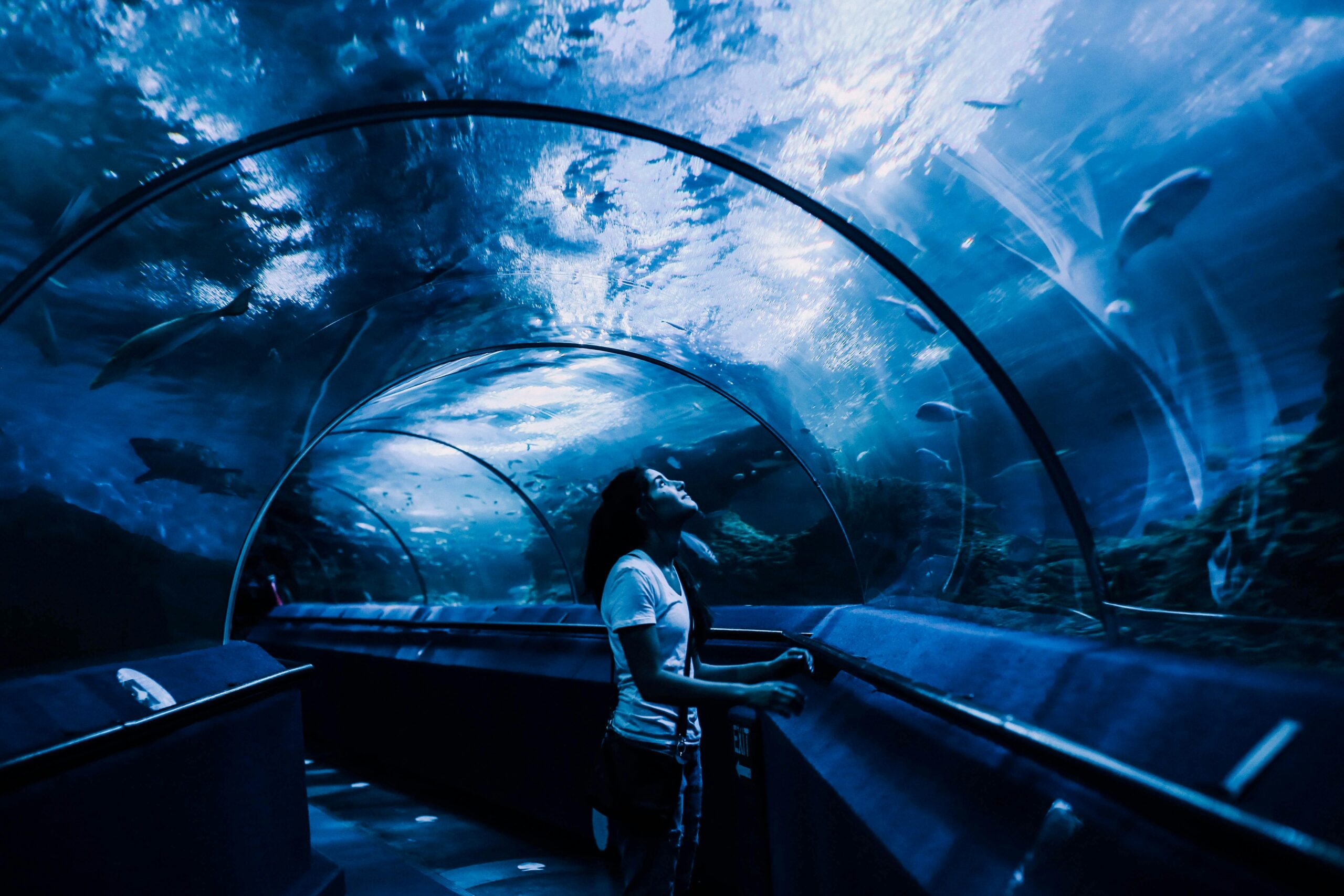
Side-scan sonar technology is transforming underwater exploration, enabling unprecedented detection capabilities for marine archaeologists, researchers, and survey professionals worldwide. 🌊
Understanding the Evolution of Underwater Detection Systems
The quest to explore what lies beneath the ocean’s surface has captivated humanity for centuries. Traditional methods of underwater exploration were limited, expensive, and often dangerous. However, the advent of side-scan sonar technology has revolutionized how we map, detect, and study underwater environments with remarkable precision and efficiency.
Side-scan sonar systems emit acoustic waves that travel through water and bounce back when they encounter objects or changes in the seafloor topography. Unlike conventional sonar that only looks directly beneath a vessel, side-scan sonar creates detailed imagery of areas extending hundreds of meters on either side of the towfish or mounted device, providing comprehensive coverage of vast underwater territories.
This technology has become indispensable across multiple industries, from maritime archaeology and environmental monitoring to infrastructure inspection and defense applications. The ability to visualize underwater features with photographic-like clarity has opened new frontiers in our understanding of marine environments and historical underwater sites.
How Cutting-Edge Side-Scan Sonar Technology Works 🔍
The fundamental principle behind side-scan sonar involves sophisticated acoustic engineering. A transducer mounted on a towfish or hull-mounted device emits sound pulses at specific frequencies, typically ranging from 100 kHz to over 1 MHz depending on the application requirements.
When these acoustic waves encounter the seafloor or objects, they reflect back to the receiver. The system measures the intensity and timing of these return signals, converting them into detailed grayscale images that reveal underwater topography, structures, and anomalies with exceptional clarity.
Key Components of Modern Side-Scan Systems
Contemporary side-scan sonar systems comprise several integrated components that work in harmony:
- Towfish or Hull-Mounted Transducer: The primary acoustic emission device that sends and receives sonar pulses
- Tow Cable: Provides power and data transmission between the vessel and towfish
- Topside Processing Unit: Sophisticated computer systems that interpret acoustic data and generate imagery
- Display Interface: Real-time visualization software showing sonar returns and processed images
- Data Storage Systems: High-capacity recording devices for post-mission analysis
- GPS Integration: Precise positioning systems for accurate georeferencing of detected features
The integration of these components creates a comprehensive detection system capable of operating in various water depths and environmental conditions, from shallow coastal waters to deep ocean trenches.
Revolutionary Applications Transforming Multiple Industries
The versatility of side-scan sonar technology has established it as an essential tool across numerous professional domains. Each application leverages the unique capabilities of acoustic imaging to solve specific challenges and advance their respective fields.
Marine Archaeology and Historical Discovery
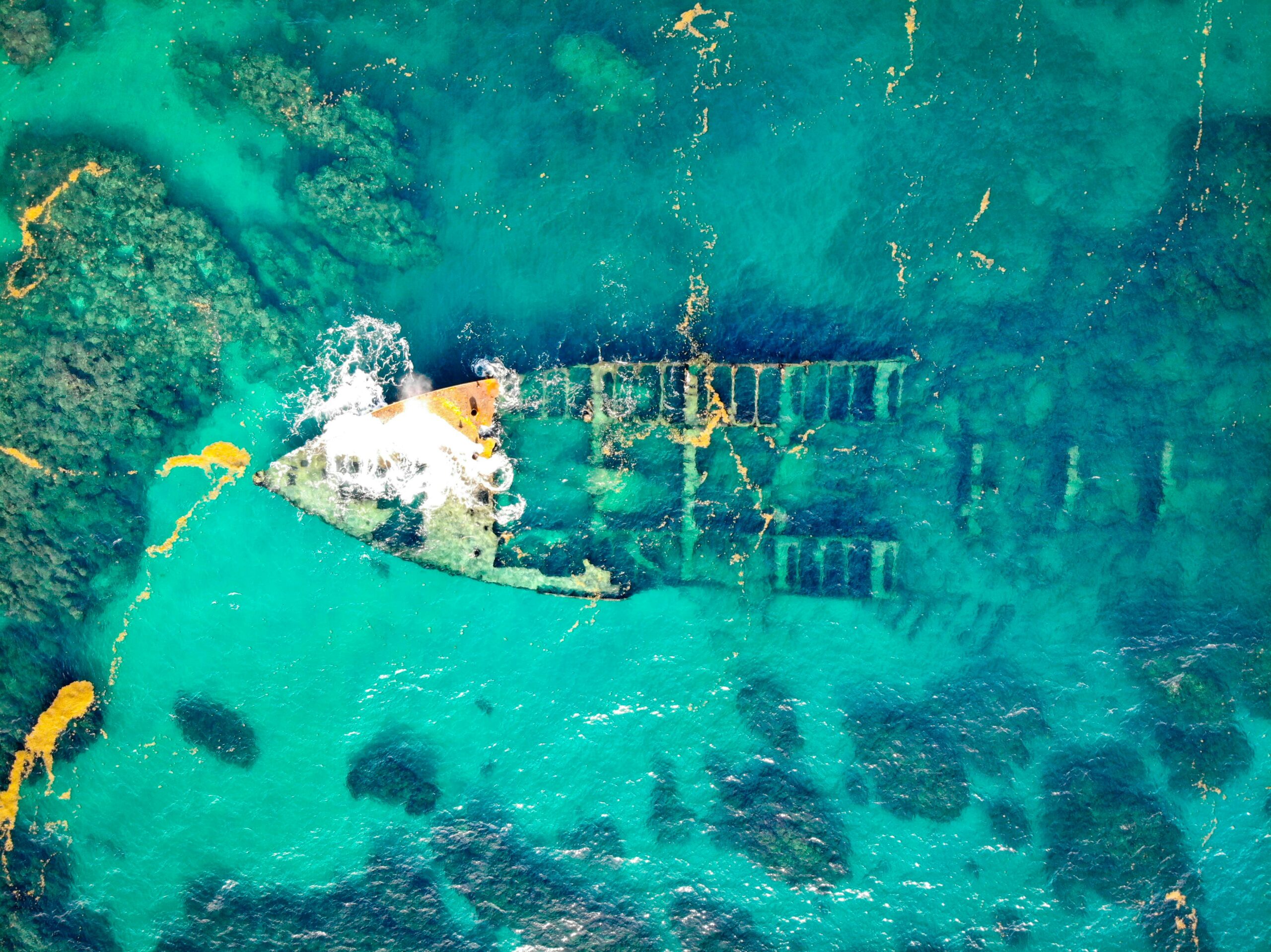
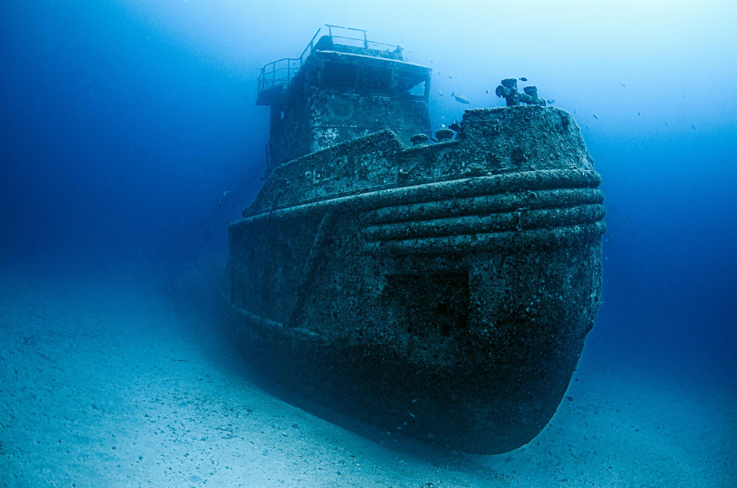
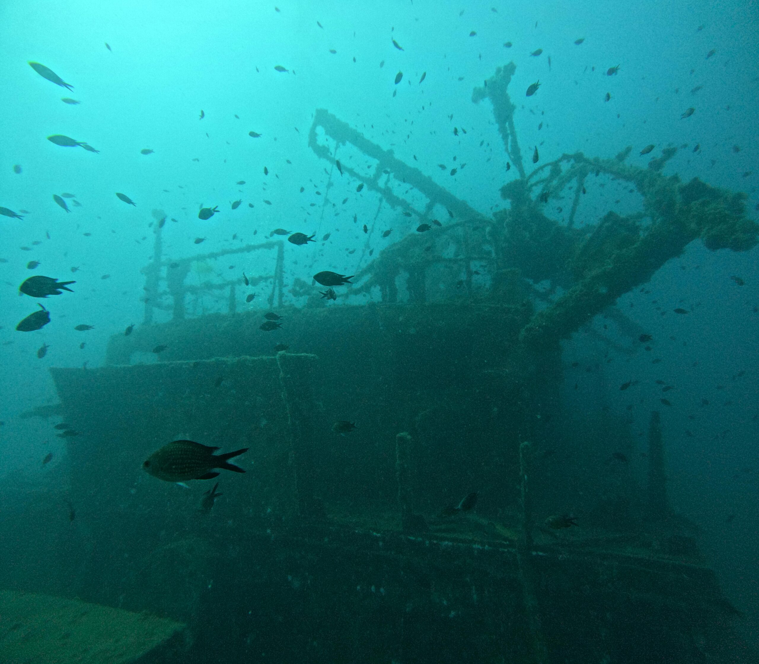
Perhaps no field has been more dramatically impacted than marine archaeology. Side-scan sonar enables researchers to locate shipwrecks, submerged settlements, and lost artifacts without disturbing sensitive sites. The technology has facilitated the discovery of historically significant vessels, from ancient trading ships to World War II submarines, providing invaluable insights into human history.
Archaeological surveys that once required months of visual inspection can now be completed in days, with comprehensive coverage and detailed documentation. This efficiency allows researchers to identify promising sites for further investigation while creating permanent records of underwater cultural heritage.
Environmental Monitoring and Habitat Mapping 🐠
Environmental scientists utilize side-scan sonar to monitor marine ecosystems, map benthic habitats, and assess environmental changes over time. The technology reveals critical information about seafloor composition, vegetation coverage, and habitat structure essential for conservation efforts.
Researchers can identify coral reef systems, seagrass beds, and other vital marine habitats, tracking their health and extent. This data informs conservation strategies, marine protected area designations, and environmental impact assessments for coastal development projects.
Infrastructure Inspection and Maintenance
The maritime infrastructure sector depends heavily on side-scan sonar for inspecting pipelines, cables, bridges, dams, and port facilities. Regular surveys detect potential problems before they become critical failures, ensuring safety and preventing costly repairs.
Utility companies employ this technology to monitor underwater power cables and communication lines, while port authorities use it to assess channel conditions, locate obstructions, and plan dredging operations. The ability to inspect infrastructure without divers reduces costs and eliminates human risk.
Search and Recovery Operations
When aircraft, vessels, or other objects are lost at sea, side-scan sonar becomes the primary search tool. Search and rescue teams, accident investigators, and recovery specialists rely on its wide coverage area and detailed imaging to locate targets efficiently in challenging underwater environments.
High-profile recovery operations, from commercial aircraft to recreational vessels, have successfully employed side-scan sonar to locate wreckage and support investigation efforts. The technology dramatically reduces search times compared to traditional methods.
Latest Technological Advancements Pushing Boundaries
The side-scan sonar industry continues evolving rapidly, with manufacturers introducing innovations that enhance resolution, range, and analytical capabilities. These advancements are expanding what’s possible in underwater detection and mapping.
Enhanced Resolution and Frequency Options
Modern systems offer multiple frequency options within a single device, allowing operators to optimize performance for specific conditions. High-frequency systems (900 kHz – 1800 kHz) provide exceptional detail for shallow water surveys, revealing objects as small as a few centimeters.
Lower frequency systems (100 kHz – 400 kHz) sacrifice some resolution for extended range, enabling surveys in deeper waters with broader coverage. Dual-frequency systems offer the best of both worlds, switching between frequencies based on mission requirements.
Real-Time Processing and Artificial Intelligence 🤖
Artificial intelligence and machine learning algorithms are revolutionizing data interpretation. These systems automatically identify targets, classify objects, and detect anomalies, significantly reducing the time analysts spend reviewing sonar imagery.
Real-time processing capabilities allow operators to make immediate decisions during surveys, adjusting parameters or investigating targets of interest without waiting for post-processing. This responsiveness improves survey efficiency and ensures critical features aren’t missed.
Synthetic Aperture Sonar (SAS)
Synthetic Aperture Sonar represents a quantum leap in sonar technology. By combining multiple acoustic returns during platform movement, SAS creates imagery with resolution approaching that of optical photographs, regardless of range from the target.
This technology maintains consistent resolution across the entire swath width, eliminating the degradation typical in traditional side-scan systems. The result is photographic-quality imagery suitable for detailed analysis and identification.
Autonomous Underwater Vehicles (AUV) Integration
The marriage of side-scan sonar with autonomous underwater vehicles creates powerful survey platforms capable of operating independently for extended periods. AUVs equipped with side-scan systems execute pre-programmed missions, collecting data in areas too dangerous or impractical for manned vessels.
These autonomous platforms reduce operational costs, improve data quality through consistent survey parameters, and enable surveys in extreme environments. They represent the future of systematic underwater mapping and detection.
Selecting the Right Side-Scan Sonar System for Your Needs
Choosing appropriate side-scan sonar equipment requires careful consideration of multiple factors. Understanding your specific requirements ensures optimal performance and return on investment.
Critical Selection Criteria
| Factor | Considerations | Impact on Performance |
|---|---|---|
| Operating Depth | Maximum depth of survey area | Determines system pressure rating and cable requirements |
| Target Resolution | Size of objects to detect | Influences frequency selection and system sophistication |
| Coverage Area | Range needed per survey pass | Affects frequency choice and towfish size |
| Platform Type | Vessel, AUV, or ROV deployment | Determines mounting configuration and power requirements |
| Environmental Conditions | Water clarity, currents, bottom type | Influences system design and operational procedures |
Budget considerations naturally play a role, but focusing solely on initial cost can prove shortsighted. Total cost of ownership, including maintenance, training, and software updates, provides a more accurate assessment of long-term investment requirements.
Best Practices for Optimal Side-Scan Sonar Operations 📊
Successful side-scan sonar surveys require more than advanced equipment. Proper planning, execution, and data processing techniques ensure high-quality results and successful mission outcomes.
Survey Planning and Preparation
Thorough pre-mission planning significantly impacts survey success. Operators should review available nautical charts, previous survey data, and environmental forecasts. Determining optimal survey line spacing, towfish altitude, and vessel speed ensures complete coverage without data gaps.
Understanding target characteristics helps operators select appropriate frequencies and system settings. Small targets require high frequencies and slower survey speeds, while broad area searches benefit from lower frequencies and faster coverage rates.
Data Collection Techniques
Maintaining consistent towfish altitude above the seafloor ensures uniform image quality across the survey area. Most applications benefit from altitudes between 10-20% of the desired range, though specific conditions may require adjustments.
Survey line overlap, typically 10-25%, provides continuity and ensures no features are missed between adjacent passes. Properly overlapped lines enable mosaic creation and facilitate target verification from multiple angles.
Post-Processing and Analysis
Raw sonar data requires processing to maximize interpretability. Modern software applies corrections for slant range, vessel motion, and acoustic anomalies, producing geometrically correct imagery suitable for measurement and analysis.
Experienced analysts review processed imagery to identify targets, classify features, and extract meaningful information. Combining sonar data with bathymetry, GPS positioning, and supplementary sensor information creates comprehensive site models supporting informed decision-making.
Overcoming Challenges in Underwater Acoustic Imaging
Despite remarkable capabilities, side-scan sonar technology faces limitations and challenges that operators must understand and address for successful deployments.
Environmental Factors
Water column properties significantly affect acoustic propagation. Temperature layers, salinity gradients, and suspended sediments can refract sound waves, creating artifacts or reducing image quality. Understanding local oceanographic conditions helps operators anticipate and mitigate these effects.
Strong currents complicate towfish positioning and vessel navigation, potentially causing data gaps or geometric distortions. Calm conditions with minimal current provide ideal survey environments, though operational requirements often demand work in less favorable conditions.
Interpretation Challenges 🎯
Sonar imagery interpretation requires training and experience. Acoustic shadows, multiple reflections, and seafloor geology create complex patterns that can confuse inexperienced operators. Regular training and review of known targets builds interpretation skills essential for accurate analysis.
Biological features, such as fish schools or dense vegetation, can obscure seafloor features or create false targets. Understanding these natural phenomena prevents misidentification and supports accurate reporting.
The Future Landscape of Underwater Detection Technology
Side-scan sonar technology continues advancing rapidly, with emerging innovations promising even greater capabilities. Understanding these trends helps organizations plan investments and prepare for future opportunities.
Miniaturization trends are producing capable systems in increasingly compact packages. Small, lightweight side-scan units suitable for small vessels and portable deployment platforms democratize access to professional-grade underwater detection capabilities.
Cloud-based data processing and storage solutions enable collaborative analysis and data sharing among distributed teams. Researchers worldwide can access survey data, contribute to interpretation efforts, and build comprehensive databases of underwater features.
Integration with other sensor technologies, including multibeam echosounders, sub-bottom profilers, and optical systems, creates comprehensive survey platforms capturing multiple data types simultaneously. This sensor fusion provides unprecedented understanding of underwater environments.
Maximizing Your Investment in Sonar Technology 💡
Organizations deploying side-scan sonar systems should implement strategies maximizing technology value and ensuring long-term success. Comprehensive operator training programs develop skills necessary for effective system operation and data interpretation.
Regular equipment maintenance following manufacturer guidelines prevents failures and extends system lifespan. Establishing preventive maintenance schedules, maintaining spare parts inventory, and documenting system performance ensures reliable operations when missions depend on it.
Engaging with user communities, attending industry conferences, and participating in training workshops keeps operators current with best practices and emerging techniques. The side-scan sonar community actively shares knowledge and experiences, benefiting all practitioners.

Transforming Our Understanding of Underwater Worlds
Side-scan sonar technology has fundamentally changed how humanity explores and interacts with underwater environments. From revealing ancient shipwrecks to monitoring critical marine habitats, these systems provide unprecedented windows into realms previously hidden from view.
The ongoing technological evolution promises even more remarkable capabilities, with higher resolutions, longer ranges, and intelligent processing systems expanding what’s possible. Organizations across industries increasingly recognize side-scan sonar as essential infrastructure for underwater operations, research, and exploration.
As systems become more accessible and user-friendly, new applications continue emerging. The democratization of professional-grade underwater detection technology enables smaller organizations, research institutions, and conservation groups to conduct sophisticated surveys previously reserved for well-funded programs.
The revolution in site detection powered by cutting-edge side-scan sonar technology has only begun. Future innovations will undoubtedly reveal even more about the 70% of our planet covered by water, supporting scientific discovery, historical preservation, environmental protection, and safe maritime operations for generations to come.
Whether you’re an archaeologist searching for lost history, an environmental scientist monitoring precious ecosystems, an engineer maintaining critical infrastructure, or a recovery specialist locating lost assets, modern side-scan sonar technology provides the tools necessary for success in the challenging underwater domain. 🌊

Toni Santos is a visual storyteller and archival artist whose work dives deep into the submerged narratives of underwater archaeology. Through a lens tuned to forgotten depths, Toni explores the silent poetry of lost worlds beneath the waves — where history sleeps in salt and sediment.
Guided by a fascination with sunken relics, ancient ports, and shipwrecked civilizations, Toni’s creative journey flows through coral-covered amphorae, eroded coins, and barnacle-encrusted artifacts. Each piece he creates or curates is a visual meditation on the passage of time — a dialogue between what is buried and what still speaks.
Blending design, storytelling, and historical interpretation, Toni brings to the surface the aesthetics of maritime memory. His work captures the textures of decay and preservation, revealing beauty in rust, ruin, and ruin’s resilience. Through his artistry, he reanimates the traces of vanished cultures that now rest on ocean floors, lost to maps but not to meaning.
As the voice behind Vizovex, Toni shares curated visuals, thoughtful essays, and reconstructed impressions of archaeological findings beneath the sea. He invites others to see underwater ruins not as remnants, but as thresholds to wonder — where history is softened by water, yet sharpened by myth.
His work is a tribute to:
The mystery of civilizations claimed by the sea
The haunting elegance of artifacts lost to time
The silent dialogue between water, memory, and stone
Whether you’re drawn to ancient maritime empires, forgotten coastal rituals, or the melancholic beauty of sunken ships, Toni welcomes you to descend into a space where the past is submerged but never silenced — one relic, one current, one discovery at a time.