The ocean floor holds countless mysteries waiting to be unveiled, and modern photogrammetry is transforming how we capture, document, and understand these hidden underwater worlds.
🌊 The Dawn of a New Era in Marine Documentation
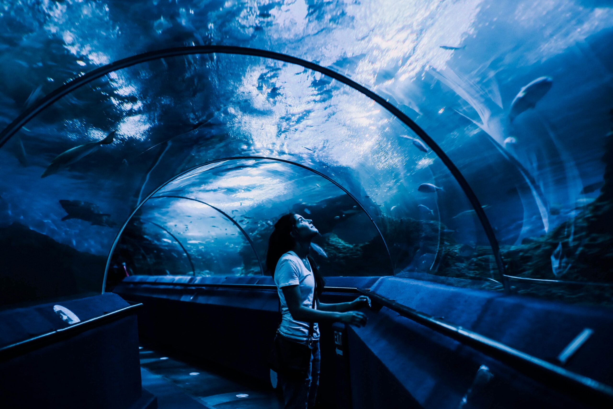
Underwater exploration has always captured human imagination, from ancient pearl divers to modern deep-sea submersibles. However, traditional methods of documenting underwater environments have been plagued by challenges including poor visibility, equipment limitations, and the ephemeral nature of marine ecosystems. Today, cutting-edge photogrammetry techniques are revolutionizing how scientists, archaeologists, and conservationists map, preserve, and study the underwater realm with unprecedented accuracy and detail.
Photogrammetry, the science of making measurements from photographs, has emerged as a game-changing technology for underwater applications. By capturing multiple overlapping images from different angles, advanced software can now create highly accurate three-dimensional models of submerged objects, coral reefs, shipwrecks, and entire underwater landscapes. This digital revolution is democratizing underwater research and opening doors to discoveries that were previously impossible or prohibitively expensive.
Understanding the Technology Behind Underwater Photogrammetry
The fundamental principle of photogrammetry relies on triangulation. When multiple photographs of the same object are taken from different positions, specialized algorithms can identify common points across images and calculate their precise three-dimensional coordinates. Underwater applications, however, introduce unique complications that require specialized approaches and equipment.
Water acts as a refractive medium, bending light rays and distorting distances and proportions. This refraction must be carefully accounted for through camera calibration and computational corrections. Additionally, the absorption of light at different wavelengths creates color distortion, with reds disappearing first and blues dominating deeper environments. Modern photogrammetry software now incorporates sophisticated algorithms to compensate for these underwater-specific challenges.
Essential Equipment for Underwater Photogrammetry Projects
Successfully implementing underwater photogrammetry requires a carefully selected toolkit. High-resolution digital cameras housed in waterproof casings form the foundation of any project. These housings must maintain optical clarity while withstanding significant pressure at depth. Many professionals opt for mirrorless or DSLR cameras with wide-angle lenses to maximize coverage and minimize the number of required images.
Lighting plays a crucial role in underwater photography. Strobes and continuous LED lights help restore natural colors and ensure consistent illumination across all captured images. Some advanced setups incorporate multiple synchronized light sources to eliminate shadows and provide even coverage of complex surfaces.
Scale bars and reference markers are essential for establishing accurate measurements. These calibrated objects appear in photographs and provide the software with known dimensions, enabling precise scaling of the resulting 3D models. GPS units and depth sensors help georeference models to real-world coordinates, making them compatible with existing mapping systems.
Revolutionary Applications Transforming Marine Science 🔬
The practical applications of underwater photogrammetry span numerous disciplines, each benefiting from the technology’s unique capabilities. Marine archaeologists are using these techniques to document shipwrecks and submerged historical sites with millimeter-level precision. Unlike traditional drawing and measurement methods that require extensive dive time, photogrammetry allows researchers to capture data quickly underwater and conduct detailed analysis safely on the surface.
Coral Reef Monitoring and Conservation
Climate change and ocean acidification pose existential threats to coral reef ecosystems worldwide. Photogrammetric surveys enable scientists to create baseline 3D models of reef structures and return periodically to document changes with objective, quantifiable data. This longitudinal monitoring reveals growth patterns, bleaching events, storm damage, and recovery trajectories with far greater accuracy than traditional survey methods.
The ability to measure coral colony volume, surface complexity, and structural integrity provides invaluable data for conservation efforts. Researchers can identify which coral species are most resilient, which areas require intervention, and whether restoration efforts are succeeding. Furthermore, these detailed 3D models serve as digital archives, preserving a record of reef structures that may not survive into future decades.
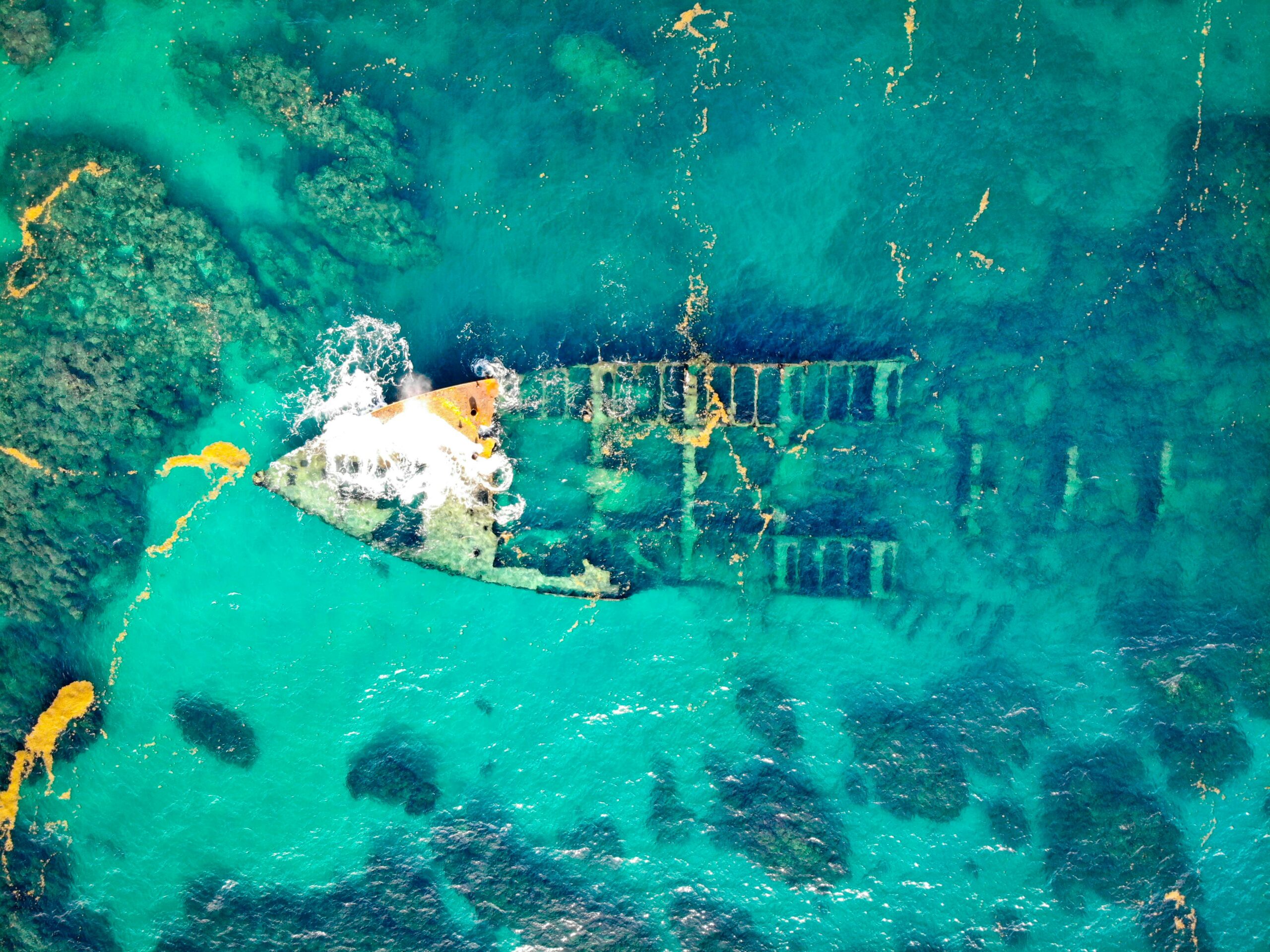
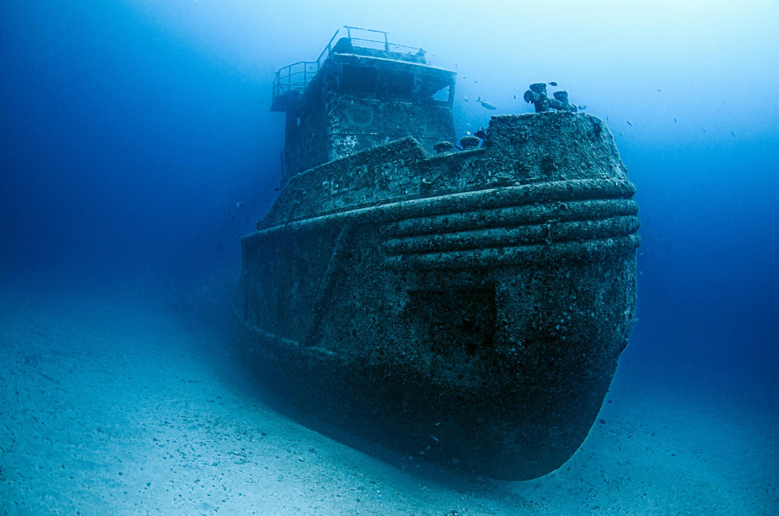
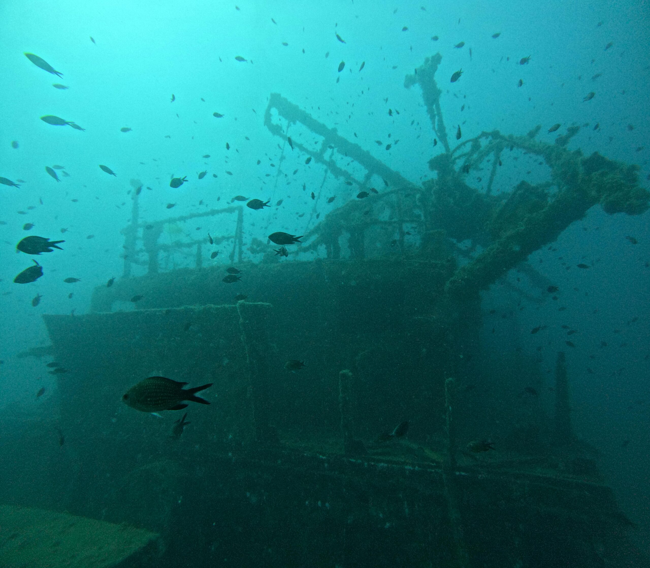
Maritime Archaeology Breakthroughs
Shipwrecks represent irreplaceable cultural heritage sites that deteriorate over time. Underwater photogrammetry enables archaeologists to create comprehensive digital twins of these sites, capturing every timber, artifact, and structural detail. These models facilitate collaborative research, allowing experts worldwide to examine discoveries without physically visiting remote or dangerous locations.
Recent projects have documented ancient Mediterranean vessels, World War II wrecks, and prehistoric submerged settlements with breathtaking detail. The resulting models support artifact analysis, site interpretation, and virtual museum exhibitions that bring underwater cultural heritage to the public. As physical sites continue to degrade, these digital records become increasingly precious repositories of historical knowledge.
Technical Workflows and Best Practices
Executing a successful underwater photogrammetry project requires careful planning and systematic execution. The process typically begins with a preliminary site survey to assess visibility conditions, identify hazards, and plan camera positions. Divers must maintain consistent altitude above the subject while capturing overlapping images with approximately 60-80% overlap between consecutive frames.
Maintaining steady buoyancy control is critical for consistent image quality. Sudden depth changes can cause pressure-related focus shifts, while water movement introduces motion blur. Professional underwater photographers often use specialized stabilization equipment and train extensively to develop the necessary skills for smooth, controlled movements.
Post-Processing and Model Generation
Once images are captured, specialized photogrammetry software processes the data through several computational stages. Structure-from-Motion (SfM) algorithms identify common features across images and reconstruct camera positions. Dense point clouds are then generated, representing millions of three-dimensional points that define the subject’s surface geometry.
These point clouds are converted into mesh models consisting of interconnected polygons that approximate the original surface. Finally, textures extracted from the original photographs are mapped onto the mesh, creating photorealistic 3D models that faithfully reproduce colors, patterns, and fine details. Advanced users may further refine models through cleaning, smoothing, and optimization for specific applications.
Overcoming Challenges in Turbid and Deep Water Environments 💡
While photogrammetry excels in clear, shallow waters, challenging conditions require adapted techniques. Turbid water with suspended sediments scatters light and reduces contrast, making feature identification difficult. In these situations, specialized lighting configurations and image enhancement algorithms can improve results, though data quality inevitably suffers compared to optimal conditions.
Deep-water environments present additional complications. Natural light diminishes rapidly with depth, necessitating powerful artificial lighting. Increased pressure affects equipment reliability and requires more robust housing designs. The logistical challenges of deep diving—including limited bottom time and decompression requirements—constrain data collection efforts and demand efficient workflows.
Emerging Solutions for Extreme Environments
Remotely Operated Vehicles (ROVs) and Autonomous Underwater Vehicles (AUVs) are expanding photogrammetry capabilities into depths beyond human reach. These robotic platforms carry camera systems and lighting arrays, capturing systematic image sequences under computer control. While they lack the flexibility and adaptability of human photographers, they enable hours-long missions in extreme environments without human risk.
Multi-beam sonar and LiDAR technologies complement photogrammetry in murky or deep conditions where optical methods struggle. These acoustic and laser-based systems measure distance directly rather than relying on visible light, producing accurate geometry even when photographic methods fail. Hybrid approaches that integrate photogrammetric textures with sonar-derived geometry combine the strengths of multiple technologies.
The Intersection of Artificial Intelligence and Underwater Mapping
Machine learning algorithms are revolutionizing photogrammetry workflows, automating tasks that previously required extensive manual effort. Neural networks trained on underwater imagery can automatically classify marine organisms, identify archaeological artifacts, and detect changes between survey periods. These AI-assisted approaches dramatically reduce analysis time while improving consistency and objectivity.
Deep learning models can also enhance image quality before photogrammetric processing. Algorithms trained to remove backscatter, restore color balance, and sharpen details improve the quality of input data, resulting in more accurate and visually appealing 3D models. As these technologies mature, they promise to make high-quality underwater photogrammetry accessible to a broader range of users.
Educational and Outreach Opportunities 📚
The immersive, visually compelling nature of 3D underwater models makes them powerful educational tools. Virtual reality applications allow students and the public to explore shipwrecks, swim through coral reefs, and examine marine life at unprecedented scales without getting wet. These experiences foster ocean literacy and inspire the next generation of marine scientists and conservationists.
Museums and cultural institutions increasingly incorporate photogrammetric models into exhibitions, providing access to underwater heritage that would otherwise remain hidden from public view. Interactive displays allow visitors to manipulate models, examine artifacts from all angles, and understand archaeological contexts in ways traditional displays cannot achieve.
Future Horizons: Where Technology Meets Discovery 🚀
The future of underwater photogrammetry promises even more exciting developments. Real-time processing capabilities will enable divers to preview 3D models during missions, ensuring adequate coverage and identifying data gaps before returning to the surface. Cloud-based collaborative platforms will facilitate global cooperation on large-scale mapping projects, pooling resources and expertise across institutions and borders.
Miniaturization of equipment will make advanced photogrammetry accessible to recreational divers and citizen scientists, democratizing underwater documentation. Standardized protocols and quality metrics will ensure data compatibility and enable meta-analyses across studies, revealing patterns and trends invisible in individual projects.
Integration with Global Monitoring Systems
As photogrammetric datasets accumulate, they are being integrated into comprehensive ocean monitoring frameworks. Global coral reef databases now incorporate thousands of 3D survey sites, tracking ecosystem health across entire ocean basins. Archaeological site registries document underwater cultural heritage with standardized 3D documentation, supporting protection and management efforts.
These interconnected systems transform isolated surveys into components of a planetary-scale underwater observatory. By standardizing methodologies and sharing data openly, the scientific community is building a comprehensive digital representation of the underwater world—a resource that will become increasingly valuable as marine environments face accelerating pressures from human activities and climate change.
Practical Considerations for Aspiring Underwater Photogrammetrists
Those interested in pursuing underwater photogrammetry should begin by developing strong diving skills and underwater photography fundamentals. Buoyancy control, situational awareness, and the ability to work efficiently underwater are prerequisites for quality data collection. Training programs specifically focused on scientific diving and underwater survey techniques provide essential skills.
Familiarity with photogrammetry software is equally important. Several excellent platforms offer varying levels of automation, capability, and cost. Beginning with user-friendly options allows newcomers to understand fundamental principles before advancing to professional-grade tools that provide greater control and flexibility.
Collaboration with experienced practitioners accelerates learning and helps avoid common pitfalls. Many professional organizations and research institutions offer workshops, field courses, and mentorship opportunities. Online communities share knowledge, troubleshoot technical challenges, and showcase innovative applications that inspire new approaches.
The Transformative Power of Underwater Digital Documentation
Underwater photogrammetry represents far more than a technological advancement—it fundamentally changes our relationship with the marine environment. By making the underwater world accessible to those who cannot dive, it broadens participation in ocean science and conservation. By preserving ephemeral and threatened sites in digital form, it safeguards cultural and natural heritage for future generations.
The precision and objectivity of photogrammetric measurements provide a solid foundation for evidence-based decision-making in marine management. Whether assessing the impacts of coastal development, evaluating marine protected area effectiveness, or documenting illegal fishing activity, accurate spatial data supports informed policy and enforcement.
As climate change accelerates and human pressures on marine ecosystems intensify, the need for comprehensive baseline documentation becomes increasingly urgent. Photogrammetry provides the tools to create that documentation—capturing the current state of underwater environments before they change irrevocably. These digital records will serve as invaluable references for restoration efforts, scientific analysis, and historical understanding.
The convergence of accessible technology, growing environmental awareness, and urgent conservation needs positions underwater photogrammetry as a critical tool for the 21st century. From shallow coral gardens to deep shipwrecks, from tropical reefs to polar waters, these techniques are unlocking the depths and revealing the ocean’s secrets with clarity and precision that would have seemed impossible just decades ago. The revolution in underwater exploration is not merely technological—it is transforming how we understand, value, and protect the blue planet we call home.

Toni Santos is a visual storyteller and archival artist whose work dives deep into the submerged narratives of underwater archaeology. Through a lens tuned to forgotten depths, Toni explores the silent poetry of lost worlds beneath the waves — where history sleeps in salt and sediment.
Guided by a fascination with sunken relics, ancient ports, and shipwrecked civilizations, Toni’s creative journey flows through coral-covered amphorae, eroded coins, and barnacle-encrusted artifacts. Each piece he creates or curates is a visual meditation on the passage of time — a dialogue between what is buried and what still speaks.
Blending design, storytelling, and historical interpretation, Toni brings to the surface the aesthetics of maritime memory. His work captures the textures of decay and preservation, revealing beauty in rust, ruin, and ruin’s resilience. Through his artistry, he reanimates the traces of vanished cultures that now rest on ocean floors, lost to maps but not to meaning.
As the voice behind Vizovex, Toni shares curated visuals, thoughtful essays, and reconstructed impressions of archaeological findings beneath the sea. He invites others to see underwater ruins not as remnants, but as thresholds to wonder — where history is softened by water, yet sharpened by myth.
His work is a tribute to:
The mystery of civilizations claimed by the sea
The haunting elegance of artifacts lost to time
The silent dialogue between water, memory, and stone
Whether you’re drawn to ancient maritime empires, forgotten coastal rituals, or the melancholic beauty of sunken ships, Toni welcomes you to descend into a space where the past is submerged but never silenced — one relic, one current, one discovery at a time.