The underwater world harbors countless architectural mysteries waiting to be discovered through revolutionary 3D modeling technologies that transform how we explore and document submerged structures.
🌊 The Revolutionary Intersection of Technology and Underwater Archaeology
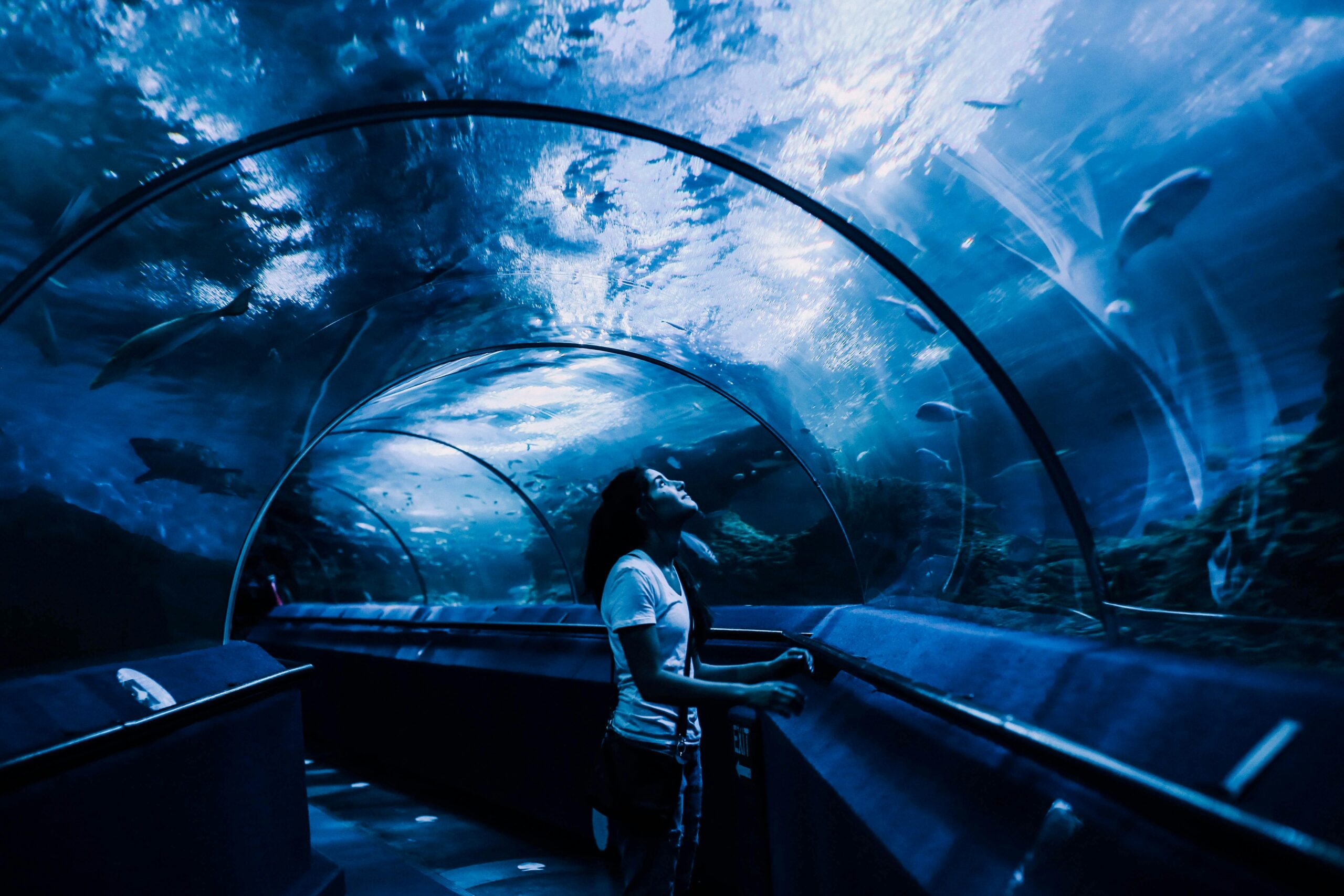
Beneath the surface of our oceans, lakes, and rivers lies a hidden world of incredible structures that tell stories of human civilization, natural phenomena, and engineering marvels. For decades, these submerged structures remained largely inaccessible to detailed study, obscured by murky waters, challenging diving conditions, and the limitations of traditional documentation methods. Today, cutting-edge 3D modeling techniques are revolutionizing how researchers, archaeologists, engineers, and conservationists approach the exploration and preservation of underwater architecture.
The marriage between advanced technology and underwater exploration has opened unprecedented opportunities for understanding our submerged heritage. From ancient shipwrecks to sunken cities, from underwater caves to modern infrastructure inspections, 3D modeling provides clarity, precision, and accessibility that was previously unimaginable. This technological revolution is not merely about creating pretty pictures; it’s about preserving history, ensuring safety, and unlocking secrets that have remained hidden for centuries or even millennia.
Understanding the Challenges of Underwater Documentation
Before diving into the innovative solutions, it’s essential to appreciate the unique challenges that submerged structures present. Unlike terrestrial sites, underwater environments introduce multiple complicating factors that make traditional documentation methods inadequate or impossible.
Water visibility stands as one of the most significant obstacles. Depending on location, sediment composition, water depth, and weather conditions, visibility can range from crystal clear to virtually zero. This variability makes consistent photographic documentation extremely difficult. Additionally, water absorbs light selectively, with red wavelengths disappearing first, fundamentally altering how colors appear and complicating accurate visual representation.
Pressure and depth limitations further constrain human access. While recreational divers can safely explore structures up to approximately 40 meters, many significant sites lie far deeper, requiring specialized equipment, training, and significantly limited bottom time. Each dive represents substantial logistical planning, expense, and risk management.
The dynamic nature of underwater environments also poses preservation challenges. Currents, marine growth, sediment movement, and biological activity constantly alter submerged structures. Documentation methods must be rapid, comprehensive, and repeatable to track changes over time and inform conservation strategies.
🚀 Photogrammetry: Transforming Photographs into Dimensional Data
Photogrammetry has emerged as one of the most accessible and powerful 3D modeling techniques for underwater applications. This method involves capturing multiple overlapping photographs of a structure from various angles and using specialized software to identify common points across images, calculating their three-dimensional positions and creating detailed digital models.
Modern underwater photogrammetry benefits from several technological advances. High-resolution digital cameras with improved low-light performance capture sharper images in challenging underwater conditions. Underwater housings protect equipment while maintaining optical quality. LED lighting systems provide consistent illumination that can be calibrated to compensate for water’s color-absorbing properties.
The workflow for underwater photogrammetric modeling typically follows a systematic approach. Divers first conduct reconnaissance to assess the site and plan coverage patterns. During documentation dives, photographers capture hundreds or thousands of images following predetermined paths that ensure complete coverage with sufficient overlap. Surface processing then involves importing images into photogrammetry software like Agisoft Metashape, RealityCapture, or open-source alternatives that compute camera positions, generate dense point clouds, and create textured mesh models.
The results can be remarkably detailed, with accuracy reaching millimeter-level precision under optimal conditions. These models serve multiple purposes: they provide permanent digital records of structures as they exist at specific moments; enable detailed measurements without requiring return dives; allow virtual exploration by researchers worldwide; and create engaging public outreach materials that bring underwater heritage to broader audiences.
LiDAR and Sonar: Seeing Through Darkness
While photogrammetry excels in relatively clear water with adequate lighting, many significant underwater structures exist in conditions where optical methods fail. This is where acoustic and laser-based technologies demonstrate their unique capabilities.
Multibeam sonar systems emit sound pulses across a wide swath beneath a survey vessel or underwater vehicle, measuring the time required for echoes to return from the seafloor and submerged structures. By processing thousands of these measurements, sophisticated software constructs detailed bathymetric models showing underwater topography and structural features. Modern systems achieve remarkable resolution, capable of identifying features as small as a few centimeters from considerable distances.
Underwater LiDAR (Light Detection and Ranging) represents a more recent innovation adapted from aerial surveying technologies. These systems emit rapid laser pulses and measure return times to calculate distances. Specialized blue-green lasers penetrate water more effectively than other wavelengths, enabling operation in depths up to several dozen meters in clear water. The resulting point cloud data provides extremely high-resolution 3D information about structure surfaces.
Both technologies offer distinct advantages in specific scenarios. Sonar excels at covering large areas quickly and operates effectively regardless of water clarity or ambient light. LiDAR provides superior resolution and accuracy but requires clearer water and operates over shorter ranges. Many comprehensive surveys now employ hybrid approaches, combining technologies to leverage their complementary strengths.
⚙️ ROVs and AUVs: Robotic Explorers of the Deep
Remotely Operated Vehicles (ROVs) and Autonomous Underwater Vehicles (AUVs) have dramatically expanded the reach and efficiency of underwater 3D modeling. These robotic systems carry sensors beyond human diving limits, operate for extended periods, and execute precisely controlled survey patterns impossible for human divers.
ROVs remain tethered to surface vessels, receiving power and control signals through umbilical cables while transmitting real-time video and sensor data. Operators can observe structures as surveys progress, adjusting approaches to focus on features of particular interest. Modern ROVs carry integrated sensor packages including high-definition cameras for photogrammetry, scanning sonars, LiDAR systems, and precision navigation equipment.
AUVs operate independently, following pre-programmed missions without physical connection to surface support. These vehicles excel at systematic large-area surveys, maintaining consistent altitude, speed, and sensor orientation while covering extensive sites. After mission completion, AUVs surface or return to recovery points where researchers download collected data for processing.
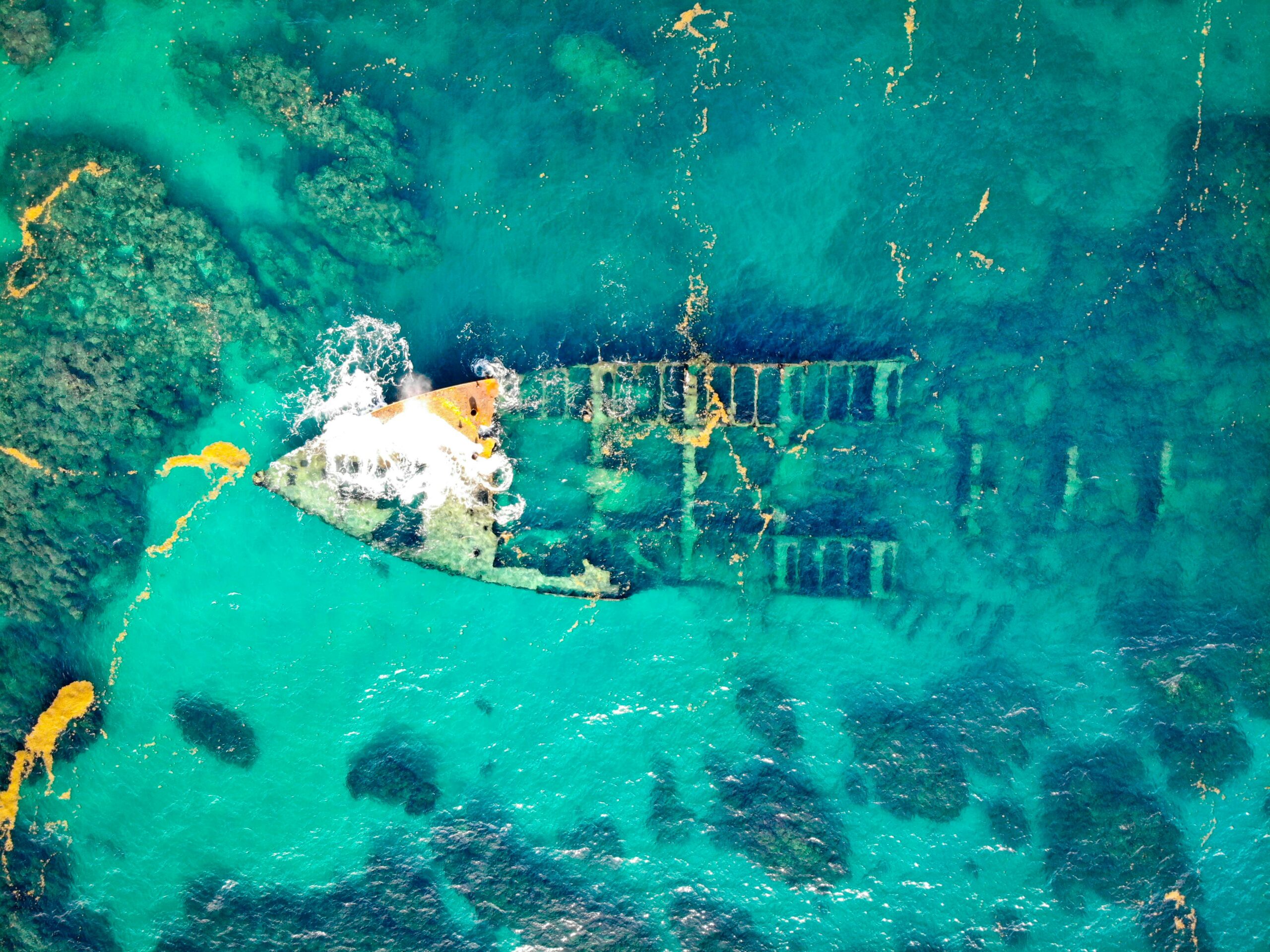
The integration of these robotic platforms with advanced sensors has enabled groundbreaking discoveries and documentation projects. Deep-ocean shipwrecks thousands of meters below the surface, previously known only through grainy sonar images, now appear in stunning three-dimensional detail. Ancient harbor installations, underwater cave systems, and geological formations receive comprehensive documentation that informs research and conservation planning.
Processing Power: From Raw Data to Actionable Models
The sophisticated sensors and platforms collecting underwater data would achieve little without equally advanced processing capabilities. Modern computational photogrammetry and point cloud processing require substantial computing power but deliver extraordinary results.
Structure from Motion (SfM) algorithms form the mathematical foundation of photogrammetric processing. These algorithms simultaneously solve for camera positions and scene structure by identifying and tracking features across multiple images. The process begins with feature detection, identifying distinctive points that can be reliably matched between photographs. Bundle adjustment then optimizes estimates of camera positions and point locations to minimize reprojection errors across all images.
Once camera positions are established, dense reconstruction algorithms generate millions of three-dimensional points representing surface details. Multi-view stereo approaches examine pixel neighborhoods across multiple images to calculate depth information with sub-pixel precision. The resulting dense point clouds contain extraordinarily detailed geometric information about documented structures.
Mesh generation algorithms convert point clouds into continuous surface models composed of interconnected triangular faces. This representation facilitates measurements, cross-sections, and texture mapping. Texture information from original photographs is projected onto mesh surfaces, creating photorealistic models that combine geometric accuracy with visual fidelity.
📊 Practical Applications Across Industries
The power of underwater 3D modeling extends far beyond academic curiosity, delivering tangible benefits across multiple professional domains. Understanding these applications illustrates why this technology represents such a significant advancement.
Maritime Archaeology and Cultural Heritage
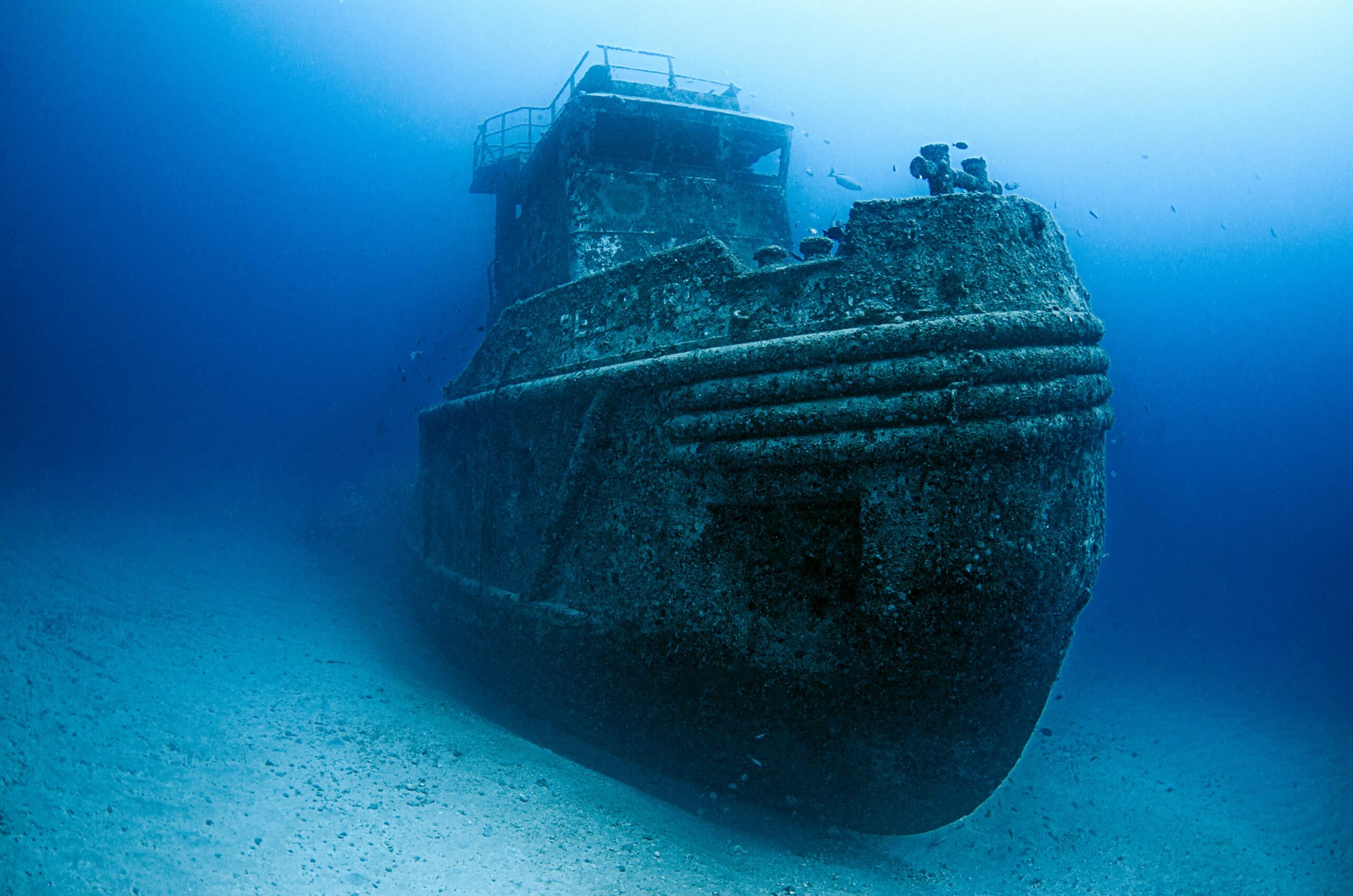
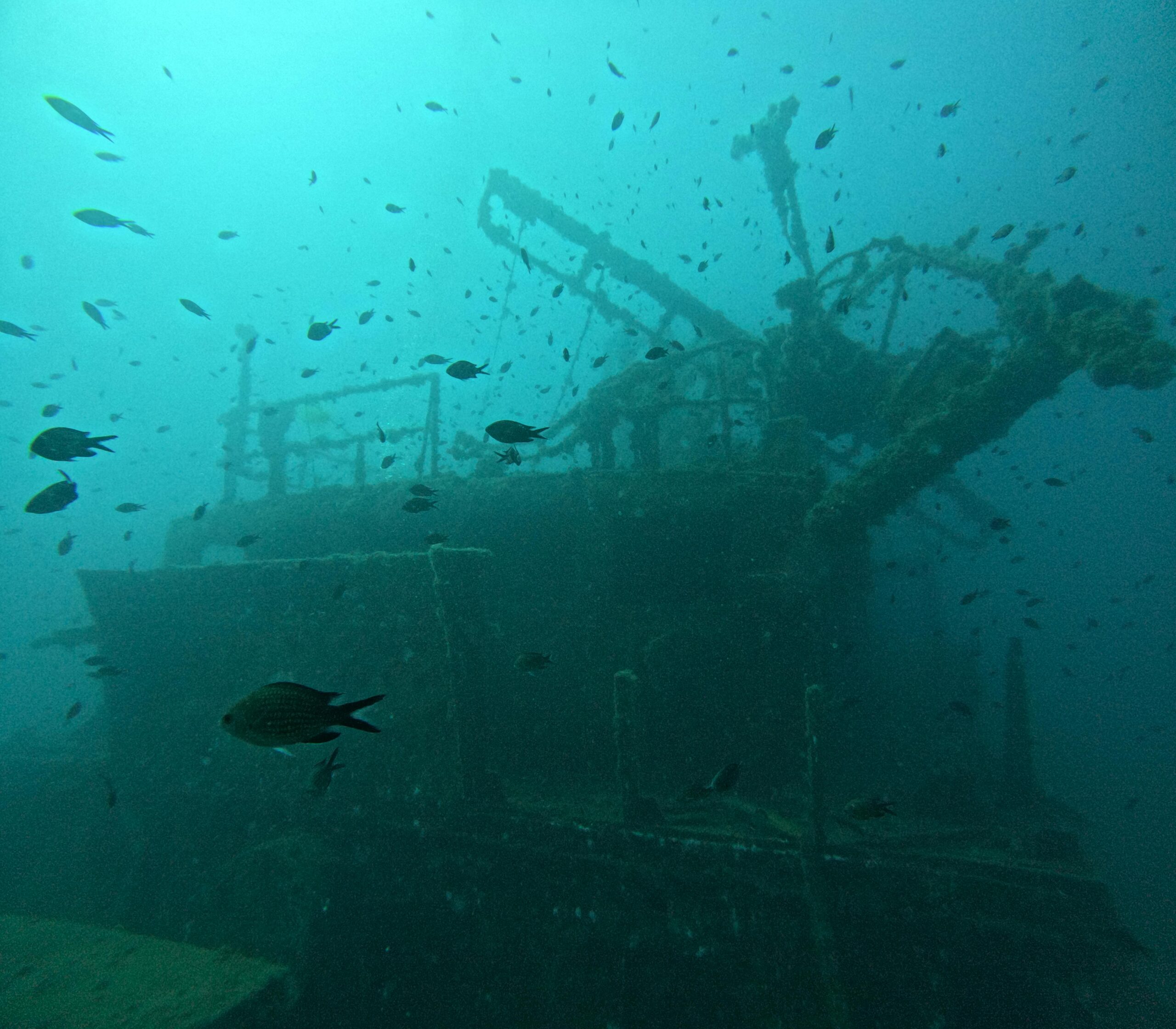
Archaeological applications perhaps most obviously benefit from underwater 3D modeling. Shipwrecks, submerged settlements, ceremonial sites, and other underwater cultural heritage receive documentation that preserves their current state while enabling detailed analysis without physical disturbance. Models facilitate artifact studies, structural analysis, and site formation process research. They also create powerful educational resources that bring underwater heritage to museums, classrooms, and public audiences who will never dive these sites personally.
Infrastructure Inspection and Maintenance
Bridges, dams, offshore platforms, pipelines, and other underwater infrastructure require regular inspection to ensure safety and functionality. Traditional methods involve divers conducting visual examinations and taking measurements—time-consuming, expensive, and potentially hazardous work. 3D modeling enables comprehensive documentation during single inspection campaigns, with models analyzed thoroughly by multiple specialists afterward. Comparison of models from successive inspections reveals structural changes, corrosion patterns, and potential failure points before they become critical.
Environmental Monitoring and Marine Biology
Coral reefs, underwater geological features, and marine habitats benefit from precise 3D documentation that tracks changes over time. Researchers measure coral growth rates, quantify storm damage, assess bleaching events, and monitor recovery by comparing successive 3D models. The technique provides objective, quantifiable data supporting marine conservation efforts and climate change research.
Forensic Investigation
Underwater accident scenes, from aviation disasters to maritime casualties, require meticulous documentation for investigation purposes. 3D modeling captures wreckage distribution, structural damage patterns, and spatial relationships that inform accident reconstruction. Models preserve evidence that might otherwise be lost to currents, deterioration, or necessary recovery operations.
🎯 Cutting-Edge Innovations Shaping the Future
The field of underwater 3D modeling continues evolving rapidly, with emerging technologies promising even greater capabilities. Artificial intelligence and machine learning increasingly automate processing workflows, identifying and classifying features within 3D models. AI algorithms can recognize specific artifact types, detect structural anomalies, or track individual coral colonies across time-series models.
Real-time processing capabilities are advancing, with some systems now generating preliminary 3D models during data collection rather than requiring extensive post-processing. This capability enables adaptive surveying strategies, where operators identify areas requiring additional coverage while still on-site.
Integration across sensor types becomes increasingly seamless. Modern platforms combine optical photogrammetry, sonar, LiDAR, and other sensors, with processing software automatically fusing data streams into comprehensive multi-modal models that leverage each technology’s strengths while compensating for individual limitations.
Virtual and augmented reality applications bring underwater 3D models to life in immersive ways. Researchers explore sites virtually, examining details from any angle and at any scale. Educational applications place students inside shipwrecks or ancient harbors, creating engagement impossible through traditional media. Training programs simulate underwater environments for divers, ROV operators, and emergency responders.
Overcoming Technical Barriers and Limitations
Despite remarkable advances, underwater 3D modeling still faces challenges that researchers actively work to address. Water clarity remains fundamentally limiting for optical methods. Innovative approaches include using polarizing filters to reduce backscatter, employing fluorescence imaging to enhance contrast, and developing algorithms that computationally compensate for water’s optical properties.
Scale ambiguity presents another challenge in underwater photogrammetry. Without reference objects of known dimensions, photogrammetric models lack absolute scale information. Solutions include placing coded scale bars within scenes, using laser scalers that project known-distance reference points, or incorporating measurements from other sensors like sonar or pressure depth sensors.
Data volume has become both an advantage and a challenge. Comprehensive surveys generate terabytes of raw imagery and sensor data, requiring substantial storage, processing capacity, and data management strategies. Cloud computing and distributed processing help address computational requirements, while standardized data formats and metadata schemas facilitate long-term archiving and data sharing.
💡 Best Practices for Successful Implementation
Organizations and researchers embarking on underwater 3D modeling projects benefit from established best practices that maximize results while minimizing common pitfalls. Thorough planning proves essential—successful projects begin long before entering the water, with clear objectives, appropriate technology selection, and detailed operational planning.
Site assessment should precede full documentation efforts. Preliminary reconnaissance establishes conditions, identifies challenges, and informs technique selection. Understanding depth, visibility, currents, and structural complexity allows realistic planning and resource allocation.
Systematic data collection following proven protocols ensures coverage quality. For photogrammetry, this means maintaining consistent altitude, ensuring adequate image overlap, and capturing sufficient perspectives to avoid reconstruction gaps. For sonar surveys, it involves appropriate line spacing, managing survey speed for resolution requirements, and accounting for vehicle motion and positioning accuracy.
Quality control during collection prevents discovering problems only after leaving the site. Real-time monitoring of data quality, checking coverage completeness, and verifying positioning accuracy allow immediate correction of deficiencies while resources remain mobilized.
Processing workflows should follow documented procedures with validation steps. Checking registration accuracy, examining models for artifacts or gaps, and comparing results against independent measurements ensures model reliability.
🌐 Democratizing Access and Building Communities
Perhaps one of the most exciting developments in underwater 3D modeling is its increasing accessibility. Technologies once restricted to well-funded research institutions or specialized companies are becoming available to smaller organizations, citizen scientists, and even recreational divers passionate about documentation and conservation.
Open-source software options reduce financial barriers to processing capabilities. Projects like OpenDroneMap, COLMAP, and MeshLab provide powerful photogrammetric and point cloud processing tools without licensing costs. Online communities share tutorials, workflows, and troubleshooting advice, helping newcomers overcome learning curves.
Affordable camera systems and underwater housings make data collection equipment accessible. Action cameras and mirrorless cameras with DIY or commercial housings enable high-quality photogrammetry at modest investment levels compared to specialized scientific systems.
Data sharing platforms allow researchers worldwide to access and study underwater 3D models without traveling to remote sites. Initiatives like Sketchfab, Open Heritage 3D, and domain-specific repositories host thousands of models freely available for research, education, and public engagement.
Charting the Course Forward in Underwater Innovation
The convergence of robotics, sensing technologies, computational power, and innovative algorithms has transformed underwater structure documentation from laborious manual processes to precise, efficient, and comprehensive digital workflows. 3D modeling techniques have unlocked previously inaccessible information about submerged heritage, infrastructure, and natural environments, enabling discovery, preservation, and understanding at unprecedented scales.
As technologies continue advancing and becoming more accessible, the coming decade promises even more remarkable capabilities. Artificial intelligence will increasingly automate workflows and extract insights from 3D data. Sensor fusion will create ever more comprehensive representations of underwater environments. Real-time processing and communication will enable remote experts to guide underwater operations and make immediate decisions based on emerging 3D models.
The secrets held by submerged structures—whether ancient shipwrecks telling stories of maritime trade, infrastructure requiring maintenance for public safety, or coral reefs indicating environmental health—are increasingly within our reach. Cutting-edge 3D modeling techniques provide the keys to unlock these secrets, transforming how we explore, understand, and preserve our underwater world for future generations. The dive into innovation continues, with each technological advance revealing new depths of knowledge waiting beneath the surface.

Toni Santos is a visual storyteller and archival artist whose work dives deep into the submerged narratives of underwater archaeology. Through a lens tuned to forgotten depths, Toni explores the silent poetry of lost worlds beneath the waves — where history sleeps in salt and sediment.
Guided by a fascination with sunken relics, ancient ports, and shipwrecked civilizations, Toni’s creative journey flows through coral-covered amphorae, eroded coins, and barnacle-encrusted artifacts. Each piece he creates or curates is a visual meditation on the passage of time — a dialogue between what is buried and what still speaks.
Blending design, storytelling, and historical interpretation, Toni brings to the surface the aesthetics of maritime memory. His work captures the textures of decay and preservation, revealing beauty in rust, ruin, and ruin’s resilience. Through his artistry, he reanimates the traces of vanished cultures that now rest on ocean floors, lost to maps but not to meaning.
As the voice behind Vizovex, Toni shares curated visuals, thoughtful essays, and reconstructed impressions of archaeological findings beneath the sea. He invites others to see underwater ruins not as remnants, but as thresholds to wonder — where history is softened by water, yet sharpened by myth.
His work is a tribute to:
The mystery of civilizations claimed by the sea
The haunting elegance of artifacts lost to time
The silent dialogue between water, memory, and stone
Whether you’re drawn to ancient maritime empires, forgotten coastal rituals, or the melancholic beauty of sunken ships, Toni welcomes you to descend into a space where the past is submerged but never silenced — one relic, one current, one discovery at a time.