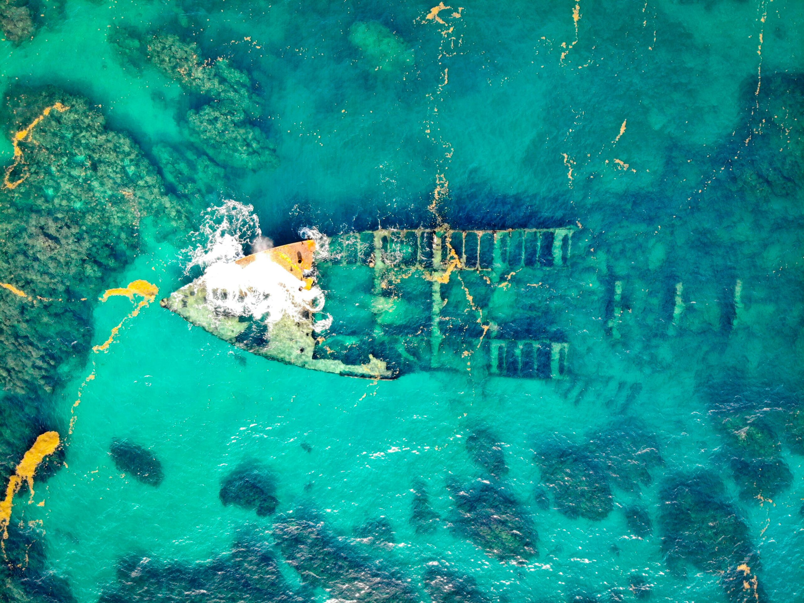
In the vast, uncharted world beneath the ocean’s surface, a symphony of colors, shapes, and textures remains hidden from our eyes. Yet, with the advent of multispectral sonar technology, we are now able to unveil these aquatic mysteries with unprecedented precision. 🌊 This technological marvel is transforming the field of subaquatic mapping, providing us with detailed insights that were once thought impossible.
Imagine a tool that can peer through the murky depths, deciphering the underwater landscape in vibrant detail. Multispectral sonar does just that, using multiple frequencies to capture a spectrum of data. This is not just a step forward in sonar technology; it’s a leap into a new era of exploration. By harnessing the power of different wavelengths, scientists and researchers can map the ocean floor with clarity and accuracy, revealing its secrets layer by layer.
Why is this important? The applications of multispectral sonar are vast and varied. From environmental conservation to naval navigation, and from oil and gas exploration to archaeology, the potential impacts are far-reaching. As we navigate through this article, we will dive deeper into these applications, exploring how this technology is reshaping our understanding of the underwater world.
In the realm of environmental conservation, multispectral sonar is a game-changer. It allows researchers to monitor coral reefs, track marine biodiversity, and assess the health of aquatic ecosystems with a level of detail previously unimaginable. By providing accurate data on the distribution of marine life and the condition of habitats, this technology aids in the formulation of effective conservation strategies.
For industries such as oil and gas, precision subaquatic mapping is crucial. The ability to accurately map the seabed ensures safer and more efficient drilling operations. Multispectral sonar offers detailed imagery that can help identify potential hazards and optimize resource extraction, reducing the environmental impact of such activities.
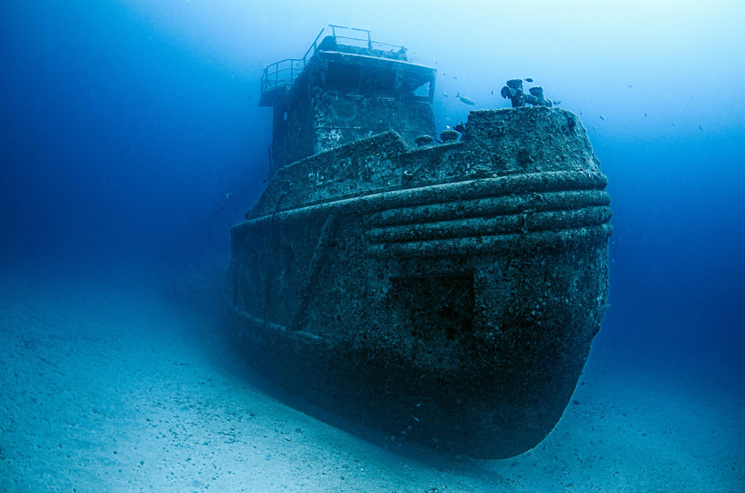
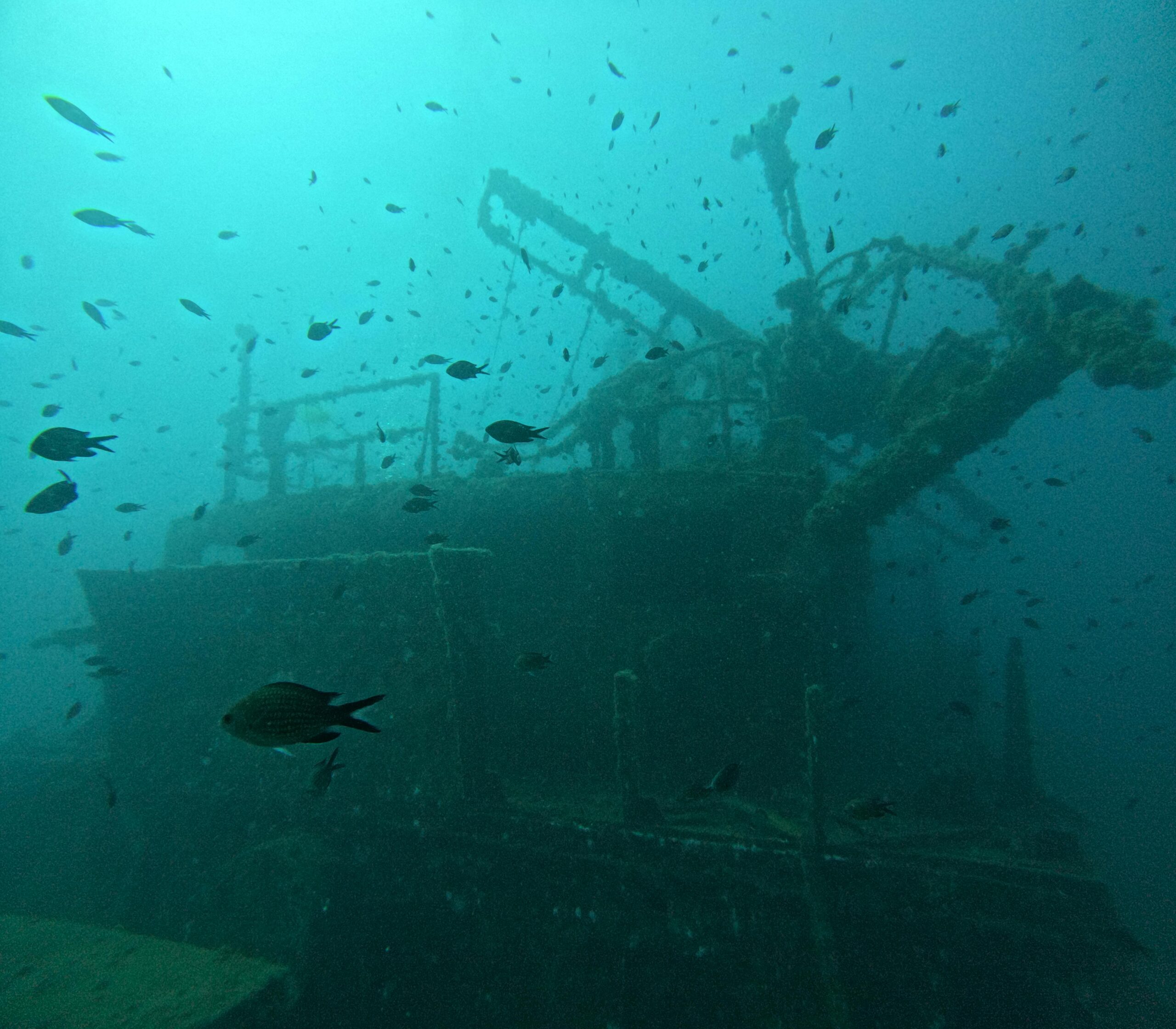
Moreover, this technology is invaluable in the field of underwater archaeology. Unearthing historical treasures from shipwrecks and ancient submerged cities requires meticulous mapping of the ocean floor. Multispectral sonar provides archaeologists with high-resolution images that reveal the layout and condition of these underwater sites, enabling more informed excavation efforts.
One of the most exciting aspects of multispectral sonar is its ability to improve maritime navigation. By providing detailed topographical maps of the ocean floor, it enhances the safety and efficiency of marine travel. Ships can navigate more confidently through treacherous waters, avoiding submerged obstacles and reducing the risk of accidents.
As we explore these topics in depth, we’ll also address the challenges and limitations of multispectral sonar technology. While the benefits are significant, there are hurdles to overcome, such as the cost of implementation and the complexity of data interpretation. However, ongoing advancements in this field promise to address these issues, making this technology more accessible and user-friendly.
In the following sections, we will delve into the science behind multispectral sonar, exploring how it works and the technical innovations that make it possible. We’ll also highlight real-world case studies that demonstrate its transformative impact across various sectors. By the end of this journey, you’ll have a comprehensive understanding of why multispectral sonar is at the forefront of modern subaquatic mapping.
So, whether you’re an environmental scientist, a maritime professional, or simply an ocean enthusiast, this exploration of multispectral sonar will provide you with a new lens through which to view the underwater world. Let’s embark on this journey together and discover the power of this groundbreaking technology. 🚀
Conclusion: Harnessing the Depths with Multispectral Sonar
As we draw our exploration to a close, it’s clear that multispectral sonar technology is revolutionizing the field of subaquatic mapping. Throughout our journey, we’ve delved into the intricacies of how this cutting-edge technology enhances our ability to understand underwater environments with unprecedented precision and clarity.
Multispectral sonar systems allow us to capture a wealth of data across various spectral bands, offering a more nuanced view of the ocean floor than ever before. 🌊 By integrating these multiple layers of information, researchers and professionals can identify and analyze underwater features with remarkable accuracy, facilitating advancements in marine biology, geology, and archaeology.
One of the most significant advantages of multispectral sonar is its ability to improve habitat mapping and resource management. By accurately identifying different types of seafloor substrates and vegetation, stakeholders can make informed decisions to protect marine ecosystems and sustainably manage marine resources.
Moreover, the enhanced precision offered by multispectral sonar is invaluable in applications such as underwater archaeology, where the identification of artifacts and structures beneath the seabed can shed light on historical human activities. This technology opens new doors for preserving cultural heritage, offering insights that were previously beyond our reach.
The power of multispectral sonar also extends to commercial and industrial applications. From optimizing fishing operations to enhancing the safety and efficiency of underwater construction, the benefits of this technology are far-reaching. By providing detailed seafloor maps, multispectral sonar enables industries to operate with greater environmental sensitivity and operational effectiveness.
As we look to the future, the potential for multispectral sonar to contribute to ocean exploration and conservation efforts is immense. With ongoing advancements in sensor technology and data processing, the precision and applicability of this technology will only continue to grow. This promises to be a pivotal tool in our quest to better understand and protect the world’s oceans.
We encourage you, dear reader, to ponder the vast possibilities that multispectral sonar presents. Whether you’re a researcher, a professional in the marine industry, or simply an enthusiast of ocean exploration, the insights gleaned from this technology are invaluable. Feel empowered to share this knowledge, engage in conversations about its implications, and consider how it might be applied within your own field of interest or work. 🤝
In closing, the unveiling of multispectral sonar as a powerful instrument in subaquatic mapping is just the beginning of an exciting new chapter in marine exploration. Let us continue to dive deeper, harnessing the potential of technology to unlock the secrets of our oceans, ultimately fostering a more informed and sustainable interaction with the marine world. 🌍
Thank you for joining us on this journey beneath the waves. We invite you to share your thoughts and insights in the comments below, and don’t hesitate to share this article with others who might find it inspiring and informative.
[Contact Us](#) | [Subscribe to Our Newsletter](#) | [Follow Us on Social Media](#)
—

Gabriel is a visual storyteller and archival artist whose lens dives deep into the submerged echoes of underwater archaeology. Through sediment and salt, Gabriel traces forgotten histories — those whispered by shipwrecks, eroded artifacts, and drowned cities.
Compelled by the allure of ancient trade routes, submerged sanctuaries, and the ocean’s quiet possession of the past, Gabriel’s work charts a poetic cartography of the sea’s memory. From coral-laced amphorae to oxidized anchors, every object he illuminates becomes part of a narrative where time collapses and the past drifts close.
His creations are more than documentation — they are visual meditations on absence and endurance. Gabriel blends design, historical research, and storytelling to surface the quiet resilience of maritime remnants. He captures the textures of time: rust that blooms like algae, stone that crumbles into myth, and silence that speaks louder than ruin.
Through curated imagery, thoughtful essays, and reconstructed impressions of what lies beneath, Gabriel invites viewers to see underwater ruins not as remnants, but as thresholds to wonder — places where memory is refracted through water, and where myth lingers like salt on stone.
His practice is a tribute to:
The unknowable depths of civilizations consumed by tides
The fragile endurance of objects left behind
The enduring dialogue between water, stone, and remembrance
If your soul drifts toward the relics of lost maritime empires, the mythic pull of coastal rituals, or the ghostly grace of sunken vessels, Gabriel welcomes you to descend into a space where history sleeps in sediment — but dreams in currents.