Beneath the ocean’s surface lie forgotten civilizations waiting to be rediscovered through revolutionary technologies that transform underwater archaeology and rewrite human history.
🌊 The Allure of Sunken Civilizations
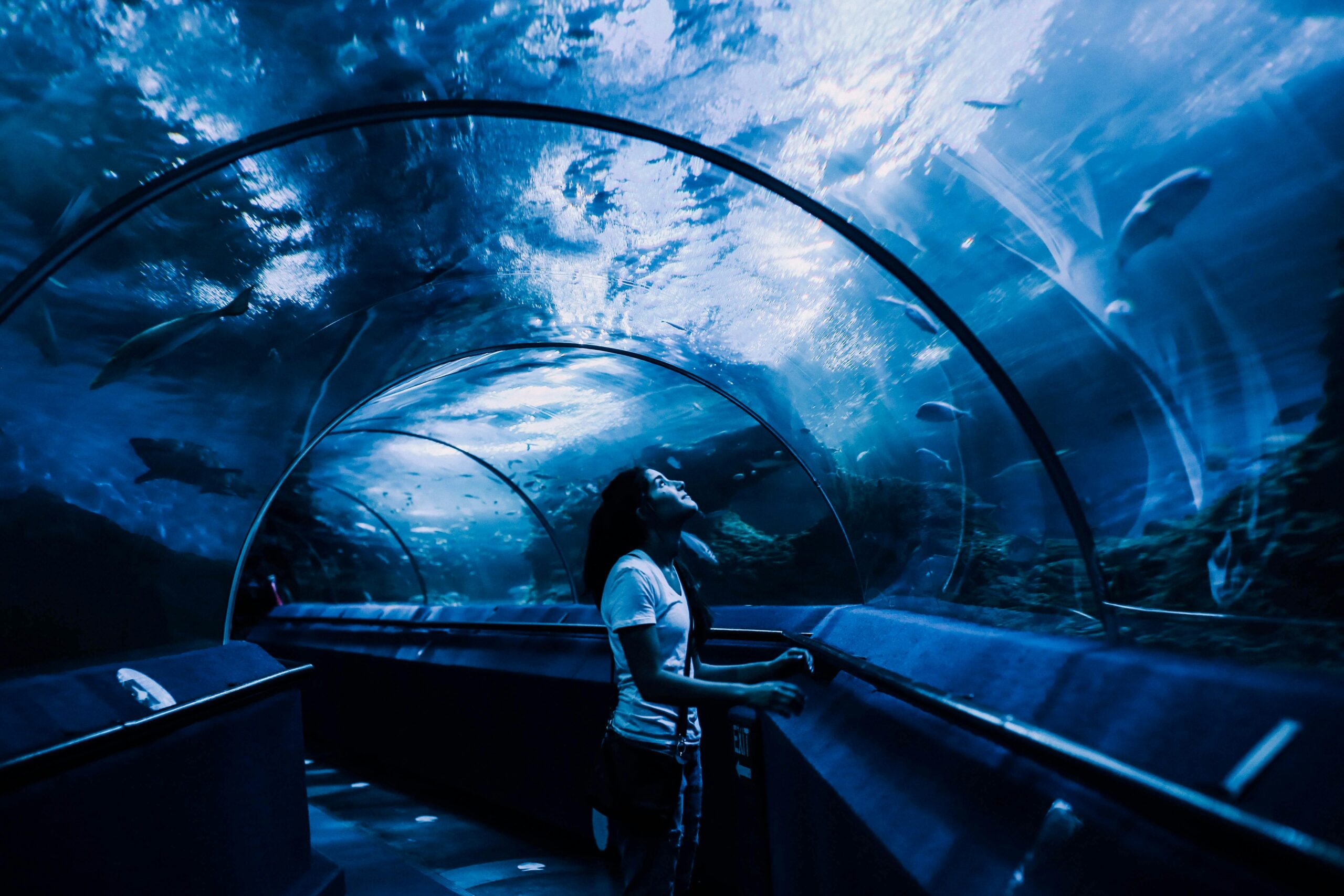
The mystery of lost cities beneath the waves has captivated humanity for centuries. From Plato’s Atlantis to the very real submerged ruins of Heracleion off Egypt’s coast, these underwater archaeological sites represent more than mere curiosities—they’re time capsules preserving invaluable information about our ancestors. As sea levels have fluctuated throughout history, countless coastal settlements have been claimed by the oceans, creating an underwater museum of human civilization that spans millennia.
Today’s archaeologists face unique challenges when exploring these submerged worlds. Unlike terrestrial excavations, underwater sites contend with limited visibility, strong currents, marine growth, and the physical constraints of diving. Traditional archaeological methods simply cannot address the scale and complexity of mapping entire submerged cities. This reality has driven researchers to develop innovative approaches that combine cutting-edge technology with traditional archaeological principles.
The importance of documenting these sites cannot be overstated. Climate change, coastal development, and natural erosion threaten to destroy these irreplaceable historical resources. Many sunken cities are deteriorating at accelerating rates, making rapid and accurate documentation essential for preservation and study. The race against time has become a driving force behind technological innovation in underwater archaeology.
Revolutionary Sonar Systems Penetrating the Deep 🔊
Multibeam sonar technology represents one of the most significant breakthroughs in underwater mapping. Unlike traditional single-beam sonar that provides only a narrow view of the seafloor, multibeam systems emit multiple sonar beams simultaneously, creating detailed three-dimensional maps of underwater terrain with unprecedented resolution. These systems can cover vast areas quickly while capturing minute details that might indicate human-made structures.
Side-scan sonar offers complementary capabilities by creating acoustic images of the seafloor. This technology works similarly to taking an X-ray photograph, revealing objects and features based on their acoustic reflectivity. Archaeologists use side-scan sonar to identify anomalies that warrant closer investigation—unusual geometric patterns, linear features, or material differences that suggest artificial construction rather than natural formations.
Synthetic aperture sonar (SAS) pushes imaging capabilities even further by using sophisticated signal processing to achieve exceptional resolution regardless of altitude. This technology can distinguish objects separated by just centimeters, even when operating hundreds of meters above the seafloor. For underwater archaeologists, SAS provides clarity comparable to aerial photography, revealing architectural details, street layouts, and artifact distributions across sunken settlements.
Integration with GPS and Positioning Systems
Accurate positioning remains crucial for creating useful archaeological maps. Modern underwater surveys integrate sonar systems with differential GPS, ultra-short baseline (USBL) acoustic positioning, and inertial navigation systems. This combination allows researchers to pinpoint discovered features with centimeter-level accuracy, creating georeferenced databases that enable precise excavation planning and long-term monitoring of site conditions.
The data from these sonar systems generates massive datasets requiring specialized processing. Advanced software applications transform raw sonar returns into interpretable images and three-dimensional models. Researchers can manipulate these digital representations, applying filters to enhance specific features, measuring structures, and creating detailed site plans without disturbing the actual archaeological remains.
🤖 Autonomous Underwater Vehicles: Tireless Explorers
Autonomous Underwater Vehicles (AUVs) have revolutionized underwater archaeological surveys by operating independently for extended periods. These robotic explorers follow pre-programmed missions, maintaining consistent altitude and speed while systematically mapping seafloor areas. Unlike human divers or tethered remotely operated vehicles (ROVs), AUVs can work in dangerous conditions, at extreme depths, and for durations impossible for human researchers.
Modern AUVs carry sophisticated sensor suites including multibeam sonar, side-scan sonar, sub-bottom profilers, magnetometers, and high-resolution cameras. This multi-sensor approach provides comprehensive data about potential archaeological sites. The vehicles can detect buried structures beneath sediment layers, identify metallic artifacts through magnetic anomalies, and capture photographic evidence—all during a single mission.
Recent developments in machine learning enable AUVs to make real-time decisions during surveys. These intelligent systems can recognize patterns indicative of archaeological features and adjust their mission parameters accordingly. If an AUV detects something unusual, it can autonomously conduct closer examination, capturing higher-resolution data without requiring human intervention. This capability dramatically increases survey efficiency and reduces mission costs.
Collaborative Robot Swarms
The latest frontier involves deploying multiple AUVs working cooperatively. These robotic swarms can cover extensive areas rapidly while maintaining overlapping coverage that ensures no features are missed. Communication protocols allow the vehicles to share data in real-time, coordinating their movements to optimize survey patterns. This approach is particularly valuable when searching for lost cities whose exact locations remain uncertain.
Battery technology and power management continue improving, extending AUV mission durations from hours to days. Some experimental vehicles harvest energy from ocean currents or thermal gradients, potentially enabling indefinite operation. For archaeologists, longer missions mean more comprehensive surveys and better data quality, as vehicles can revisit areas under different conditions to verify findings.
Light Detection and Ranging Technology Beneath the Surface 💡
LiDAR (Light Detection and Ranging) technology, traditionally used for terrestrial and aerial surveys, has been adapted for underwater archaeological applications through systems called bathymetric LiDAR. These systems use blue-green laser wavelengths that penetrate water effectively, measuring depth and creating detailed topographic maps of shallow underwater sites. The technology excels in coastal environments where sunken cities often cluster.
Airborne bathymetric LiDAR surveys conducted from aircraft can rapidly map extensive shallow-water areas, identifying potential archaeological sites that warrant further investigation. The technology penetrates water to depths of approximately 70 meters in optimal conditions, providing resolution sufficient to detect individual structures, defensive walls, and harbors. This bird’s-eye perspective helps archaeologists understand site layouts and relationships between features.
Underwater LiDAR systems mounted on AUVs or ROVs provide even greater detail when examining specific sites. These systems create millimeter-resolution three-dimensional models of artifacts, architectural features, and entire structures. The resulting point cloud data enables virtual excavation, where researchers can digitally explore sites, take measurements, and plan physical interventions without disturbing delicate remains.
Photogrammetric Reconstruction
Complementing LiDAR, underwater photogrammetry constructs three-dimensional models from overlapping photographs. Specialized software identifies common features across multiple images, calculating spatial relationships and building accurate digital replicas. Modern cameras and processing algorithms produce models with stunning detail, capturing texture, color, and fine details that laser scanning might miss.
The combination of LiDAR precision and photogrammetric detail creates comprehensive digital twins of underwater archaeological sites. These virtual representations serve multiple purposes: research tools for analysis, preservation records documenting current conditions, educational resources for public engagement, and planning aids for conservation interventions. As physical sites deteriorate, these digital archives become increasingly valuable.
🧲 Magnetic and Electromagnetic Detection Methods
Marine magnetometers detect variations in the Earth’s magnetic field caused by ferrous materials, making them invaluable for locating shipwrecks, anchors, cannons, and other metal artifacts associated with sunken settlements. Advanced cesium vapor magnetometers achieve sensitivity levels that can detect individual nails or coins buried beneath sediment, providing clues about hidden structures and artifact distributions.
Gradiometer configurations using paired magnetometers measure magnetic field gradients, helping distinguish archaeological features from geological background noise. This approach improves target identification and reduces false positives caused by natural magnetic variations. Archaeologists tow magnetometer arrays behind survey vessels or mount them on AUVs, creating detailed magnetic maps that reveal subsurface features invisible to visual inspection or sonar.
Electromagnetic induction systems operate on different principles, generating electromagnetic fields and measuring how seafloor materials respond. These systems detect both ferrous and non-ferrous metals, expanding the range of artifacts they can locate. The technology also provides information about conductivity variations that might indicate different sediment types, buried foundations, or material interfaces marking ancient construction.
Ground-Penetrating Radar Adaptations
While traditional ground-penetrating radar (GPR) struggles in saltwater environments due to signal attenuation, researchers have developed adapted systems for underwater use in low-salinity conditions like lakes and rivers. These systems map buried structures, excavation layers, and subsurface features without physical disturbance. In brackish environments where many ancient ports developed, modified GPR provides valuable subsurface information complementing other survey methods.
Sub-bottom profilers fill the gap in marine environments, using acoustic pulses at lower frequencies than conventional sonar to penetrate sediment layers. These systems reveal stratigraphy beneath the seafloor, identifying buried structures, paleochannels, and geological features important for understanding site formation processes. The data helps archaeologists determine where to focus excavation efforts and understand how sites changed over time.
Satellite Technology and Remote Sensing Applications 🛰️
Satellite-based remote sensing contributes to underwater archaeology in surprising ways. Multispectral and hyperspectral imaging from space can detect shallow submerged structures by analyzing how different wavelengths of light interact with water and seafloor features. In clear, shallow waters, variations in color and brightness reveal artificial structures, ancient harbor works, and modified landscapes.
Synthetic aperture radar (SAR) satellites detect surface expressions of underwater features. Submerged structures influence water currents, wave patterns, and surface roughness in ways detectable from space. SAR imagery has helped locate ancient harbors, submerged breakwaters, and coastal settlements by identifying subtle surface anomalies connected to underwater features. This capability enables researchers to identify promising survey areas across vast oceanic expanses.
Satellite altimetry measures sea surface height with extraordinary precision, detecting subtle variations caused by gravitational effects of massive underwater structures. While this approach lacks the resolution for detailed mapping, it helps identify large-scale features like submerged plateaus, ancient river valleys, or geological formations that might have supported early settlements. These datasets guide targeted surveys to areas with high archaeological potential.
Historical Coastline Reconstruction
Combining satellite data with geological information and sea level models, researchers reconstruct ancient coastlines and landscapes. These paleogeographic reconstructions identify areas that were terrestrial during periods of human occupation but now lie underwater. Understanding where ancient peoples would have established settlements guides exploration efforts, focusing resources on areas most likely to contain archaeological remains.
Climate and oceanographic data from satellites inform site preservation strategies. Monitoring water temperature, current patterns, storm intensity, and sediment transport helps predict threats to underwater archaeological sites. This information enables proactive conservation measures and prioritizes documentation efforts for sites facing imminent destruction.
🔬 Artificial Intelligence and Machine Learning in Data Analysis
The massive datasets generated by modern survey technologies overwhelm traditional analysis methods. Artificial intelligence and machine learning algorithms transform archaeological data processing by automatically identifying features of interest within sonar imagery, bathymetric maps, and photographic surveys. These systems learn to recognize patterns characteristic of human-made structures, distinguishing them from natural geological features.
Convolutional neural networks excel at image classification tasks, training on examples of known archaeological features to identify similar patterns in new survey data. As these systems process more data, their accuracy improves, enabling rapid preliminary assessment of extensive survey areas. Archaeologists can then focus their expert attention on the most promising locations identified by AI screening.
Predictive modeling represents another powerful application of machine learning in underwater archaeology. By analyzing relationships between known archaeological sites and environmental variables—depth, distance from ancient coastlines, substrate type, proximity to resources—algorithms generate probability maps indicating where undiscovered sites most likely exist. These models guide exploration strategies, optimizing the use of limited survey resources.
Automated Feature Extraction and Classification
Advanced algorithms automatically extract meaningful features from three-dimensional models and point clouds. These systems identify walls, columns, streets, and other architectural elements, measuring dimensions, orientations, and spatial relationships. The extracted data populates geographic information system (GIS) databases that support spatial analysis, revealing urban planning patterns, construction techniques, and site evolution over time.
Natural language processing analyzes historical texts, ship logs, and archival documents, extracting references to lost settlements and their approximate locations. Combining textual evidence with environmental data and survey results creates comprehensive knowledge bases supporting archaeological research. These integrated approaches leverage diverse information sources to build more complete pictures of ancient underwater worlds.
Virtual and Augmented Reality for Immersive Exploration 🥽
Virtual reality technology transforms how researchers and the public experience underwater archaeological sites. High-fidelity VR reconstructions built from survey data allow users to explore sunken cities as they exist today or as they appeared in antiquity. These immersive experiences support research by enabling detailed spatial analysis from desktop environments, eliminating repeated risky dives to hazardous sites.
Augmented reality applications overlay digital information onto diver’s masks or ROV video feeds, providing real-time navigation aids, feature identification, and contextual information during underwater investigations. Divers see highlighted areas of interest, measurement data, and comparisons with previous documentation, enhancing efficiency and ensuring comprehensive data collection. This technology bridges the gap between digital planning and physical exploration.
Educational applications of VR and AR democratize access to underwater archaeological discoveries. Virtual museum exhibits allow global audiences to explore sites that few will ever physically visit. Interactive experiences explain archaeological contexts, demonstrate research methods, and illustrate historical significance, fostering public appreciation for underwater cultural heritage and supporting conservation efforts.
🌍 Notable Rediscoveries Enabled by Modern Technology
The ancient Egyptian city of Heracleion, lost beneath the Mediterranean for over 1,200 years, was rediscovered using side-scan sonar and magnetometer surveys. Subsequent mapping with multibeam sonar and photogrammetry revealed a sprawling port city with temples, harbors, and residential areas. The technology-driven approach enabled systematic documentation of the extensive site, guiding selective excavations that recovered thousands of artifacts.
In India’s Gulf of Khambhat, side-scan sonar surveys identified geometric patterns and structures at depths of 30-40 meters. Though controversial, the discovery prompted discussions about ancient settlements and sea level changes. The case demonstrates both the potential and challenges of technology-dependent archaeology, where interpretation of remote sensing data requires careful validation through physical investigation.
Pavlopetri off the coast of Greece, considered one of the oldest submerged cities, has been comprehensively mapped using sonar and underwater photogrammetry. The resulting three-dimensional models reveal a Bronze Age town with streets, buildings, and a sophisticated urban plan dating to approximately 5,000 years ago. Digital preservation ensures this fragile site remains accessible for study even as physical remains deteriorate.
Port Royal, Jamaica: A Snapshot in Time
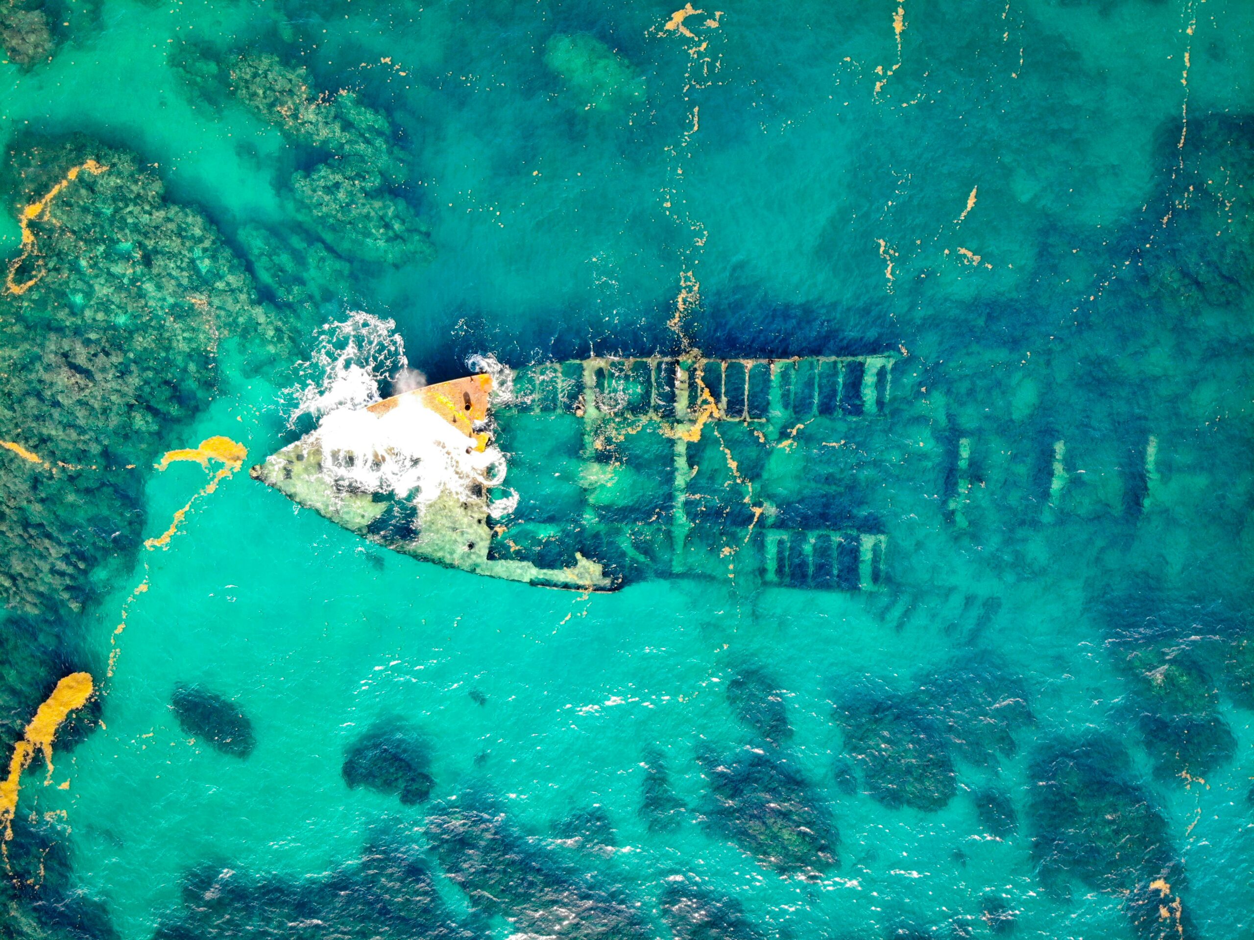
The 17th-century city of Port Royal, which sank during a catastrophic earthquake in 1692, has been extensively surveyed using modern technologies. Sub-bottom profilers mapped buried structures, while photogrammetry documented exposed remains. The site offers unique preservation conditions, with waterlogged artifacts and structures providing extraordinary insights into daily life in a colonial Caribbean port. Technology-driven mapping guides careful excavation and conservation efforts.
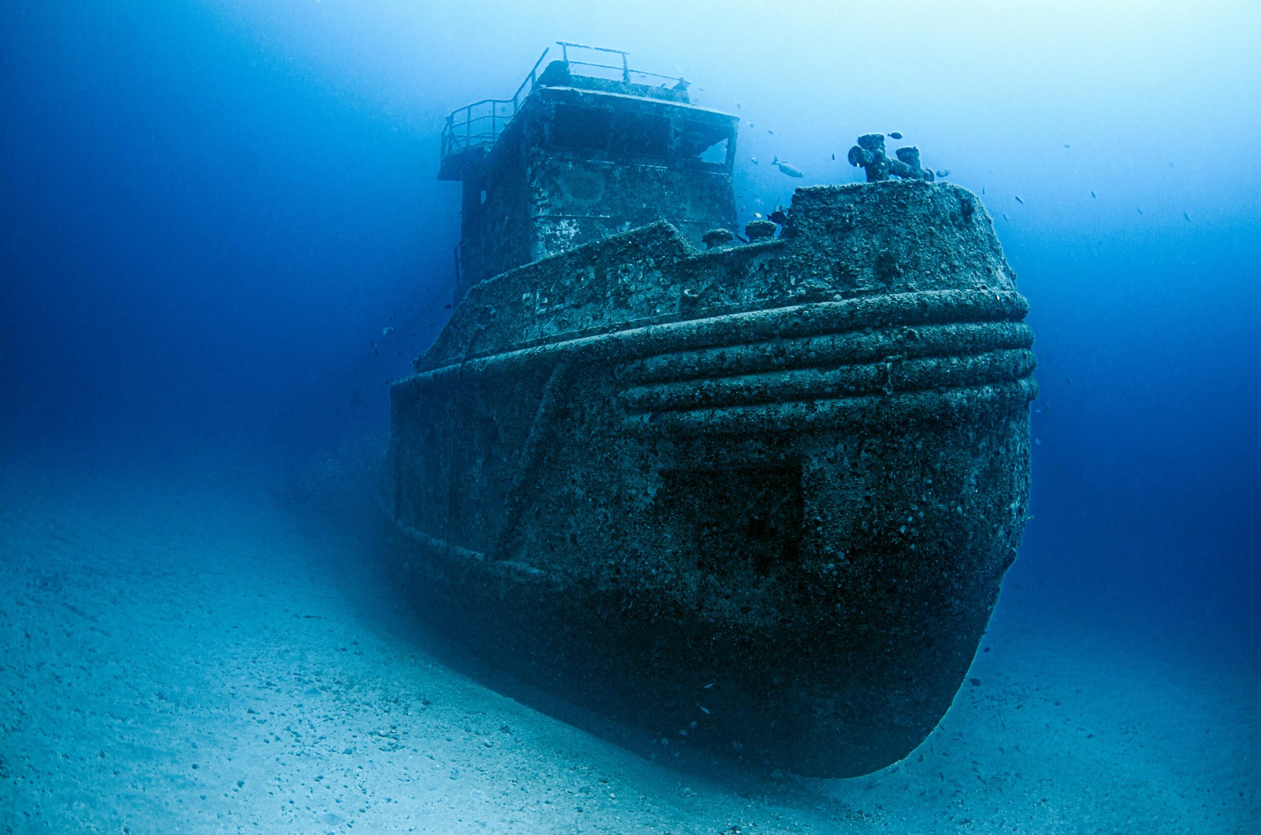
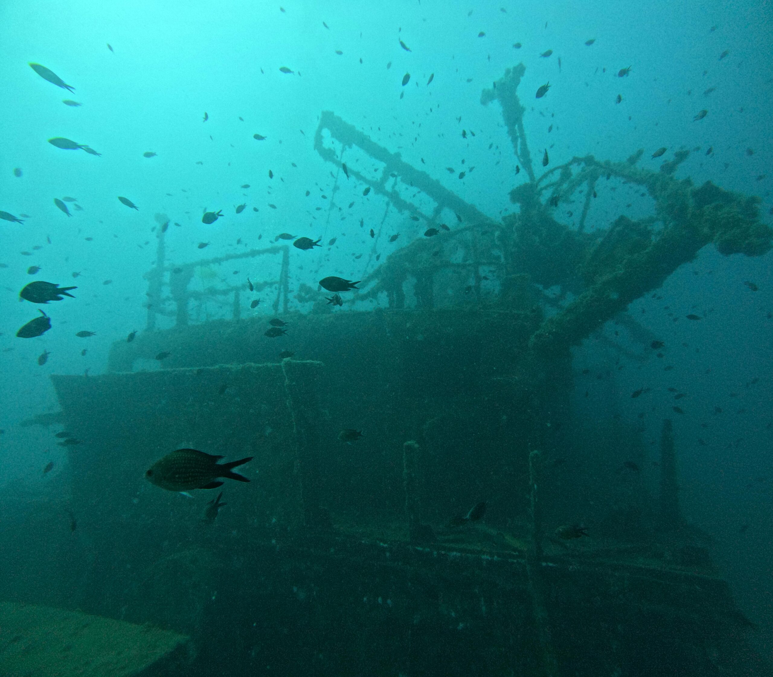
Recent discoveries in the Baltic Sea have revealed remarkably preserved medieval shipwrecks and submerged settlements thanks to AUV surveys covering vast areas. The low-salinity, cold waters provide exceptional preservation, maintaining wooden structures in near-perfect condition. High-resolution multibeam sonar and photogrammetric surveys create detailed records without disturbing these time capsules.
Ethical Considerations and Future Directions 🔮
As technology enables discovery of more underwater archaeological sites, ethical questions about preservation, access, and ownership intensify. Should all discovered sites be excavated, or should some be documented and left in situ? How do we balance scientific research with protection from looters who increasingly use consumer-grade technology for illegal artifact recovery? These questions require ongoing dialogue among archaeologists, governments, and local communities.
The democratization of underwater survey technology creates both opportunities and challenges. Affordable sonar units, consumer drones with waterproof cameras, and accessible software enable citizen scientists to contribute to discoveries. However, this accessibility also facilitates looting and irresponsible site disturbance. Developing ethical frameworks and promoting archaeological literacy becomes crucial as technology spreads.
Climate change adds urgency to underwater archaeological research. Rising sea levels will submerge more coastal sites, while changing ocean conditions affect preservation of existing underwater remains. Warming waters accelerate biological degradation, stronger storms cause physical damage, and ocean acidification dissolves calcareous materials. Technology-driven rapid documentation becomes essential for recording sites before they’re lost forever.
Collaborative International Frameworks
Future progress requires enhanced international cooperation. Underwater archaeological sites often span jurisdictional boundaries or exist in international waters, necessitating collaborative frameworks for research, protection, and heritage management. Organizations like UNESCO facilitate these partnerships, promoting best practices and supporting capacity building in regions with significant underwater cultural heritage but limited technical resources.
Emerging technologies promise even more revolutionary capabilities. Quantum sensors may achieve unprecedented detection sensitivity, neuromorphic computing could enable real-time processing of complex datasets, and advanced materials might allow longer, deeper missions. As these technologies mature, the pace of discovery will accelerate, revealing more lost worlds and rewriting our understanding of human history.
The convergence of multiple cutting-edge technologies transforms underwater archaeology from a field limited by physical constraints into one capable of systematically documenting humanity’s submerged heritage. These tools not only enable rediscovery of lost cities but also provide means for their digital preservation and global accessibility. As we unveil more underwater worlds, we gain invaluable perspectives on how our ancestors adapted to changing environments, built resilient societies, and created the foundations of modern civilization. The lost cities beneath the waves are no longer truly lost—they’re waiting to share their stories through the lens of revolutionary technology.

Toni Santos is a visual storyteller and archival artist whose work dives deep into the submerged narratives of underwater archaeology. Through a lens tuned to forgotten depths, Toni explores the silent poetry of lost worlds beneath the waves — where history sleeps in salt and sediment.
Guided by a fascination with sunken relics, ancient ports, and shipwrecked civilizations, Toni’s creative journey flows through coral-covered amphorae, eroded coins, and barnacle-encrusted artifacts. Each piece he creates or curates is a visual meditation on the passage of time — a dialogue between what is buried and what still speaks.
Blending design, storytelling, and historical interpretation, Toni brings to the surface the aesthetics of maritime memory. His work captures the textures of decay and preservation, revealing beauty in rust, ruin, and ruin’s resilience. Through his artistry, he reanimates the traces of vanished cultures that now rest on ocean floors, lost to maps but not to meaning.
As the voice behind Vizovex, Toni shares curated visuals, thoughtful essays, and reconstructed impressions of archaeological findings beneath the sea. He invites others to see underwater ruins not as remnants, but as thresholds to wonder — where history is softened by water, yet sharpened by myth.
His work is a tribute to:
The mystery of civilizations claimed by the sea
The haunting elegance of artifacts lost to time
The silent dialogue between water, memory, and stone
Whether you’re drawn to ancient maritime empires, forgotten coastal rituals, or the melancholic beauty of sunken ships, Toni welcomes you to descend into a space where the past is submerged but never silenced — one relic, one current, one discovery at a time.