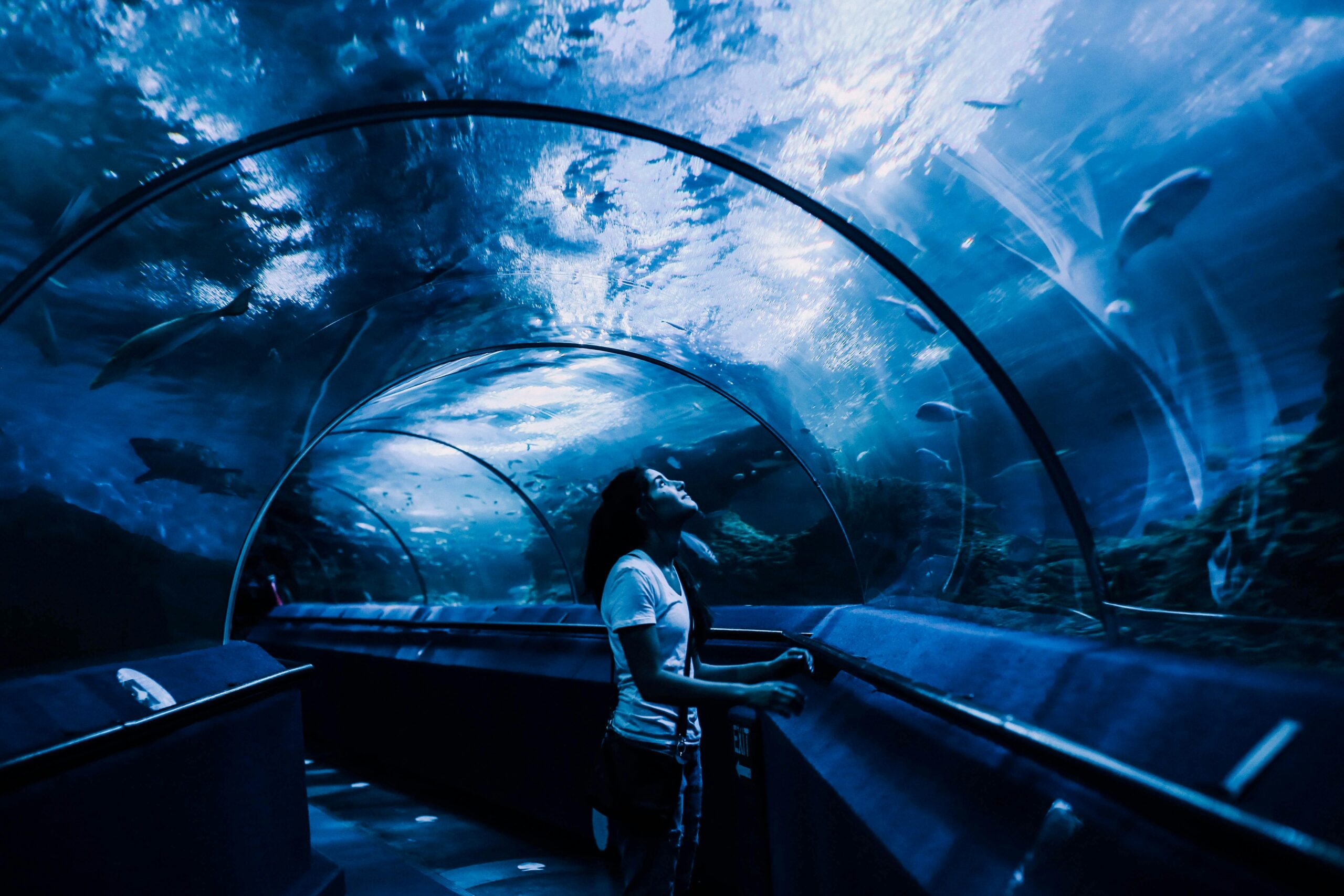
Advanced autonomous underwater vehicles are reshaping how we explore and map the ocean floor, bringing unprecedented accuracy and speed to marine research and industrial applications worldwide.
🌊 The Dawn of a New Era in Ocean Exploration
The world’s oceans remain one of the least explored frontiers on our planet, with more than 80% of the seabed still unmapped at high resolution. This remarkable gap in our knowledge is rapidly closing thanks to revolutionary advances in autonomous underwater vehicle (AUV) technology. These sophisticated robotic platforms are transforming seabed mapping from a slow, expensive, and labor-intensive process into a precise, efficient, and cost-effective operation that’s opening new possibilities for scientific discovery, resource management, and environmental protection.
Modern AUVs represent the convergence of multiple technological breakthroughs, including advanced sensor systems, artificial intelligence, extended battery life, and sophisticated navigation algorithms. Unlike their predecessors, today’s AUVs can operate independently for extended periods, covering vast areas of seafloor while collecting high-resolution data that would have been impossible to obtain just a decade ago.
Understanding the Technology Behind Modern AUVs
At the heart of every advanced AUV lies a complex integration of hardware and software systems working in perfect harmony. These vehicles typically measure between three to six meters in length and are designed to withstand extreme pressure, corrosive saltwater, and challenging underwater conditions while maintaining precise control and sensor accuracy.
The propulsion systems in modern AUVs have evolved significantly, utilizing energy-efficient electric motors and streamlined hull designs that maximize range and minimize acoustic signatures. This quiet operation is crucial for marine research, as it reduces disturbance to marine life and improves the quality of acoustic sensor data collected during missions.
Advanced Sensor Suites Driving Precision Mapping
The real revolution in seabed mapping comes from the sophisticated sensor packages that modern AUVs carry. Multibeam sonar systems create detailed bathymetric maps by emitting multiple sound beams simultaneously, measuring the time it takes for each beam to return after bouncing off the seafloor. Contemporary systems can achieve resolutions of less than one meter, revealing features that were previously invisible to conventional survey methods.
Side-scan sonar complements multibeam systems by providing photographic-quality images of the seafloor texture and identifying objects, geological features, and potential hazards. Synthetic aperture sonar takes this capability even further, using sophisticated signal processing to create ultra-high-resolution images that can detect objects as small as a few centimeters across.
Sub-bottom profilers penetrate beneath the seafloor surface, revealing sediment layers and geological structures hidden below. This capability is invaluable for understanding marine geology, identifying potential hazards for offshore construction, and locating buried archaeological artifacts or natural resources.
🎯 Navigation and Positioning: The Foundation of Accuracy
Accurate positioning represents one of the greatest challenges in underwater operations, as GPS signals cannot penetrate seawater. Advanced AUVs overcome this limitation through sophisticated inertial navigation systems (INS) that track the vehicle’s movement through space using accelerometers and gyroscopes. These systems are complemented by Doppler velocity logs that measure velocity relative to the seafloor and acoustic positioning systems that triangulate the vehicle’s position using underwater transponder networks.
Recent developments in quantum sensing technology promise to revolutionize underwater navigation further, with quantum accelerometers and gyroscopes offering unprecedented accuracy that doesn’t drift over time like conventional inertial sensors. Some experimental systems are already demonstrating position accuracy better than one meter after hours of operation without external reference points.
Artificial Intelligence Enhancing Mission Autonomy
Machine learning algorithms are transforming AUVs from pre-programmed robots into intelligent explorers capable of making real-time decisions based on environmental conditions and mission objectives. These AI systems can automatically adjust survey patterns to focus on areas of particular interest, avoid obstacles, optimize battery usage, and even identify interesting features that warrant closer inspection.
Neural networks trained on millions of seafloor images can now automatically classify bottom types, identify man-made objects, detect marine life, and flag anomalies for human review. This capability dramatically reduces the time required for data analysis and ensures that important features aren’t overlooked in the massive datasets that modern surveys generate.
Operational Efficiency Transforming Marine Industries
The efficiency gains from advanced AUVs extend far beyond faster survey speeds. Traditional ship-based surveys require expensive vessels, large crews, and favorable weather conditions. AUVs can operate in conditions that would be dangerous or impossible for surface vessels, including under ice, in shallow water with strong currents, and during storms that would force traditional survey ships to seek shelter.
Modern AUVs can be deployed from relatively small support vessels or even from shore in some cases, dramatically reducing operational costs. Multiple vehicles can operate simultaneously from a single support vessel, multiplying survey productivity while maintaining consistent data quality across the entire survey area.
Extended Mission Duration Through Energy Innovation
Battery technology advances have extended AUV mission duration from hours to days or even weeks in some cases. Lithium-ion batteries with improved energy density provide the foundation, while sophisticated power management systems ensure optimal energy use throughout the mission. Some experimental vehicles are exploring alternative power sources, including fuel cells, which could enable missions lasting months.
Energy harvesting technologies are also being integrated into AUV designs, with solar panels for near-surface operations, thermal gradient generators that exploit temperature differences in the water column, and even systems that harvest energy from ocean currents. These innovations promise to extend mission duration further while reducing the environmental impact of battery disposal.
🔬 Scientific Discovery and Environmental Monitoring
Advanced AUVs are accelerating scientific discovery across multiple disciplines. Marine biologists use them to study deep-sea ecosystems, track marine mammal populations, and monitor coral reef health with minimal disturbance to the creatures under study. The ability to revisit the same locations repeatedly with precise positioning enables researchers to document environmental changes over time with unprecedented accuracy.
Oceanographers employ AUVs to measure water properties, ocean currents, and chemical composition across three-dimensional volumes of ocean space. This data improves our understanding of ocean circulation patterns, carbon cycling, and the impacts of climate change on marine ecosystems. Some AUVs are equipped with specialized sensors that can detect specific chemical compounds, enabling them to track pollution, identify hydrothermal vent emissions, or locate underwater gas seeps.
Mapping the Unknown: Deep Ocean Exploration
The deep ocean, particularly areas below 6,000 meters, remains largely unexplored due to the extreme technical challenges involved. Advanced AUVs designed for ultra-deep operations are beginning to change this situation, with vehicles capable of reaching the deepest ocean trenches while maintaining full sensor functionality and navigation accuracy.
These deep-diving platforms have revealed entirely new ecosystems, discovered previously unknown geological features, and provided insights into the processes that shape our planet’s surface. The discovery of new species, hydrothermal vent systems, and geological phenomena continues at an accelerating pace as more capable AUVs expand the reach of human exploration.
Industrial Applications Driving Commercial Adoption
The offshore energy industry has emerged as one of the largest adopters of advanced AUV technology. Companies use these vehicles for pipeline inspection, platform surveys, site investigation for new installations, and environmental monitoring to ensure compliance with regulations. The precision and efficiency of AUV surveys have made them indispensable for planning and maintaining offshore infrastructure.
Telecommunications companies rely on AUVs to survey routes for undersea cables that carry the vast majority of international data traffic. The detailed seafloor maps these vehicles produce help engineers identify the safest, most direct routes while avoiding hazards that could damage cables and disrupt global communications.
Maritime Security and Defense Applications
Naval forces worldwide are incorporating advanced AUVs into their operations for mine countermeasures, harbor security, and intelligence gathering. These vehicles can survey potential mine fields at safe distances from surface vessels, identify underwater threats, and map coastal areas in preparation for amphibious operations. The autonomous nature of these systems reduces risk to human personnel while providing detailed information about underwater environments.
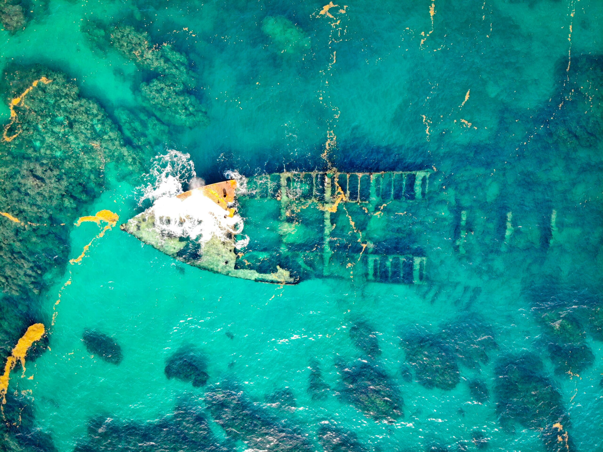
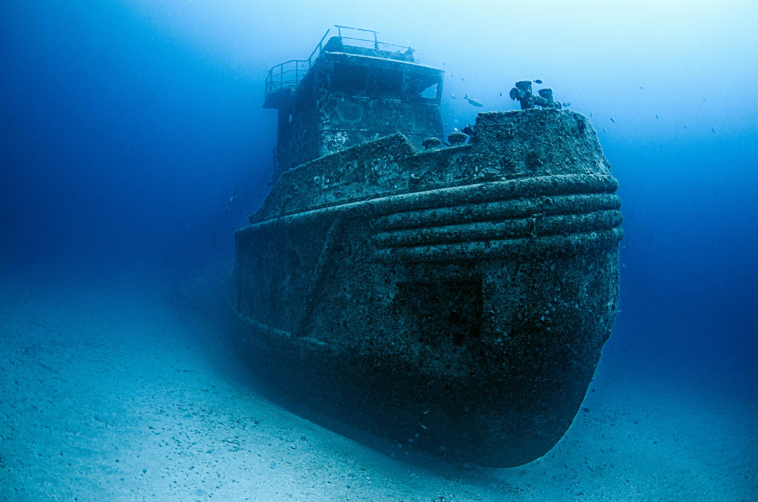
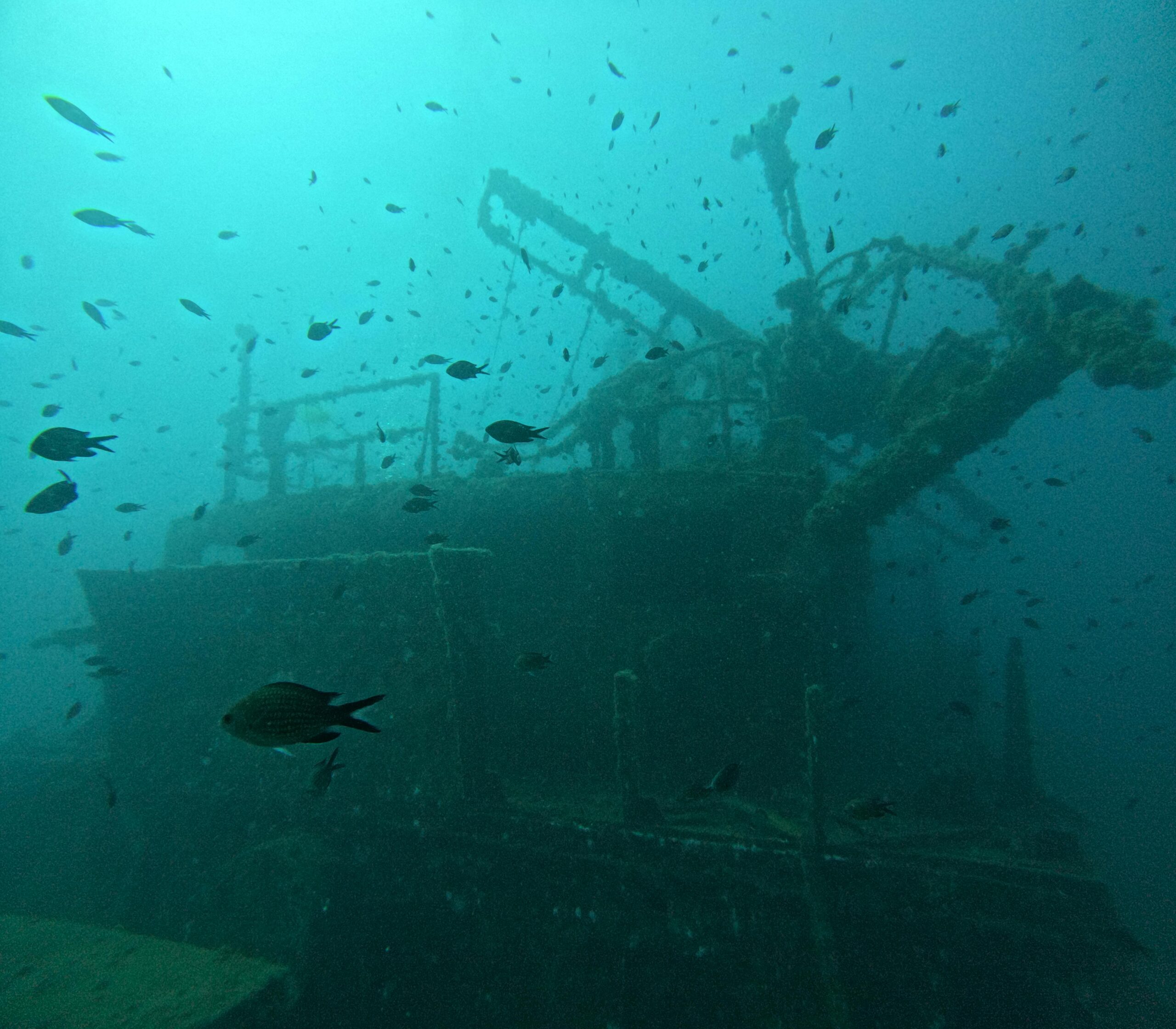
Archaeological surveys have also benefited tremendously from AUV technology, with researchers using these vehicles to locate and document shipwrecks, submerged settlements, and other underwater cultural heritage sites. The non-invasive nature of acoustic surveys allows archaeologists to assess sites without disturbing them, preserving these irreplaceable resources for future study.
⚡ Overcoming Challenges and Future Developments
Despite remarkable advances, several challenges remain in AUV technology. Communication with submerged vehicles remains limited, as radio waves don’t propagate well through seawater. Acoustic communications offer low bandwidth connectivity, while optical systems provide higher speeds but only over short distances. Researchers are exploring novel solutions, including networks of autonomous surface vehicles that maintain position above AUVs to relay data and commands.
Data storage and processing represent another challenge, as high-resolution sensors generate enormous volumes of data during extended missions. Some vehicles now incorporate edge computing capabilities, processing data onboard to extract key information and reduce the volume that must be transmitted or stored. This approach also enables more sophisticated autonomous behaviors based on real-time data analysis.
Swarm Technology: The Next Frontier
The future of ocean exploration may lie in coordinated swarms of smaller, more affordable AUVs working together to map vast areas quickly. Swarm technology draws inspiration from natural systems like schools of fish or flocks of birds, where simple local interactions between individuals produce sophisticated group behaviors. Research teams are developing algorithms that enable multiple AUVs to coordinate their actions autonomously, adapting their survey patterns in real-time to maximize efficiency and data quality.
These swarm systems could dramatically reduce the cost and time required for comprehensive ocean mapping while providing redundancy that increases mission reliability. If one vehicle experiences problems, others can compensate, ensuring mission completion even in the face of equipment failures.
Environmental Considerations and Sustainable Exploration
As AUV operations expand, environmental considerations are receiving increased attention. Researchers are studying the potential impacts of acoustic emissions on marine life, particularly marine mammals and fish that rely on sound for communication and navigation. Modern AUVs are being designed with this in mind, incorporating quieter propulsion systems and adaptive sensor operation that minimizes acoustic energy when not essential for mission success.
The materials used in AUV construction are also evolving, with manufacturers exploring biodegradable components and recyclable materials that reduce environmental impact if vehicles are lost at sea. Battery technology advances are reducing the use of toxic materials while improving energy density and safety.
🚀 Transforming Our Relationship with the Ocean
The revolution in seabed mapping enabled by advanced AUVs extends beyond technical capabilities to fundamentally change how humanity relates to the ocean environment. For the first time in history, we possess the tools to comprehensively map, monitor, and understand the ocean floor at scales ranging from individual rocks to entire ocean basins. This knowledge empowers better decision-making for resource management, conservation, and sustainable development.
International initiatives like the Nippon Foundation-GEBCO Seabed 2030 project, which aims to map the entire ocean floor at high resolution by 2030, rely heavily on AUV technology to achieve their ambitious goals. These efforts promise to reveal the last great frontier on Earth, advancing scientific knowledge while supporting practical applications from fisheries management to climate modeling.
Education and Public Engagement
Advanced AUVs are also serving as powerful tools for ocean education and public engagement. Real-time data streaming from AUV missions allows students and interested citizens worldwide to follow along with exploration missions, fostering ocean literacy and inspiring the next generation of marine scientists and engineers. Virtual reality applications that recreate seafloor environments from AUV data enable immersive experiences that bring the deep ocean to audiences who would never have the opportunity to visit these environments personally.
The Path Forward: Integration and Innovation
Looking ahead, the integration of AUVs with other ocean observation platforms promises even greater capabilities. Autonomous surface vehicles can extend AUV range by serving as mobile communication relays and battery charging stations. Underwater docking stations enable AUVs to operate continuously in remote locations, uploading data and recharging without returning to shore. Gliders and profiling floats complement AUV surveys by providing water column measurements that add context to seafloor observations.
The convergence of AUV technology with advances in materials science, quantum sensing, artificial intelligence, and energy storage will continue to push the boundaries of what’s possible in ocean exploration. Each improvement in capability opens new applications and enables discoveries that were previously impossible, driving a virtuous cycle of innovation and exploration that shows no signs of slowing.
As these technologies mature and costs continue to decline, access to advanced ocean mapping capabilities will democratize, enabling smaller research institutions, developing nations, and private organizations to participate in ocean exploration and monitoring. This broader participation promises to accelerate the pace of discovery while ensuring that ocean knowledge serves the benefit of all humanity rather than remaining the exclusive domain of wealthy nations and large corporations.
The revolution in ocean exploration driven by advanced AUVs represents more than technological progress—it marks a transformation in human capability that will shape how we understand, manage, and protect our planet’s largest and most important ecosystem for generations to come. As these remarkable vehicles continue to evolve and proliferate, they carry with them our hopes for a sustainable future built on deep knowledge of the ocean environment that sustains all life on Earth.

Toni Santos is a visual storyteller and archival artist whose work dives deep into the submerged narratives of underwater archaeology. Through a lens tuned to forgotten depths, Toni explores the silent poetry of lost worlds beneath the waves — where history sleeps in salt and sediment.
Guided by a fascination with sunken relics, ancient ports, and shipwrecked civilizations, Toni’s creative journey flows through coral-covered amphorae, eroded coins, and barnacle-encrusted artifacts. Each piece he creates or curates is a visual meditation on the passage of time — a dialogue between what is buried and what still speaks.
Blending design, storytelling, and historical interpretation, Toni brings to the surface the aesthetics of maritime memory. His work captures the textures of decay and preservation, revealing beauty in rust, ruin, and ruin’s resilience. Through his artistry, he reanimates the traces of vanished cultures that now rest on ocean floors, lost to maps but not to meaning.
As the voice behind Vizovex, Toni shares curated visuals, thoughtful essays, and reconstructed impressions of archaeological findings beneath the sea. He invites others to see underwater ruins not as remnants, but as thresholds to wonder — where history is softened by water, yet sharpened by myth.
His work is a tribute to:
The mystery of civilizations claimed by the sea
The haunting elegance of artifacts lost to time
The silent dialogue between water, memory, and stone
Whether you’re drawn to ancient maritime empires, forgotten coastal rituals, or the melancholic beauty of sunken ships, Toni welcomes you to descend into a space where the past is submerged but never silenced — one relic, one current, one discovery at a time.