The ocean covers over 70% of Earth’s surface, yet remains one of the least explored frontiers. Modern technology is changing this reality dramatically. 🌊
The Evolution of Underwater Navigation Technology
For centuries, sailors and explorers relied on celestial navigation, compasses, and dead reckoning to traverse the world’s oceans. However, once beneath the surface, navigators entered a realm where traditional tools became virtually useless. The magnetic compass loses reliability at depth, radio waves cannot penetrate water effectively, and GPS signals—which revolutionized land and surface navigation—simply do not work underwater.
This fundamental challenge has driven innovation in underwater positioning systems over the past several decades. From early acoustic beacons to sophisticated integrated networks, the technology has evolved remarkably. Today’s underwater positioning systems combine acoustic signals, inertial navigation, and surface GPS coordination to create comprehensive navigation solutions that enable unprecedented exploration and operation in the ocean depths.
Why GPS Fails Beneath the Waves
Understanding why GPS doesn’t work underwater is crucial to appreciating the alternative technologies developed for subsea navigation. GPS satellites transmit radio frequency signals at approximately 1.5 GHz. These electromagnetic waves travel exceptionally well through the atmosphere and space, but water—particularly saltwater—absorbs and attenuates these signals rapidly.
Radio waves in the GPS frequency range can only penetrate a few centimeters of seawater before becoming completely absorbed. This physical limitation isn’t a design flaw; it’s an unavoidable consequence of how electromagnetic radiation interacts with conductive media. Freshwater performs slightly better but still prevents GPS signals from reaching any meaningful depth.
This reality has necessitated the development of entirely different positioning systems based on acoustic rather than electromagnetic transmission. Sound waves, unlike radio waves, propagate efficiently through water, traveling approximately 1,500 meters per second in seawater—about four times faster than through air.
Acoustic Positioning: The Foundation of Underwater Navigation
Acoustic positioning systems form the backbone of modern underwater navigation. These systems use sound waves transmitted through water to determine the position of vehicles, divers, or equipment. Several distinct approaches have emerged, each with specific advantages for different applications.
Long Baseline (LBL) Systems 🎯
Long Baseline systems represent the most accurate acoustic positioning method available. LBL networks consist of multiple transponders positioned on the seafloor in a precise geometric pattern, typically covering an area ranging from several hundred meters to several kilometers across. These transponders create a reference frame similar to GPS satellites, but operating underwater.
A submersible or underwater vehicle equipped with an acoustic interrogator sends signals to these transponders. By measuring the time it takes for acoustic signals to travel to and from multiple transponders, the system calculates the vehicle’s precise three-dimensional position through trilateration. LBL systems can achieve positioning accuracy of less than one meter, making them ideal for scientific research, offshore oil and gas operations, and archaeological surveys.
The primary limitation of LBL systems is the initial deployment requirement. Installing and calibrating a network of seafloor transponders demands significant time, specialized equipment, and vessel support. However, once established, an LBL network can provide reliable positioning for extended operations in a defined area.
Ultra-Short Baseline (USBL) Systems
Ultra-Short Baseline systems offer a more flexible alternative to LBL networks. USBL operates from a single transceiver head mounted on a surface vessel or submerged platform. This compact array contains multiple transducer elements positioned very close together—hence “ultra-short baseline.”
When the USBL transceiver interrogates a transponder on an underwater vehicle or equipment, it measures both the range (from travel time) and the bearing (from phase differences between the transducer elements). The system can then calculate the transponder’s position relative to the transceiver. Combined with GPS positioning of the surface vessel and heading information from an inertial navigation system, USBL provides absolute positioning of underwater targets.
USBL systems typically achieve accuracy between one and three percent of the slant range, making them less precise than LBL at long distances but far more convenient for mobile operations, rapid deployment scenarios, and tracking multiple targets across large areas.
Short Baseline (SBL) Systems
Short Baseline systems represent a middle ground between LBL and USBL approaches. SBL uses multiple transducers mounted on a surface vessel’s hull, separated by distances of 10-50 meters. This configuration provides better geometric strength than USBL while maintaining the convenience of ship-based deployment without seafloor infrastructure.
SBL systems are particularly common in military applications and commercial diving support, where they balance accuracy, cost, and operational flexibility effectively.
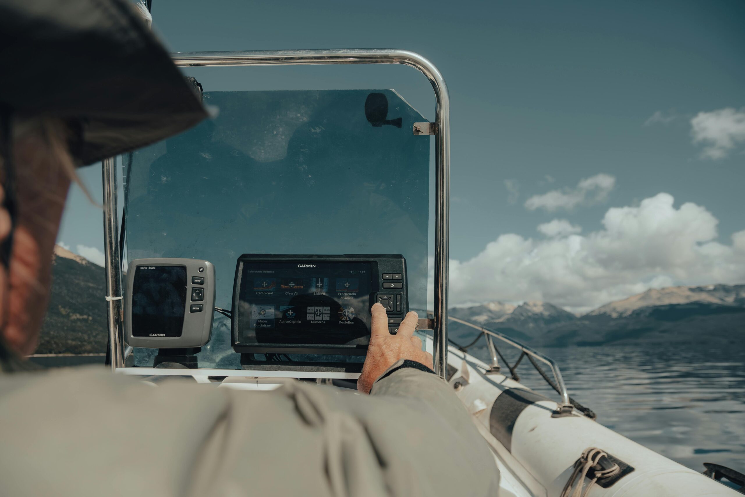
Integrating Surface GPS with Underwater Positioning 📡
While GPS cannot function underwater, it plays a vital role in comprehensive underwater positioning systems. The integration of surface GPS with acoustic positioning creates hybrid systems capable of providing accurate global coordinates to submerged assets.
Surface vessels equipped with differential GPS (DGPS) or real-time kinematic (RTK) GPS can achieve positioning accuracy at the centimeter level. When these vessels operate USBL or SBL systems, the precise surface position combines with the acoustic range and bearing measurements to calculate the exact global coordinates of underwater targets.
Autonomous underwater vehicles (AUVs) often surface periodically to obtain GPS fixes, updating their onboard inertial navigation systems. This technique, called GPS disciplining, allows the vehicle to maintain acceptable positioning accuracy during extended underwater missions by correcting accumulated drift from dead reckoning.
Inertial Navigation and Doppler Velocity Logs
Between acoustic position updates, underwater vehicles rely heavily on inertial navigation systems (INS) and Doppler velocity logs (DVL) to maintain position awareness through dead reckoning.
Modern INS units incorporate accelerometers and gyroscopes that measure acceleration and rotation in three dimensions. By continuously integrating these measurements, the system calculates position and orientation. However, small measurement errors accumulate over time, causing position estimates to drift—sometimes dramatically over extended periods.
Doppler velocity logs complement INS by measuring the vehicle’s velocity relative to the seafloor or water column. A DVL transmits acoustic beams toward the bottom and measures the Doppler shift in the returned signal, precisely determining speed over ground. When integrated with INS, DVL significantly reduces position drift, often maintaining accuracy within 0.1-0.2% of distance traveled between position fixes.
Applications Transforming Ocean Exploration
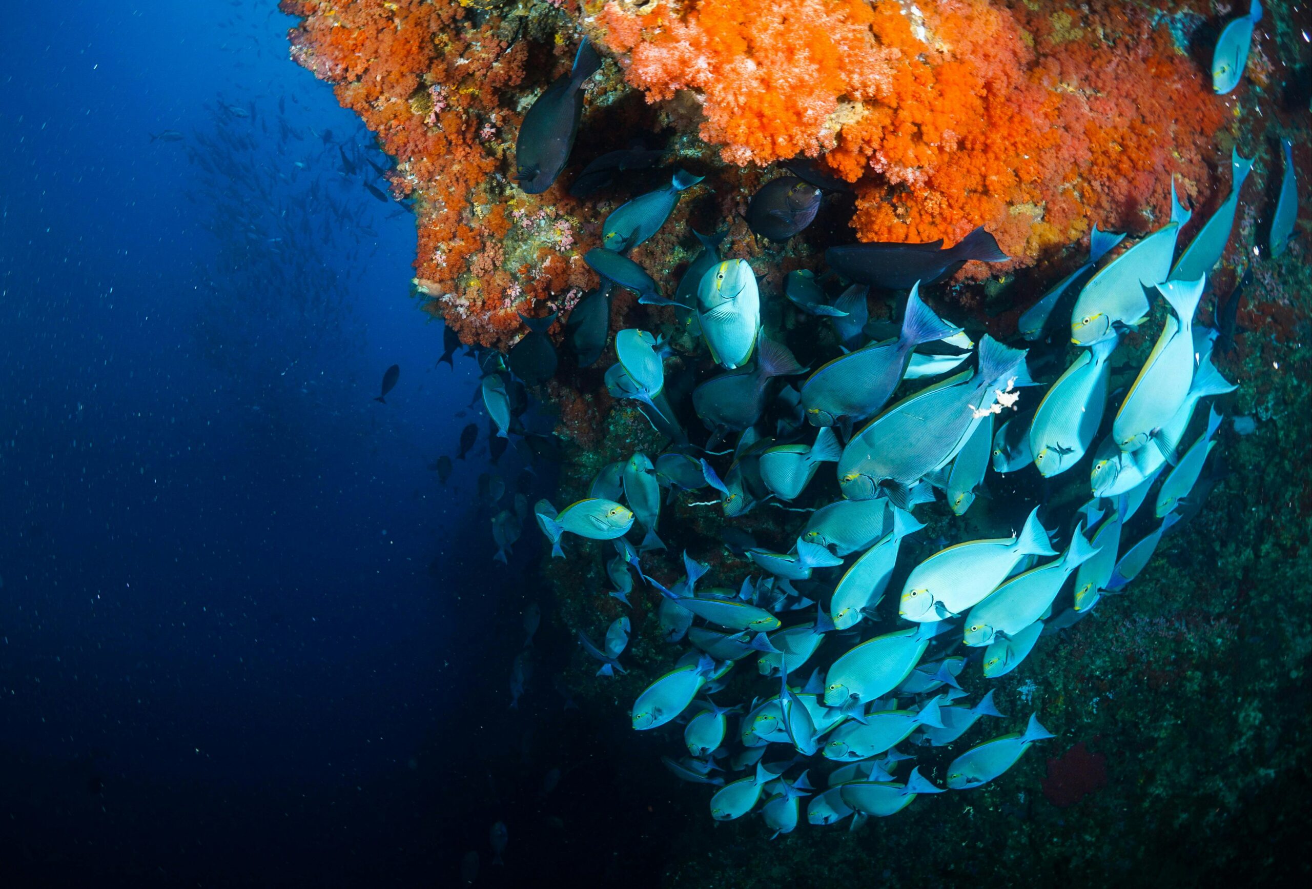
Scientific Research and Marine Biology 🔬
Precise underwater positioning has revolutionized marine science. Researchers can now track individual fish using acoustic tags, map benthic habitats with centimeter-level accuracy, and conduct repeated surveys of specific sites to monitor environmental changes over time.
Deep-sea research vehicles equipped with sophisticated positioning systems have discovered hydrothermal vents, mapped seamounts, and documented ecosystems in environments previously inaccessible to detailed study. The ability to return to exact locations enables long-term monitoring programs that track oceanographic changes, species migration patterns, and ecological responses to climate change.
Offshore Energy Operations
The offshore oil and gas industry represents one of the largest users of underwater positioning technology. Precision positioning is essential for drilling operations, pipeline installation, subsea infrastructure inspection, and remotely operated vehicle (ROV) work at depths exceeding 3,000 meters.
Renewable energy installations, particularly offshore wind farms, increasingly rely on underwater positioning for foundation surveys, cable laying, and ongoing structural monitoring. As these installations move into deeper waters, positioning requirements become more demanding, driving continued technological advancement.
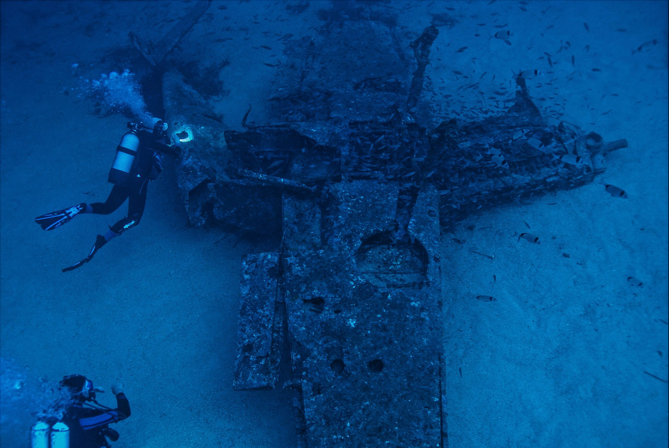
Archaeological and Shipwreck Documentation
Underwater archaeology has been transformed by precise positioning capabilities. Researchers can create detailed three-dimensional maps of shipwrecks and submerged cultural sites, documenting artifacts in their exact positions before recovery. This spatial information provides crucial archaeological context that would be lost with less precise methods.
The combination of acoustic positioning with photogrammetry and multibeam sonar enables the creation of millimeter-resolution digital models of underwater sites, preserving cultural heritage in unprecedented detail while minimizing physical disturbance to fragile historical materials.
Military and Defense Applications 🛡️
Naval forces worldwide employ sophisticated underwater positioning for submarine navigation, mine countermeasures, underwater surveillance, and autonomous vehicle operations. Military requirements have driven development of highly accurate, covert positioning systems that operate without revealing position through acoustic transmissions.
Terrain-referenced navigation represents an advanced technique where vehicles compare measured seafloor topography against digital bathymetric maps to determine position without external signals. This approach provides positioning accuracy comparable to LBL systems while maintaining complete acoustic stealth.
Challenges and Current Limitations
Despite remarkable progress, underwater positioning still faces significant challenges. Acoustic propagation is affected by water temperature, salinity, pressure, and suspended particles, creating variations in sound speed that can introduce positioning errors. Multi-path reflections from the surface, seafloor, and other structures can create ambiguous measurements.
Deep ocean environments present particular difficulties. At depths beyond 6,000 meters, extreme pressure, low temperatures, and long acoustic propagation times challenge equipment reliability and positioning update rates. Coverage in ice-covered regions remains problematic, as ice keels create acoustic reflections and interfere with surface vessel operations.
Cost represents another significant barrier. High-precision underwater positioning systems require substantial capital investment and specialized expertise to deploy and operate effectively. This economic reality limits access primarily to well-funded government agencies, military organizations, and major commercial operators.
Emerging Technologies and Future Directions
Underwater Communication Networks
Researchers are developing underwater acoustic communication networks that provide both positioning and data transmission capabilities. These networks enable swarms of autonomous vehicles to coordinate operations, share sensor data, and collectively map large ocean areas more efficiently than individual platforms.
Optical and Magnetic Positioning
Experimental systems using optical methods and magnetic field mapping offer potential alternatives to acoustic positioning in specific scenarios. Optical positioning using cameras and artificial markers works well over short ranges in clear water, while geomagnetic navigation techniques show promise for large-scale positioning in areas with distinctive magnetic anomalies.
Machine Learning and Artificial Intelligence 🤖
AI algorithms are being integrated into underwater positioning systems to predict and compensate for environmental effects on acoustic propagation, identify and reject erroneous measurements, and optimize navigation strategies based on mission objectives and environmental conditions. Machine learning approaches can potentially extract positioning information from ambient acoustic noise and environmental features that conventional systems ignore.
The Next Frontier: Standardization and Accessibility
As underwater positioning technology matures, efforts toward standardization and increased accessibility are gaining momentum. Open-source positioning software, lower-cost acoustic transponders, and integrated sensor packages designed for small autonomous vehicles are making precision underwater navigation available to smaller research institutions, environmental organizations, and innovative startups.
International collaboration on seafloor reference networks and shared positioning infrastructure could dramatically reduce operational costs while improving data compatibility across different research programs and national boundaries. Such cooperation would accelerate ocean exploration and scientific discovery while promoting sustainable ocean management.
Charting the Course Forward 🧭
The convergence of GPS technology for surface operations with sophisticated acoustic positioning systems for underwater navigation has created capabilities that previous generations could scarcely imagine. Today’s explorers can navigate the ocean depths with confidence, returning to precise locations, tracking moving targets, and conducting operations that require centimeter-level accuracy thousands of meters below the surface.
Yet vast portions of the ocean remain unexplored, their secrets waiting to be discovered. The continued evolution of underwater positioning technology—incorporating advances in acoustic engineering, inertial sensors, artificial intelligence, and autonomous systems—will unlock these mysteries. From understanding climate change impacts on deep ocean ecosystems to locating mineral resources for sustainable extraction, from protecting underwater cultural heritage to ensuring safe navigation in increasingly busy ocean spaces, precise positioning technology forms the foundation for humanity’s expanding relationship with the ocean.
As technology becomes more capable, affordable, and accessible, we stand at the threshold of an era of ocean exploration and understanding comparable to the great age of terrestrial mapping. The tools now exist to navigate the depths with precision approaching that available on land and in space. How we use these capabilities—whether to exploit or protect, to understand or simply to use—will determine not just what we discover in the ocean depths, but what kind of future we create for our blue planet.
The revolution in underwater positioning has only begun. The depths await, and for the first time in human history, we possess the navigation tools to meet them on equal terms. What we choose to do with this capability will echo through generations yet to come.

Toni Santos is a maritime researcher and underwater archaeologist specializing in the study of submerged heritage, ancient port systems, and the cultural landscapes preserved beneath the sea. Through an interdisciplinary and immersive approach, Toni investigates how humanity has left traces of knowledge, commerce, and legend in the underwater world — across oceans, myths, and sunken cities.
His work is grounded in a fascination with wrecks not only as artifacts, but as carriers of hidden meaning. From historic shipwreck discoveries to mythical harbors and lost coastal settlements, Toni uncovers the physical and cultural evidence through which civilizations preserved their relationship with the maritime unknown.
With a background in marine archaeology and underwater survey methods, Toni blends technical analysis with archival research to reveal how oceans were used to shape identity, transmit memory, and encode sacred knowledge.
As the creative mind behind revaltro, Toni curates documented dive studies, speculative harbor maps, and archaeological interpretations that revive the deep cultural ties between water, folklore, and forgotten science.
His work is a tribute to:
The submerged heritage of Historic Shipwrecks and Their Cargoes
The legendary sites of Mythical Harbors and Lost Civilizations
The technical methods of Underwater Exploration Techniques
The natural archiving power of Preservation in Salt and Sediment
Whether you’re a maritime historian, nautical researcher, or curious explorer of forgotten submerged worlds, Toni invites you to explore the hidden depths of oceanic heritage — one wreck, one harbor, one legend at a time.