The ocean floor remains one of the last great frontiers on Earth, holding secrets that cutting-edge side-scan sonar technology is finally helping us reveal with unprecedented clarity and precision. 🌊
For centuries, humanity has gazed upon the ocean’s surface while the depths below remained shrouded in mystery. Traditional exploration methods provided only fragmented glimpses of what lies beneath the waves. Today, however, revolutionary side-scan sonar mapping technology is transforming our ability to visualize, understand, and interact with underwater environments in ways that seemed impossible just decades ago.
This technological revolution is not merely an incremental improvement over previous methods—it represents a fundamental shift in how we approach underwater exploration, marine archaeology, environmental conservation, and resource management. From discovering ancient shipwrecks to mapping critical habitats and ensuring maritime safety, side-scan sonar has become an indispensable tool across numerous industries and scientific disciplines.
The Evolution of Underwater Acoustic Imaging 🔊
Side-scan sonar technology emerged from military applications during the mid-20th century, initially designed to detect submarines and underwater mines. The fundamental principle involves emitting sound waves from a device towed behind or mounted beneath a vessel, then capturing the echoes that bounce back from the seafloor and underwater objects.
Unlike traditional depth sounders that only measure directly beneath a vessel, side-scan sonar systems emit fan-shaped acoustic beams perpendicular to the direction of travel. This allows for comprehensive coverage of wide swaths of seafloor in a single pass, creating detailed acoustic images that reveal texture, composition, and topography.
Modern systems have evolved dramatically from their predecessors. Early models produced grainy, difficult-to-interpret images with limited range and resolution. Contemporary side-scan sonar technology now offers high-definition imaging capabilities, extended range, real-time processing, and integration with GPS and other positioning systems for precise georeferencing.
How Modern Side-Scan Sonar Systems Work
Understanding the mechanics behind this technology reveals why it has become so transformative. The process begins when transducers emit acoustic pulses at specific frequencies—typically ranging from 100 kHz to over 1 MHz, depending on the application requirements.
Lower frequencies penetrate deeper into sediments and provide greater range but with reduced resolution. Higher frequencies offer exceptional detail but over shorter distances. Advanced systems often employ multiple frequencies simultaneously, combining the advantages of both approaches.
As sound waves travel through water and encounter the seafloor or objects, they reflect back to receiving hydrophones. The intensity and timing of these returns create an acoustic shadow image. Hard, dense objects like rocks or metal produce strong returns (appearing light in the imagery), while soft sediments absorb more sound energy (appearing darker).
Sophisticated signal processing algorithms then convert this raw acoustic data into interpretable images. Modern software can enhance contrast, reduce noise, correct for vessel motion, and even create three-dimensional representations of underwater features.
Revolutionary Applications Transforming Multiple Industries ⚓
The versatility of side-scan sonar mapping technology has made it invaluable across an impressive range of applications, each benefiting from the unique capabilities this technology provides.
Marine Archaeology and Cultural Heritage Preservation
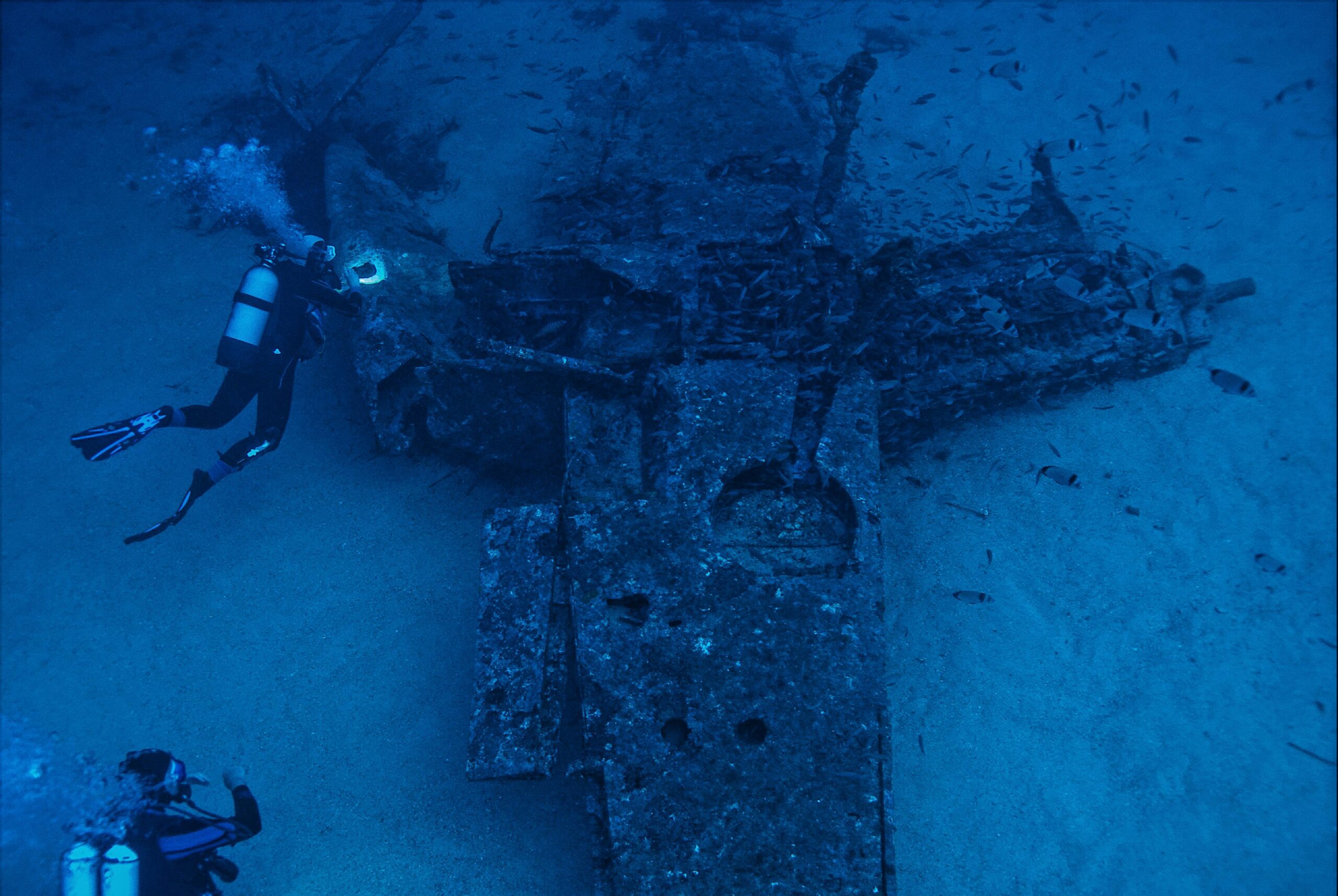
Perhaps no field has been more dramatically transformed than underwater archaeology. Side-scan sonar allows researchers to survey vast areas of seafloor quickly and non-invasively, identifying potential archaeological sites without disturbing them.
Legendary shipwreck discoveries have been made possible through systematic side-scan surveys. The technology can distinguish between natural geological features and human-made structures, even when buried under sediment layers. Researchers can now create comprehensive maps of entire maritime archaeological landscapes, understanding ancient trade routes, naval battles, and cultural connections.
The non-destructive nature of acoustic imaging is particularly important for heritage preservation. Traditional excavation methods are expensive, time-consuming, and inherently destructive. Side-scan sonar provides detailed information about site extent, artifact distribution, and preservation conditions before any physical intervention occurs.
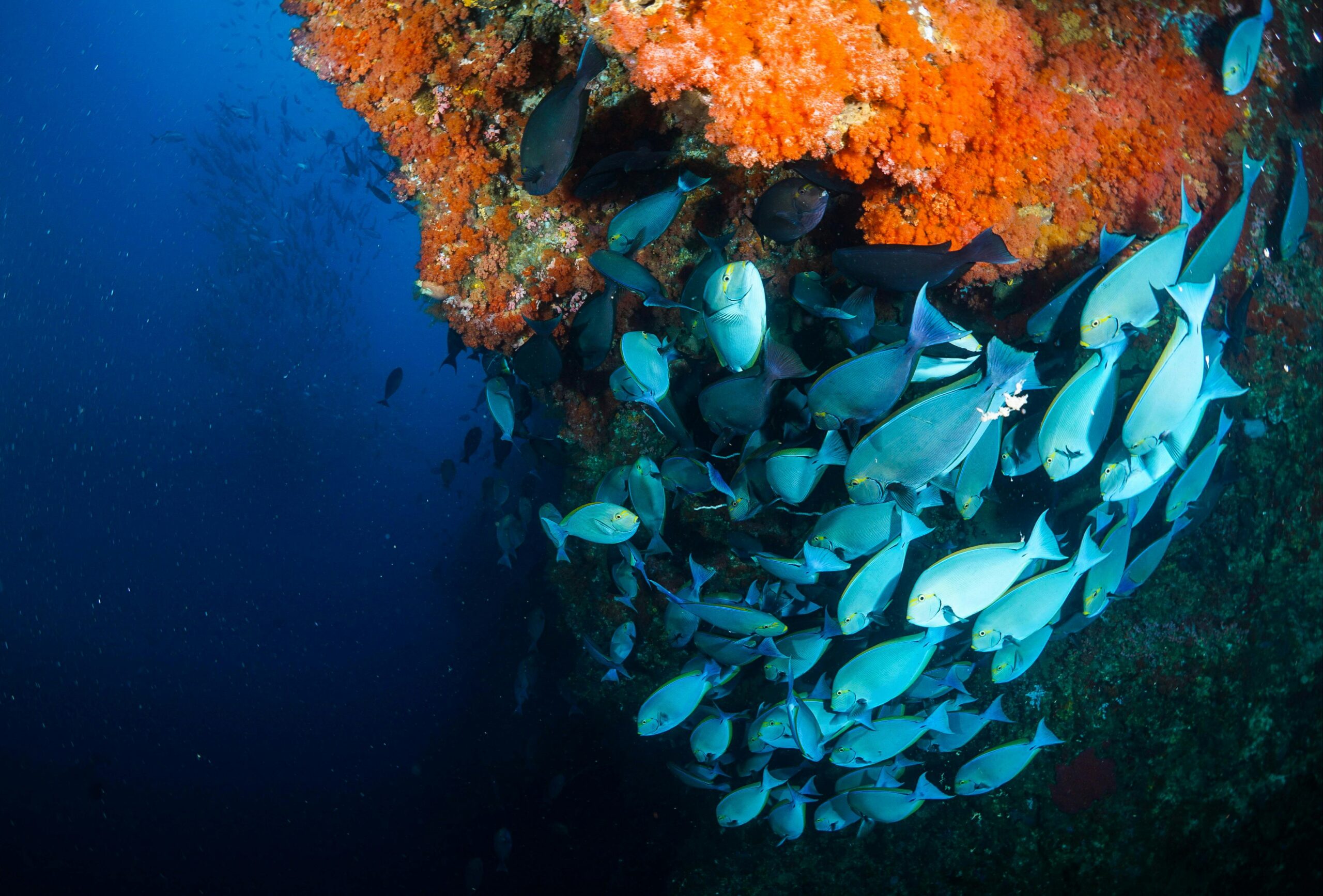
Environmental Monitoring and Habitat Mapping
Conservation efforts increasingly rely on accurate baseline data about marine ecosystems. Side-scan sonar excels at mapping benthic habitats, distinguishing between different substrate types, vegetation coverage, and topographical features that determine where organisms can thrive.
Scientists use this technology to monitor changes over time, tracking coastal erosion, sediment transport, coral reef health, and the impacts of human activities. The ability to repeatedly survey the same areas with high precision enables detection of subtle environmental changes that might otherwise go unnoticed until significant damage has occurred.
Fisheries management also benefits enormously from habitat mapping. Understanding where critical spawning grounds, nursery areas, and feeding zones exist allows for more effective conservation measures and sustainable resource management strategies.
Infrastructure Inspection and Maritime Safety
Underwater infrastructure—including pipelines, cables, bridge foundations, and offshore platforms—requires regular inspection to ensure integrity and safety. Side-scan sonar provides detailed imagery of these structures and their surrounding environments, identifying potential problems like scour, corrosion, or debris accumulation.
Port authorities use the technology for navigational safety, mapping underwater hazards, monitoring dredging operations, and ensuring shipping channels remain clear. The ability to quickly survey large areas makes it ideal for routine maintenance and emergency response situations.
Following natural disasters or maritime accidents, side-scan sonar becomes crucial for damage assessment and recovery operations. Search and rescue teams rely on it to locate aircraft wreckage, sunken vessels, and missing persons in challenging underwater environments where visibility is limited or nonexistent.
Technical Advancements Pushing Boundaries Forward 🚀
The rapid pace of technological innovation continues to expand the capabilities and applications of side-scan sonar systems. Several key developments are particularly noteworthy.
Synthetic Aperture Sonar (SAS)
Synthetic aperture sonar represents a quantum leap in imaging resolution. By processing multiple acoustic pings from different positions along the survey track, SAS creates the effect of a much larger transducer array than physically exists on the towfish or autonomous vehicle.
This technique produces imagery with resolution comparable to optical photography in many cases, revealing details previously impossible to discern. Objects separated by mere centimeters can be distinguished, and fine-scale textures become visible with stunning clarity.
The consistency of SAS imagery across varying ranges also eliminates the degradation typically seen in conventional side-scan data as distance from the sensor increases. This makes interpretation more straightforward and automated processing more effective.
Autonomous Underwater Vehicles (AUVs)
The integration of side-scan sonar with autonomous underwater vehicles has revolutionized survey efficiency and accessibility. AUVs can operate in conditions too dangerous for human divers and maintain more consistent survey parameters than towed systems affected by surface conditions.
These vehicles follow pre-programmed survey patterns with extraordinary precision, maintaining optimal altitude above the seafloor and ensuring complete coverage without gaps. Real-time onboard processing allows some systems to make intelligent decisions during missions, adjusting survey parameters or investigating features of interest autonomously.
Battery and propulsion improvements now enable AUVs to conduct extended missions lasting days rather than hours, surveying hundreds of square kilometers in a single deployment. This dramatically reduces the cost per square kilometer of seafloor mapped compared to traditional ship-based operations.
Multi-Beam Integration and Data Fusion
Modern survey platforms increasingly combine side-scan sonar with complementary sensors, particularly multi-beam echo sounders. While side-scan excels at revealing texture and small-scale features, multi-beam provides precise bathymetric data showing three-dimensional topography.
Fusing these datasets creates comprehensive representations of underwater environments that leverage the strengths of each technology. Specialized software registers and blends the different data types, producing visualizations that are both geometrically accurate and richly detailed.
Additional sensors like magnetometers, sub-bottom profilers, and optical cameras further enhance the information gathered during surveys. This multi-sensor approach provides complementary perspectives on the same features, improving interpretation confidence and reducing ambiguity.
Overcoming Challenges in Complex Underwater Environments 🌐
Despite remarkable capabilities, side-scan sonar technology faces challenges that researchers and engineers continue addressing through innovation and methodology refinement.
Environmental Interference and Noise
Acoustic imaging is susceptible to various environmental factors. Water column properties like temperature gradients, salinity variations, and turbidity affect sound propagation. Biological activity from fish schools or marine mammals can create acoustic clutter that obscures features of interest.
Advanced signal processing techniques increasingly mitigate these issues. Adaptive filtering algorithms can distinguish between environmental noise and genuine returns from the seafloor. Frequency diversity helps overcome specific interference types, while repeated surveys under different environmental conditions improve detection confidence.
Data Volume and Processing Requirements
High-resolution surveys generate massive datasets—often terabytes for comprehensive mapping projects. Processing, storing, and analyzing this information requires substantial computational resources and specialized expertise.
Cloud computing and machine learning are emerging as powerful solutions. Automated classification algorithms can identify features of interest within vast datasets far more quickly than human analysts. Pattern recognition systems trained on known examples can flag potential archaeological sites, environmental anomalies, or infrastructure issues for expert review.
Standardization efforts are also improving data shareability and long-term accessibility. Consistent file formats, metadata standards, and archiving protocols ensure that valuable survey data remains usable for future research and comparison studies.
The Future Landscape of Underwater Exploration 🔮
Looking ahead, several trends will shape how side-scan sonar technology evolves and expands its impact on underwater exploration and marine science.
Miniaturization and Accessibility
As components become smaller, lighter, and more affordable, side-scan sonar capabilities are reaching new user communities. Compact systems suitable for small vessels or even diver-deployed applications are democratizing access to technology once limited to specialized research institutions and well-funded commercial operations.
This accessibility revolution will likely accelerate citizen science initiatives, enabling broader participation in marine research and conservation. Local communities can monitor their coastal environments, educators can provide hands-on oceanographic experiences, and resource-limited organizations can conduct meaningful surveys.
Real-Time Analysis and Decision Support
The integration of artificial intelligence with side-scan sonar systems promises to transform survey efficiency. Rather than simply recording data for later analysis, future systems will interpret imagery in real-time, automatically detecting features of interest and guiding subsequent investigation.
This capability will be particularly valuable for time-sensitive applications like emergency response, where rapid assessment of underwater situations can save lives and resources. Autonomous systems could conduct initial reconnaissance, identify critical features, and direct human experts or specialized equipment to specific locations requiring detailed attention.
Global Seafloor Mapping Initiatives
Ambitious projects like the Nippon Foundation-GEBCO Seabed 2030 initiative aim to completely map the world’s ocean floor by the end of this decade. Side-scan sonar technology, particularly when deployed on autonomous platforms, will be instrumental in achieving this goal.
Comprehensive seafloor maps will revolutionize our understanding of Earth systems, improve climate models, enhance resource management, and reveal countless discoveries about our planet’s geological and biological history. The economic benefits alone—from improved navigation to better-informed resource extraction and renewable energy development—will likely justify the investment many times over.
Practical Considerations for Organizations Adopting This Technology 📊
For organizations considering implementing side-scan sonar capabilities, several factors warrant careful consideration to ensure successful outcomes and return on investment.
- Mission Requirements: Define specific objectives clearly before selecting equipment. Different applications demand different frequency ranges, resolution levels, and survey speeds.
- Platform Integration: Consider whether towed systems, hull-mounted installations, or autonomous vehicles best suit operational needs and existing infrastructure.
- Personnel Training: Effective use requires skilled operators and data analysts. Budget adequate resources for training and ongoing professional development.
- Data Management Infrastructure: Establish robust systems for data storage, processing, archiving, and sharing before conducting extensive surveys.
- Quality Assurance Protocols: Implement standardized procedures for system calibration, survey execution, and data validation to ensure consistent, reliable results.
- Regulatory Compliance: Understand and adhere to relevant regulations regarding acoustic emissions, environmental protection, and data sharing in survey areas.
Bridging Science and Industry Through Innovation 🌉
The remarkable progress in side-scan sonar technology exemplifies how scientific innovation and practical application can reinforce each other, creating virtuous cycles of improvement and expanding possibilities.
Academic research pushes technological boundaries, developing new processing algorithms, exploring novel applications, and rigorously validating capabilities. Commercial operators provide feedback from real-world conditions, identifying practical limitations and driving demand for specific improvements. This partnership accelerates advancement far beyond what either sector could achieve independently.
Collaborative projects increasingly bring together researchers, industry partners, and government agencies, pooling resources and expertise to tackle challenges beyond any single organization’s capacity. These initiatives not only advance technology but also build communities of practice that share knowledge, establish best practices, and train the next generation of underwater exploration professionals.
Transforming Our Relationship with the Ocean Depths 🐋
Ultimately, side-scan sonar mapping technology represents more than technical achievement—it fundamentally changes humanity’s relationship with the vast underwater realm covering most of our planet.
What was once mysterious and largely inaccessible becomes knowable and manageable. Hidden dangers are revealed and mitigated. Lost history emerges from obscurity. Critical ecosystems become visible and protected. Economic resources are identified and responsibly developed.
This transformation carries profound implications. Better knowledge enables better stewardship. As we gain unprecedented ability to see and understand underwater environments, we also accept greater responsibility for protecting them. The same technology that locates valuable resources can monitor exploitation impacts and guide conservation efforts.
Future generations will inherit oceans either degraded by ignorance and neglect or sustained through informed, science-based management. Side-scan sonar and related technologies provide essential tools for choosing the latter path, revealing what we must protect and monitoring whether our efforts succeed.
The revolution in underwater exploration continues accelerating, driven by relentless innovation and expanding applications. Each technical advancement opens new possibilities, answering long-standing questions while revealing new mysteries waiting to be explored. As we unlock the depths with cutting-edge side-scan sonar mapping technology, we discover not only what lies beneath the waves but also profound insights about our planet, our history, and our future on this blue world we call home.

Toni Santos is a maritime researcher and underwater archaeologist specializing in the study of submerged heritage, ancient port systems, and the cultural landscapes preserved beneath the sea. Through an interdisciplinary and immersive approach, Toni investigates how humanity has left traces of knowledge, commerce, and legend in the underwater world — across oceans, myths, and sunken cities.
His work is grounded in a fascination with wrecks not only as artifacts, but as carriers of hidden meaning. From historic shipwreck discoveries to mythical harbors and lost coastal settlements, Toni uncovers the physical and cultural evidence through which civilizations preserved their relationship with the maritime unknown.
With a background in marine archaeology and underwater survey methods, Toni blends technical analysis with archival research to reveal how oceans were used to shape identity, transmit memory, and encode sacred knowledge.
As the creative mind behind revaltro, Toni curates documented dive studies, speculative harbor maps, and archaeological interpretations that revive the deep cultural ties between water, folklore, and forgotten science.
His work is a tribute to:
The submerged heritage of Historic Shipwrecks and Their Cargoes
The legendary sites of Mythical Harbors and Lost Civilizations
The technical methods of Underwater Exploration Techniques
The natural archiving power of Preservation in Salt and Sediment
Whether you’re a maritime historian, nautical researcher, or curious explorer of forgotten submerged worlds, Toni invites you to explore the hidden depths of oceanic heritage — one wreck, one harbor, one legend at a time.