LIDAR technology is transforming how scientists, archaeologists, and coastal researchers explore shorelines, revealing hidden landscapes and ancient secrets buried beneath dense vegetation and water.
🌊 The Dawn of a New Era in Coastal Discovery
Coastal regions have long captivated human imagination, holding mysteries that span millennia. From submerged archaeological sites to undiscovered geological formations, our shorelines contain treasures that traditional exploration methods struggled to uncover. Enter LIDAR—Light Detection and Ranging—a revolutionary technology that’s peeling back layers of obscurity and revealing coastal wonders with unprecedented clarity.
Unlike conventional surveying techniques that require laborious ground-level exploration, LIDAR operates from aerial or marine platforms, scanning vast areas in mere hours. This game-changing approach has already led to remarkable discoveries along coastlines worldwide, from lost settlements to forgotten shipwrecks, fundamentally altering our understanding of human history and natural coastal evolution.
Understanding LIDAR: The Science Behind the Revolution
LIDAR functions similarly to radar, but instead of radio waves, it employs laser pulses to measure distances. When mounted on aircraft, drones, or boats, LIDAR systems emit millions of laser beams per second, bouncing off surfaces below and returning to sensors. The time lag between emission and return allows precise distance calculations, creating detailed three-dimensional maps of the terrain.
What makes LIDAR particularly valuable for coastal exploration is its ability to penetrate vegetation canopies and shallow water. Traditional bathymetric LIDAR uses green wavelengths that can pierce water surfaces, mapping submerged features that remain invisible to conventional surveying methods. This dual capability—simultaneously mapping land and shallow marine environments—makes it indispensable for comprehensive coastal research.
Types of LIDAR Systems for Coastal Applications
Coastal researchers typically employ three primary LIDAR variants, each tailored to specific exploration needs:
- Topographic LIDAR: Uses near-infrared light to map land surfaces, ideal for revealing archaeological features hidden beneath coastal forests and dunes
- Bathymetric LIDAR: Employs water-penetrating green lasers to chart shallow underwater topography, uncovering submerged structures and geological formations
- Full-waveform LIDAR: Captures complete energy distribution of returned signals, providing enhanced detail about surface characteristics and vegetation density
🏛️ Archaeological Breakthroughs Along Ancient Shorelines
Perhaps nowhere has LIDAR’s impact been more dramatic than in coastal archaeology. Traditional excavation methods are expensive, time-consuming, and often destructive. LIDAR offers a non-invasive alternative, revealing archaeological features without disturbing a single grain of sand.
In Central America, LIDAR surveys have uncovered extensive Maya settlements along coastal regions that remained hidden beneath jungle canopy for centuries. These discoveries revealed sophisticated urban planning, including previously unknown pyramids, roadways, and agricultural terraces that demonstrate advanced coastal management techniques. What would have taken decades of ground-based exploration was accomplished in weeks of LIDAR scanning.
Similarly, European coastal zones have yielded remarkable finds. LIDAR mapping of Britain’s shores revealed Iron Age settlements, Roman fortifications, and medieval harbors that had been gradually consumed by rising sea levels and obscured by vegetation. These discoveries have rewritten chapters of maritime history, demonstrating that coastal populations were far more extensive and organized than previously believed.
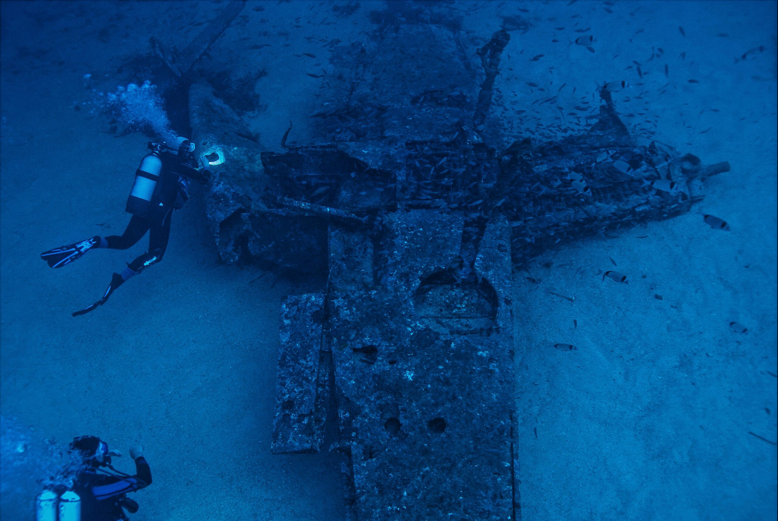
Mapping Submerged Cultural Heritage
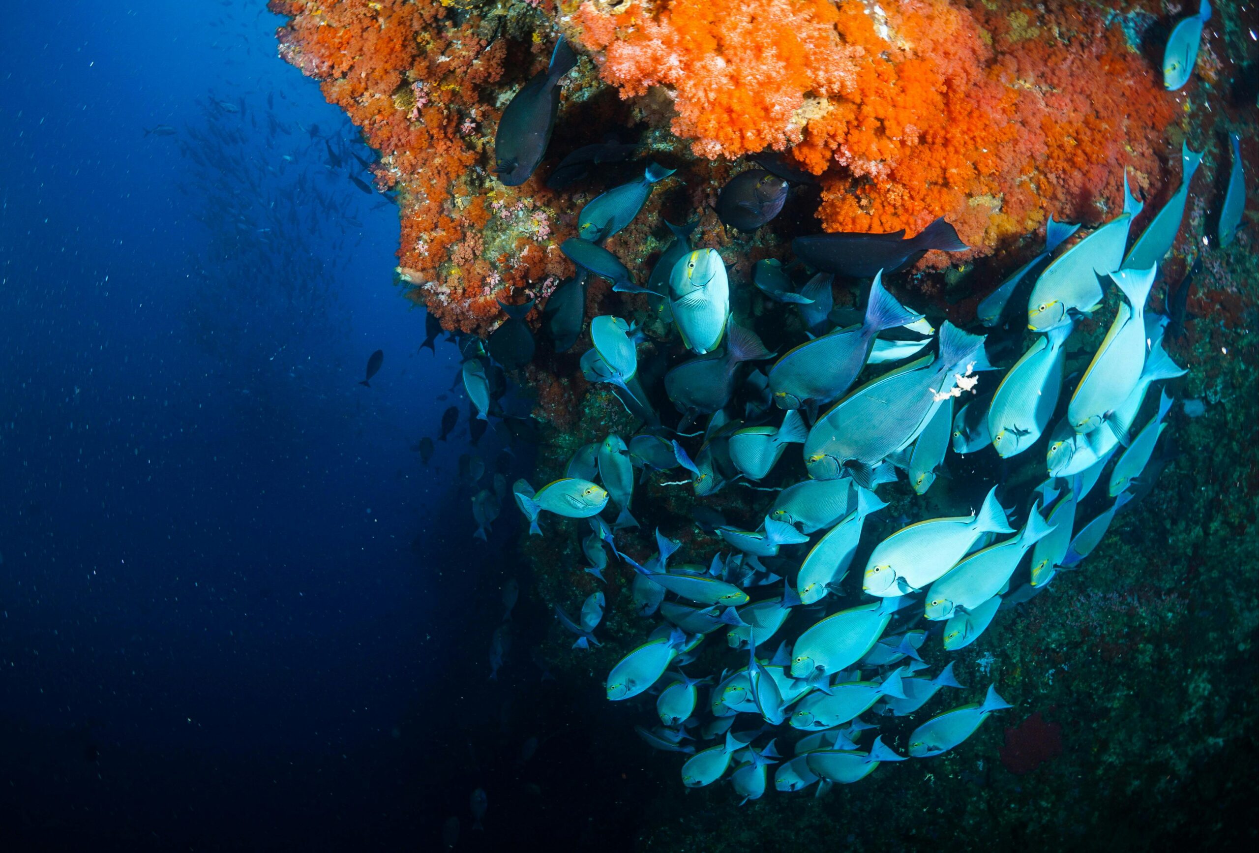
Bathymetric LIDAR has proven particularly valuable for documenting submerged archaeological sites. As sea levels have fluctuated throughout history, many ancient coastal settlements now rest beneath shallow waters. Traditional underwater archaeology is expensive and hazardous, but LIDAR can rapidly map these submerged landscapes from the surface.
Off the Mediterranean coast, LIDAR surveys have identified ancient port facilities, shipwrecks, and even entire submerged villages dating back thousands of years. These discoveries provide invaluable insights into ancient maritime trade routes, shipbuilding techniques, and how past civilizations adapted to changing sea levels—knowledge increasingly relevant as modern coastal communities face similar challenges.
Geological Discoveries and Natural Resource Management 🗺️
Beyond archaeology, LIDAR technology is revolutionizing our understanding of coastal geology and geomorphology. Coastal landscapes are dynamic environments, constantly shaped by waves, currents, tides, and storms. LIDAR’s ability to capture detailed topographic data enables scientists to study these processes with unprecedented precision.
Repeated LIDAR surveys allow researchers to create time-series datasets, documenting how coastlines change over months, years, or decades. This temporal perspective reveals erosion patterns, sediment transport dynamics, and the impacts of extreme weather events. Such information is crucial for coastal zone management, helping authorities make informed decisions about development, conservation, and disaster preparedness.
Uncovering Hidden Coastal Ecosystems
LIDAR has also revealed previously unknown coastal ecosystems and habitats. By mapping subtle elevation changes and vegetation structures, researchers have identified rare wetland types, unique dune systems, and critical wildlife habitats that warrant protection. In some cases, LIDAR has discovered entirely new coastal landforms that escaped detection through conventional surveys.
In tropical regions, LIDAR mapping has documented extensive mangrove ecosystems with far greater accuracy than satellite imagery alone. These detailed maps help conservation organizations prioritize protection efforts and monitor ecosystem health over time. Understanding mangrove distribution is particularly important given their role in coastal protection, carbon sequestration, and supporting marine biodiversity.
Practical Applications for Modern Coastal Communities
The practical benefits of LIDAR coastal mapping extend well beyond academic research. Coastal planners, engineers, and policymakers increasingly rely on LIDAR data to address pressing challenges facing shoreline communities worldwide.
Flood risk assessment has been transformed by high-resolution LIDAR elevation data. By accurately mapping coastal topography, authorities can model storm surge scenarios, identify vulnerable areas, and design effective evacuation routes. This capability has become critical as climate change intensifies coastal flooding events globally.
Infrastructure planning similarly benefits from LIDAR’s precision. Whether designing coastal highways, positioning renewable energy installations, or planning port expansions, engineers need accurate topographic and bathymetric data. LIDAR provides this information efficiently and cost-effectively, reducing project risks and optimizing designs for coastal conditions.
Environmental Monitoring and Conservation
Environmental scientists use LIDAR to monitor coastal ecosystem changes, track habitat degradation, and assess restoration project success. The technology’s ability to measure vegetation structure helps researchers quantify biomass, estimate carbon storage, and evaluate habitat quality for endangered species.
Beach nourishment projects—where sand is added to eroding beaches—benefit significantly from LIDAR monitoring. Regular surveys document how nourished beaches evolve, informing future project designs and ensuring taxpayer investments achieve intended outcomes. This data-driven approach to coastal management represents a significant advancement over historical trial-and-error methods.
🚁 Technological Advances Pushing Boundaries Further
LIDAR technology continues evolving rapidly, with innovations expanding its capabilities and accessibility. Modern systems are smaller, lighter, and more affordable than earlier generations, democratizing access to this powerful tool. Drone-mounted LIDAR units now enable small research teams and even individual enthusiasts to conduct sophisticated coastal surveys previously requiring expensive aircraft and specialized operators.
Integration with other technologies multiplies LIDAR’s value. When combined with high-resolution photography, multispectral imaging, or thermal sensors, LIDAR data becomes even more informative. These multi-sensor approaches provide comprehensive coastal assessments, simultaneously capturing topographic, ecological, and environmental information in single survey missions.
Artificial Intelligence and Data Processing
Perhaps the most exciting recent development involves applying artificial intelligence to LIDAR datasets. Machine learning algorithms can automatically identify archaeological features, classify vegetation types, detect coastal infrastructure, or recognize geological formations within massive point clouds containing billions of data points.
These AI-powered analysis tools dramatically reduce the time required to extract meaningful information from LIDAR surveys. What once took skilled technicians months to process manually can now be accomplished in days or hours, accelerating the pace of coastal discovery and making LIDAR data more actionable for time-sensitive applications like disaster response.
Challenges and Limitations in Coastal LIDAR Applications
Despite its remarkable capabilities, LIDAR technology faces certain limitations that researchers must acknowledge. Bathymetric LIDAR’s water penetration depth depends on water clarity—turbid coastal waters limit its effectiveness, sometimes restricting surveys to very shallow areas. In such conditions, traditional sonar-based methods may prove more suitable.
Cost remains a consideration, though declining steadily. Comprehensive LIDAR surveys of extensive coastal regions still require significant investment in equipment, aircraft operations, and skilled personnel. This financial barrier can limit access for under-resourced research institutions or developing nations with vast coastlines to map.
Data management presents another challenge. LIDAR surveys generate enormous datasets requiring substantial storage capacity and processing power. Organizations conducting coastal mapping must invest in appropriate computing infrastructure and develop workflows for efficiently managing, analyzing, and archiving these data volumes.
The Future of Coastal Exploration with LIDAR 🔮
Looking ahead, LIDAR’s role in coastal exploration will only expand. Emerging applications include near-continuous coastal monitoring using permanent LIDAR installations, creating real-time datasets documenting coastal changes as they occur. Such systems could provide early warning of erosion accelerations, habitat degradation, or infrastructure vulnerabilities.
Underwater LIDAR technology is advancing rapidly, with new systems promising greater water penetration depths and improved performance in turbid conditions. These developments will unlock deeper coastal waters for non-invasive mapping, potentially revealing archaeological sites and geological features currently beyond reach.
Global initiatives are working to create comprehensive LIDAR coverage of the world’s coastlines, establishing baseline datasets against which future changes can be measured. These ambitious projects will provide unprecedented resources for climate change research, coastal management, and conservation planning worldwide.
Getting Involved in Coastal LIDAR Exploration
The democratization of LIDAR technology means participation opportunities extend beyond professional researchers. Citizen science projects increasingly incorporate LIDAR data, enabling enthusiasts to contribute to coastal mapping efforts and archaeological discoveries.
Educational institutions offer training programs in LIDAR data collection and analysis, preparing the next generation of coastal scientists. Online resources, including freely available LIDAR datasets from government agencies, allow anyone with interest and appropriate software to explore coastal landscapes digitally, making discoveries from their own computers.
For those passionate about coastal exploration, familiarizing yourself with LIDAR technology and its applications opens doors to exciting opportunities. Whether pursuing academic research, contributing to conservation efforts, or simply satisfying curiosity about our remarkable coastlines, LIDAR provides powerful tools for discovery.
Transforming Our Relationship with Coastal Environments 🌍
Ultimately, LIDAR technology is doing more than revealing hidden treasures—it’s fundamentally transforming how we understand, value, and interact with coastal environments. By making the invisible visible, LIDAR helps us appreciate the rich complexity of our shorelines, from ancient human settlements to dynamic natural processes.
This enhanced understanding carries profound implications. When coastal communities can visualize their vulnerability to flooding, they’re more likely to support protective measures. When archaeologists reveal sophisticated ancient coastal civilizations, we gain perspective on human resilience and adaptation. When ecologists document rare coastal habitats, conservation efforts gain momentum.
As coastal regions face unprecedented pressures from development, climate change, and population growth, the insights provided by LIDAR become increasingly valuable. This technology equips us with knowledge necessary to make informed decisions about coastal management, balancing human needs with environmental protection and cultural heritage preservation.
The revolution in coastal exploration sparked by LIDAR technology continues accelerating, promising ever more remarkable discoveries in years ahead. From revealing lost civilizations to protecting vulnerable ecosystems, from understanding geological processes to safeguarding coastal communities, LIDAR stands as an indispensable tool for navigating our relationship with these dynamic, treasure-filled environments. The coastlines we thought we knew are yielding secrets beyond imagination, and LIDAR is the key unlocking these hidden wonders, one laser pulse at a time.

Toni Santos is a maritime researcher and underwater archaeologist specializing in the study of submerged heritage, ancient port systems, and the cultural landscapes preserved beneath the sea. Through an interdisciplinary and immersive approach, Toni investigates how humanity has left traces of knowledge, commerce, and legend in the underwater world — across oceans, myths, and sunken cities.
His work is grounded in a fascination with wrecks not only as artifacts, but as carriers of hidden meaning. From historic shipwreck discoveries to mythical harbors and lost coastal settlements, Toni uncovers the physical and cultural evidence through which civilizations preserved their relationship with the maritime unknown.
With a background in marine archaeology and underwater survey methods, Toni blends technical analysis with archival research to reveal how oceans were used to shape identity, transmit memory, and encode sacred knowledge.
As the creative mind behind revaltro, Toni curates documented dive studies, speculative harbor maps, and archaeological interpretations that revive the deep cultural ties between water, folklore, and forgotten science.
His work is a tribute to:
The submerged heritage of Historic Shipwrecks and Their Cargoes
The legendary sites of Mythical Harbors and Lost Civilizations
The technical methods of Underwater Exploration Techniques
The natural archiving power of Preservation in Salt and Sediment
Whether you’re a maritime historian, nautical researcher, or curious explorer of forgotten submerged worlds, Toni invites you to explore the hidden depths of oceanic heritage — one wreck, one harbor, one legend at a time.