Remote sensing technologies transform how we observe and understand our planet, revealing patterns and phenomena invisible to the naked eye across vast distances.
🌍 The Revolutionary Eyes Above: Understanding Remote Sensing Fundamentals
Remote sensing represents one of humanity’s most powerful tools for understanding Earth and beyond. At its core, this technology involves gathering information about objects or areas from a distance, typically from aircraft or satellites. Unlike traditional observation methods requiring physical presence, remote sensing allows us to monitor vast territories, track environmental changes, and detect patterns that would otherwise remain hidden from human perception.
The concept isn’t entirely new—early aerial photography during the 19th century laid the groundwork for what would become a sophisticated scientific discipline. Today’s remote sensing systems employ advanced sensors capable of detecting electromagnetic radiation across multiple wavelengths, from visible light to infrared and microwave frequencies. This multispectral capability enables scientists, researchers, and decision-makers to extract unprecedented amounts of information from our environment.
Modern remote sensing systems operate through two primary mechanisms: passive and active sensing. Passive sensors detect natural radiation emitted or reflected by objects, similar to how cameras capture visible light. Active sensors, conversely, emit their own energy and measure what returns, like radar systems that send radio waves and analyze their echoes. Both approaches offer unique advantages depending on the application and environmental conditions.
🛰️ The Technology Behind Earth Observation Systems
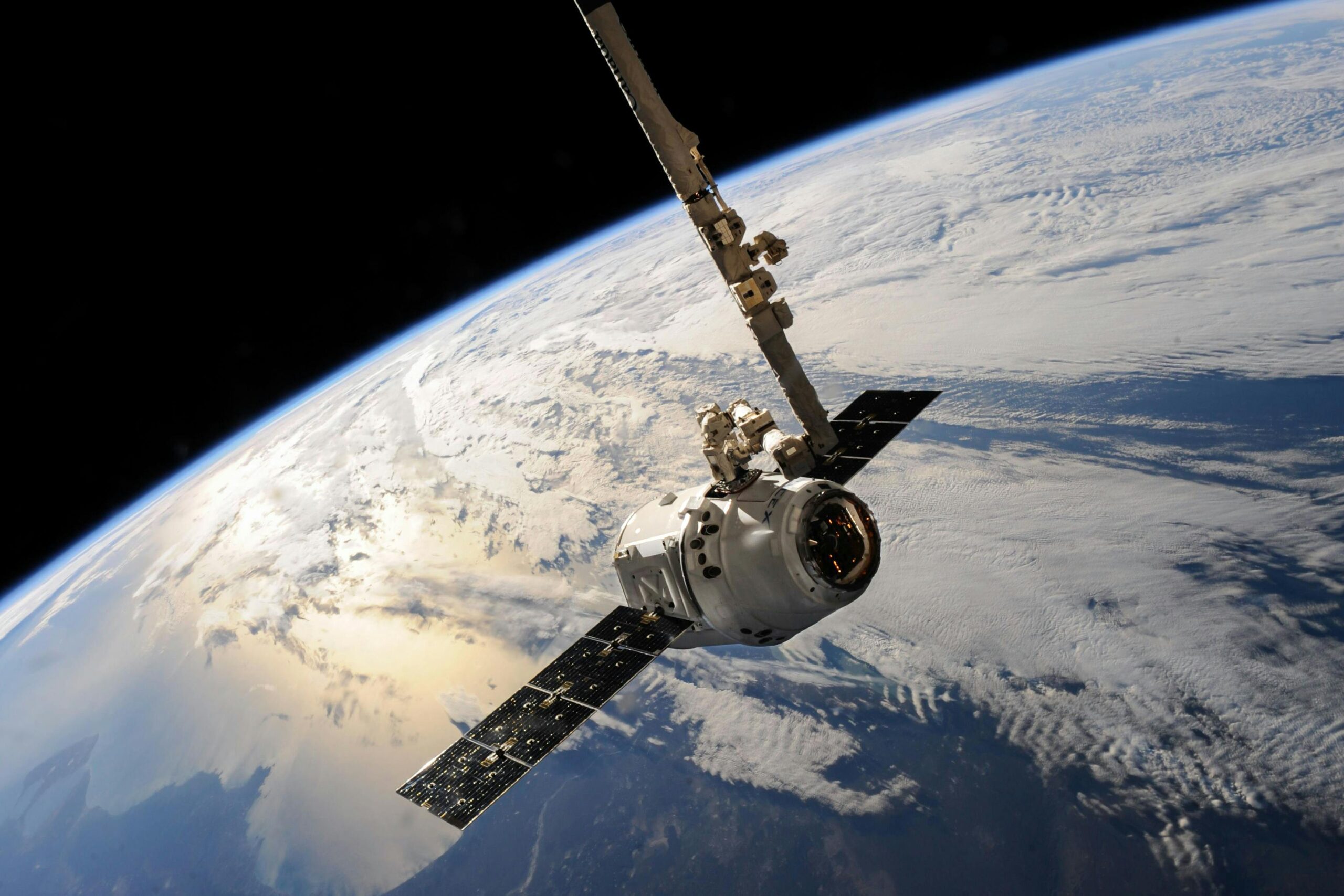
Contemporary remote sensing platforms represent remarkable feats of engineering and innovation. Satellite-based systems orbit Earth at various altitudes, each optimized for specific observation tasks. Low Earth orbit satellites typically operate between 160 to 2,000 kilometers above the surface, providing high-resolution imagery ideal for detailed terrain analysis and urban planning. Geostationary satellites stationed approximately 36,000 kilometers above the equator remain fixed relative to Earth’s surface, making them perfect for continuous weather monitoring and communication applications.
The sensors themselves have evolved dramatically over recent decades. Optical sensors capture images across visible and near-infrared wavelengths, producing data similar to conventional photographs but with far greater spectral detail. Thermal sensors detect heat signatures, enabling nighttime observations and temperature mapping crucial for environmental monitoring. Radar sensors penetrate clouds and darkness, providing all-weather capability essential for regions with persistent cloud cover.
Spectral Bands and Their Applications
Different wavelengths reveal different information about Earth’s surface. Blue wavelengths penetrate water effectively, making them valuable for bathymetric studies and coastal mapping. Green wavelengths help assess vegetation vigor and distinguish between plant types. Red wavelengths are absorbed by chlorophyll, making them useful for identifying vegetation boundaries and crop health assessment.
Near-infrared radiation, invisible to human eyes, provides perhaps the most valuable data for vegetation analysis. Healthy plants strongly reflect near-infrared light, creating stark contrasts between vegetated and non-vegetated areas. Short-wave infrared helps distinguish moisture content in soil and vegetation, while thermal infrared measures surface temperatures, revealing heat islands in cities, volcanic activity, and water temperature variations affecting marine ecosystems.
🌾 Agricultural Revolution Through Precision Monitoring
Agriculture has experienced a transformation through remote sensing applications, enabling precision farming techniques that optimize crop yields while minimizing environmental impact. Farmers now access detailed information about their fields without walking every acre, identifying problem areas requiring attention before visible symptoms appear.
Vegetation indices derived from multispectral imagery provide quantitative measures of crop health and growth stages. The Normalized Difference Vegetation Index (NDVI) compares red and near-infrared reflectance, producing values indicating vegetation density and vigor. By monitoring NDVI throughout growing seasons, farmers detect stress from drought, disease, or nutrient deficiencies, allowing targeted interventions that save resources and improve productivity.
Water management benefits enormously from remote sensing capabilities. Thermal sensors identify irrigation inefficiencies by detecting temperature variations across fields, indicating areas receiving too much or too little water. Soil moisture sensors help optimize irrigation schedules, reducing water waste while ensuring crops receive adequate hydration. These technologies become increasingly critical as climate change intensifies water scarcity challenges globally.
Yield Prediction and Crop Classification
Remote sensing enables accurate crop type classification and yield forecasting across regional and continental scales. Machine learning algorithms analyze multitemporal satellite imagery, identifying crop species based on their unique spectral signatures and growth patterns throughout seasons. This information supports agricultural planning, commodity market analysis, and food security assessments.
Governments and international organizations employ these capabilities for early warning systems predicting food shortages. By monitoring crop conditions across vulnerable regions, authorities can anticipate harvest failures and coordinate humanitarian responses before crises develop. This proactive approach saves lives and reduces the economic impacts of agricultural disasters.
🌊 Environmental Monitoring and Climate Change Tracking
Perhaps no application demonstrates remote sensing’s power more dramatically than environmental monitoring and climate research. Satellites provide continuous, consistent observations across decades, creating invaluable datasets documenting Earth’s changing conditions. These records reveal trends invisible within human lifespans, quantifying changes that might otherwise remain disputed or uncertain.
Deforestation monitoring exemplifies remote sensing’s conservation applications. Organizations track forest cover changes in near real-time, detecting illegal logging activities in remote areas where ground patrols prove impractical. The Amazon rainforest, Congo Basin, and Southeast Asian forests all undergo regular surveillance through multiple satellite systems, with data publicly available to researchers, activists, and enforcement agencies worldwide.
Glacial retreat and ice sheet dynamics provide stark climate change indicators accurately measured through remote sensing. Satellites equipped with radar altimeters measure ice thickness changes with millimeter precision, documenting alarming losses in Greenland and Antarctica. Sea ice extent data shows Arctic summer ice declining at unprecedented rates, confirming climate models and informing adaptation strategies.
Ocean Health and Marine Resource Management
Remote sensing technologies revolutionize oceanography by revealing phenomena across vast marine environments. Sea surface temperature measurements track ocean currents, identify upwelling zones supporting fisheries, and monitor coral bleaching events threatening reef ecosystems. Ocean color sensors detect phytoplankton concentrations, mapping primary productivity fundamental to marine food webs.
Coastal zone management relies heavily on satellite observations combining optical and radar data to monitor erosion, track sediment transport, and assess wetland health. These dynamic environments change rapidly, requiring frequent observations that only satellite systems can provide economically. Fisheries management uses sea surface temperature and chlorophyll concentration data to predict fish distribution, helping fishing fleets operate efficiently while supporting sustainable harvest practices.
🏙️ Urban Planning and Infrastructure Development
Cities worldwide harness remote sensing for planning, management, and infrastructure monitoring. High-resolution satellite imagery provides up-to-date basemaps for geographic information systems, supporting everything from property assessment to emergency response planning. Urban growth patterns become visible through time-series analysis, revealing sprawl dynamics and informal settlement expansion challenging municipal authorities.
Heat island mapping using thermal imagery identifies neighborhoods experiencing dangerous temperature extremes during heatwaves. This information guides urban greening initiatives, helping planners prioritize tree planting and park development in areas most needing cooling effects. Building energy efficiency assessments also benefit from thermal sensing, identifying structures with poor insulation requiring retrofitting.
Infrastructure monitoring represents another critical application. Radar interferometry detects millimeter-scale ground movements, warning of potential landslides, sinkhole formation, or building subsidence. Transportation planners analyze traffic patterns through vehicle detection algorithms applied to high-frequency satellite passes, optimizing road networks and public transit systems.
⚠️ Disaster Management and Emergency Response
When disasters strike, remote sensing provides critical situational awareness impossible to obtain otherwise. Earthquakes, floods, hurricanes, and wildfires all trigger immediate satellite observations, delivering damage assessment information to emergency responders within hours. This rapid response capability saves lives by helping authorities deploy resources efficiently and coordinate evacuation efforts.
Flood mapping during active events uses radar sensors penetrating clouds and operating regardless of daylight. These systems identify inundated areas, helping rescue teams navigate toward stranded populations while avoiding dangerous zones. Post-disaster damage assessment compares pre-event and post-event imagery, quantifying destruction for insurance claims and recovery planning.
Wildfire monitoring relies on thermal sensors detecting heat signatures from active fires, even through smoke obscuring visible observations. Fire perimeters updated multiple times daily guide firefighting efforts and public safety warnings. Burn scar mapping after fires helps assess ecological damage and identify areas requiring restoration efforts.
Volcano Monitoring and Earthquake Analysis
Volcanic activity monitoring through remote sensing detects ground deformation preceding eruptions, thermal anomalies indicating magma movement, and gas emissions signaling volcanic unrest. These observations complement ground-based monitoring networks, providing comprehensive surveillance of volcanic regions worldwide, many located in remote areas with limited infrastructure.
Earthquake damage assessment happens rapidly through synthetic aperture radar interferometry, which detects ground displacement patterns revealing fault rupture characteristics. This information advances seismological understanding while supporting emergency response and recovery efforts in affected regions.
🔬 Scientific Research and Discovery
Remote sensing drives scientific breakthroughs across disciplines from archaeology to zoology. Archaeologists discover ancient sites invisible at ground level but revealed through subtle vegetation differences or soil marks detected by multispectral sensors. Lost cities, ancient agricultural systems, and prehistoric landscapes emerge from remote sensing analyses, rewriting historical understanding.
Wildlife conservation employs thermal and high-resolution optical imagery for population surveys of endangered species. Counting animals across vast territories becomes feasible, with algorithms automatically detecting individuals in imagery covering thousands of square kilometers. Migration pattern tracking through repeated observations helps protect critical habitats and wildlife corridors.
Geological mapping benefits from hyperspectral sensors identifying rock types and mineral compositions based on spectral signatures. Resource exploration companies use this data for initial surveys before expensive ground investigations. Geologists mapping remote or inaccessible terrain rely on radar imagery revealing structural features beneath vegetation cover.
📱 Democratization Through Technology and Data Access
Remote sensing capabilities once restricted to governments and large institutions have become increasingly accessible. Free satellite data from programs like Landsat and Sentinel democratize Earth observation, enabling researchers, non-profit organizations, and developing nations to harness these powerful technologies. Cloud computing platforms provide processing capabilities handling massive datasets without requiring expensive local infrastructure.
Mobile applications bring remote sensing insights to end users, from farmers checking crop health on smartphones to hikers accessing detailed terrain maps. This democratization accelerates innovation as diverse users develop novel applications addressing local challenges with global technologies.
Educational initiatives teach remote sensing skills to new generations, expanding the field’s practitioner base beyond traditional scientific communities. Online courses, open-source software, and collaborative platforms lower barriers to entry, fostering innovation through diverse perspectives and creative problem-solving approaches.
🚀 Future Horizons: Emerging Technologies and Applications
Remote sensing continues evolving rapidly with technological advances promising even greater capabilities. Small satellite constellations provide unprecedented temporal resolution, imaging locations multiple times daily rather than weekly or monthly. This frequent revisit capability enables applications requiring near real-time monitoring, from shipping tracking to rapid agricultural assessment.
Artificial intelligence and machine learning revolutionize data analysis, extracting information from imagery faster and more accurately than traditional methods. Deep learning algorithms automatically identify features, detect changes, and classify land cover types across continental scales, processing data volumes overwhelming human analysts.
Hyperspectral sensors measuring hundreds of narrow spectral bands promise to unlock additional information invisible to current multispectral systems. These advanced sensors distinguish subtle differences in material composition, advancing applications from precision agriculture to environmental contamination detection. Integration with other data sources through sensor fusion creates comprehensive information products exceeding capabilities of individual systems.
💡 Transforming Our Relationship With Planet Earth
Remote sensing technologies fundamentally alter humanity’s relationship with our planet, providing objective, consistent observations documenting environmental conditions and changes. This capability becomes increasingly critical as we confront climate change, biodiversity loss, and resource management challenges requiring global coordination based on shared understanding of Earth’s systems.
The invisible world revealed through remote sensing shows interconnections between human activities and environmental consequences across scales from local to planetary. Deforestation in one region affects climate patterns elsewhere. Urban development transforms regional hydrology. Agricultural practices influence air quality hundreds of kilometers away. Remote sensing makes these connections visible, supporting informed decision-making and sustainable resource management.
As technologies advance and accessibility increases, remote sensing’s potential for positive impact grows exponentially. From feeding growing populations through precision agriculture to protecting endangered ecosystems through conservation monitoring, these tools empower humanity to address pressing challenges with knowledge and insight previously unimaginable. The invisible world becomes visible, transforming our capacity to understand, protect, and sustainably manage the remarkable planet we call home.

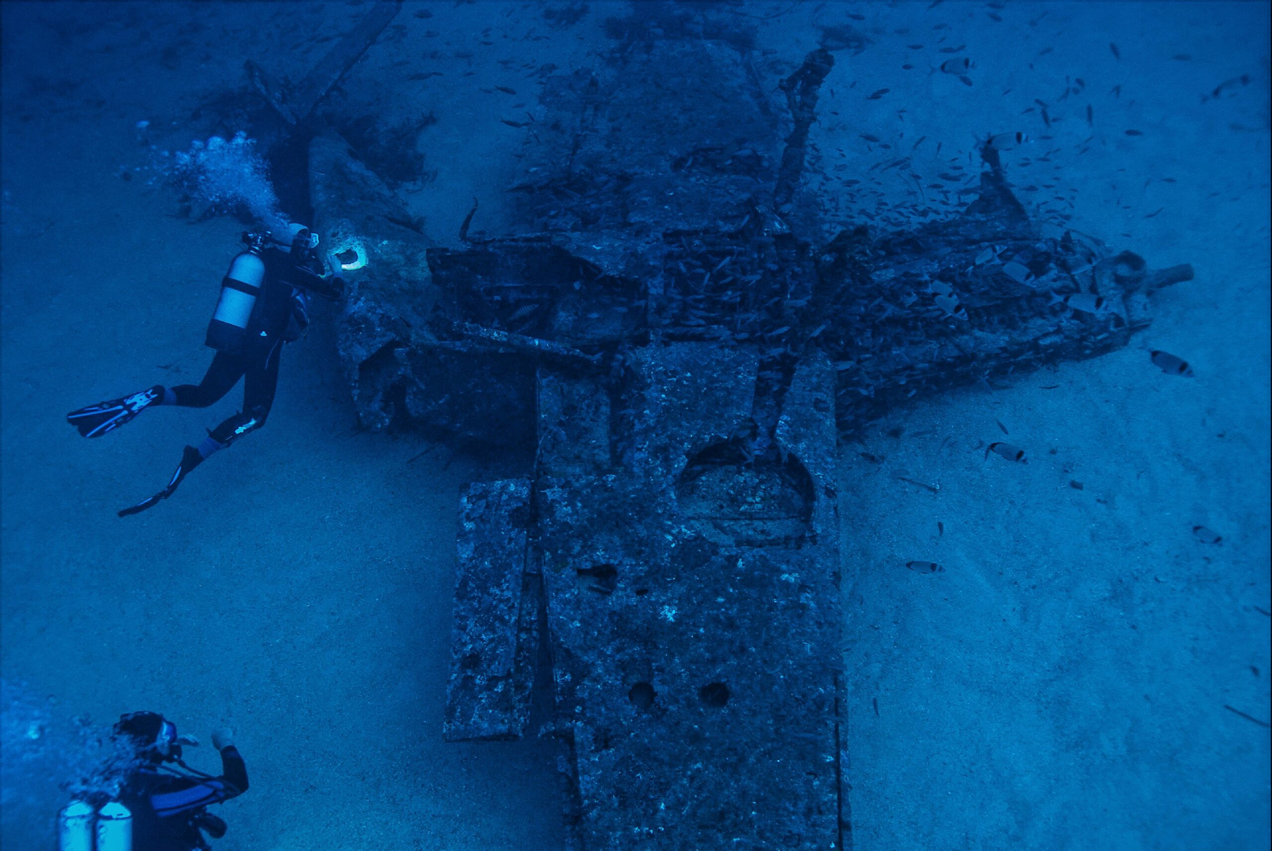
Toni Santos is a maritime researcher and underwater archaeologist specializing in the study of submerged heritage, ancient port systems, and the cultural landscapes preserved beneath the sea. Through an interdisciplinary and immersive approach, Toni investigates how humanity has left traces of knowledge, commerce, and legend in the underwater world — across oceans, myths, and sunken cities.
His work is grounded in a fascination with wrecks not only as artifacts, but as carriers of hidden meaning. From historic shipwreck discoveries to mythical harbors and lost coastal settlements, Toni uncovers the physical and cultural evidence through which civilizations preserved their relationship with the maritime unknown.
With a background in marine archaeology and underwater survey methods, Toni blends technical analysis with archival research to reveal how oceans were used to shape identity, transmit memory, and encode sacred knowledge.
As the creative mind behind revaltro, Toni curates documented dive studies, speculative harbor maps, and archaeological interpretations that revive the deep cultural ties between water, folklore, and forgotten science.
His work is a tribute to:
The submerged heritage of Historic Shipwrecks and Their Cargoes
The legendary sites of Mythical Harbors and Lost Civilizations
The technical methods of Underwater Exploration Techniques
The natural archiving power of Preservation in Salt and Sediment
Whether you’re a maritime historian, nautical researcher, or curious explorer of forgotten submerged worlds, Toni invites you to explore the hidden depths of oceanic heritage — one wreck, one harbor, one legend at a time.