Modern technology transforms how we discover and preserve underwater archaeological sites through advanced 3D modeling techniques that reveal centuries-old secrets beneath the waves.
🌊 The Digital Revolution Beneath the Surface
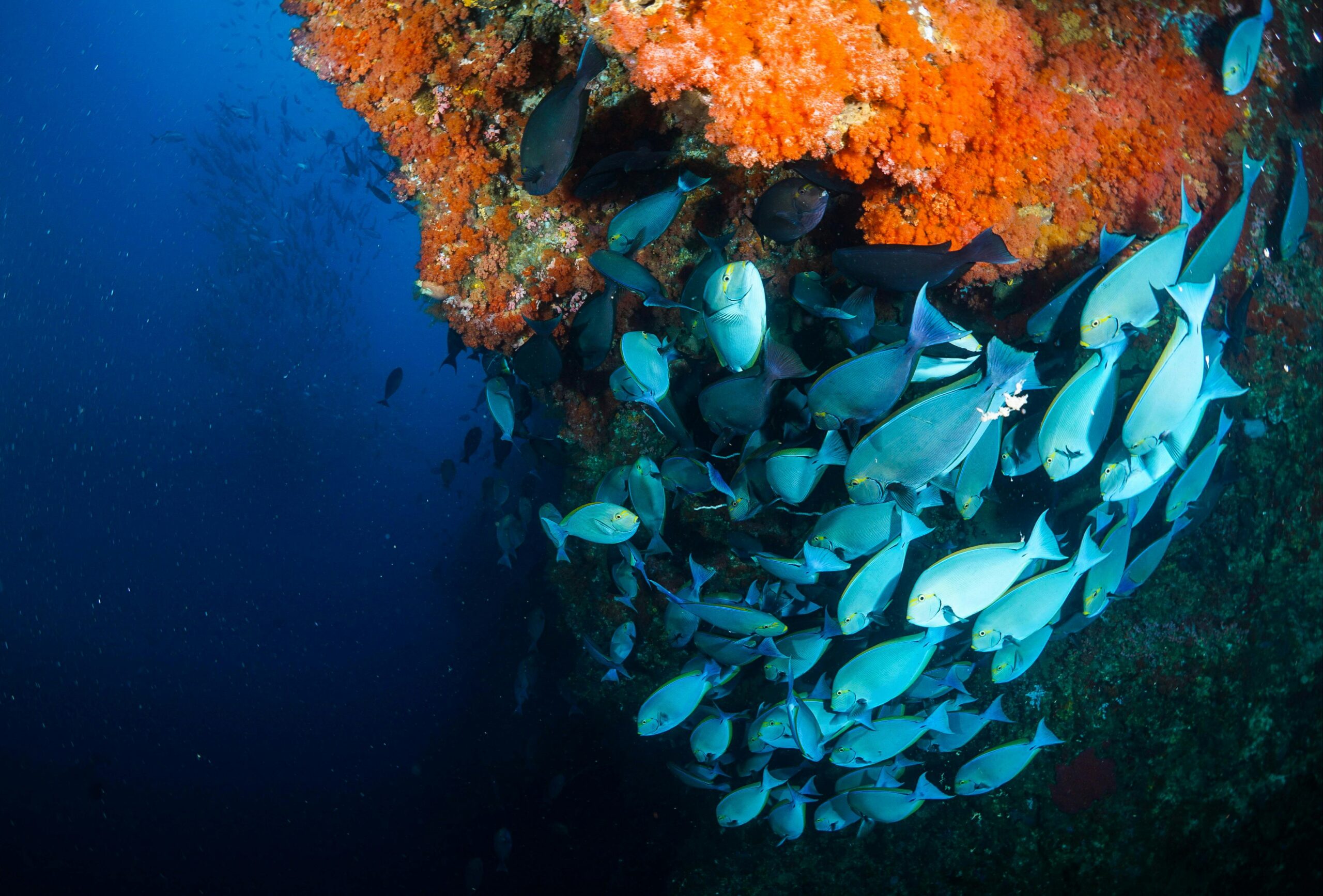
The ocean floor holds countless mysteries waiting to be discovered, from ancient shipwrecks to lost civilizations. Traditional underwater archaeology faced significant challenges including limited dive time, dangerous conditions, and the difficulty of accurately documenting findings. Today, innovative 3D modeling techniques are revolutionizing how researchers explore, document, and share underwater treasures with the world.
Three-dimensional modeling has emerged as a game-changing tool for marine archaeologists, enabling them to create precise digital replicas of submerged artifacts and entire archaeological sites. These digital twins preserve historical information while making it accessible to researchers and the public without disturbing delicate underwater environments.
Understanding Photogrammetry in Underwater Exploration
Photogrammetry stands as one of the most powerful techniques for creating 3D models of underwater treasures. This method involves capturing multiple overlapping photographs of an object or site from different angles, then using specialized software to process these images into detailed three-dimensional representations.
Underwater photogrammetry requires careful planning and execution. Divers must maintain consistent distances from their subjects while accounting for water clarity, lighting conditions, and current movements. The technique has proven remarkably effective for documenting shipwrecks, ancient harbor structures, and scattered artifact fields across the seafloor.
Key Advantages of Photogrammetric Methods
- Cost-effective compared to specialized scanning equipment
- Requires minimal additional hardware beyond quality cameras
- Produces highly detailed textures and color information
- Enables remote analysis without repeated dive operations
- Creates shareable digital archives for global research collaboration
LiDAR Technology: Piercing Through the Depths
Light Detection and Ranging (LiDAR) technology has adapted remarkably well to underwater applications. Bathymetric LiDAR systems emit laser pulses that penetrate water surfaces, measuring the time it takes for light to reflect back from the seafloor. This generates precise depth measurements and topographical data.
Modern airborne LiDAR systems can map shallow coastal waters and reveal submerged structures invisible from the surface. The technology proves particularly valuable for initial site surveys, covering vast areas quickly and identifying promising locations for detailed investigation. Green laser wavelengths penetrate water more effectively, making them ideal for bathymetric applications.
⚓ Multibeam Sonar Mapping Systems
Multibeam echo sounders represent another crucial technology for underwater 3D modeling. These sophisticated sonar systems emit multiple sound beams simultaneously, measuring the time required for each beam to return after bouncing off the seafloor. The result is a detailed three-dimensional map of underwater terrain and objects.
Unlike optical methods, sonar systems work effectively in turbid waters where visibility is severely limited. This makes them invaluable for exploring deep-water sites, murky rivers, and locations where sediment clouds would render photography useless. High-frequency multibeam systems can achieve centimeter-level resolution for smaller archaeological targets.
Comparing Major 3D Modeling Technologies
| Technology | Best Application | Depth Range | Resolution |
|---|---|---|---|
| Photogrammetry | Clear water, detailed artifacts | 0-50 meters | Sub-millimeter |
| Bathymetric LiDAR | Coastal surveys, large areas | 0-70 meters | 10-30 cm |
| Multibeam Sonar | Deep water, turbid conditions | Any depth | 1 cm – 1 meter |
| Structured Light | Small artifacts, lab work | Shallow/controlled | Sub-millimeter |
Structured Light Scanning for Artifact Precision
When archaeologists recover artifacts from underwater sites, structured light scanning provides extraordinary detail for documentation and analysis. This technique projects patterns of light onto objects, capturing how these patterns deform across three-dimensional surfaces. The distortions reveal precise shape information.
Structured light systems work best in controlled environments, making them ideal for scanning recovered artifacts in conservation laboratories. The resulting models capture intricate details like tool marks, inscriptions, and manufacturing techniques that help researchers understand ancient craftsmanship and cultural practices.
🔍 Autonomous Underwater Vehicles and ROVs
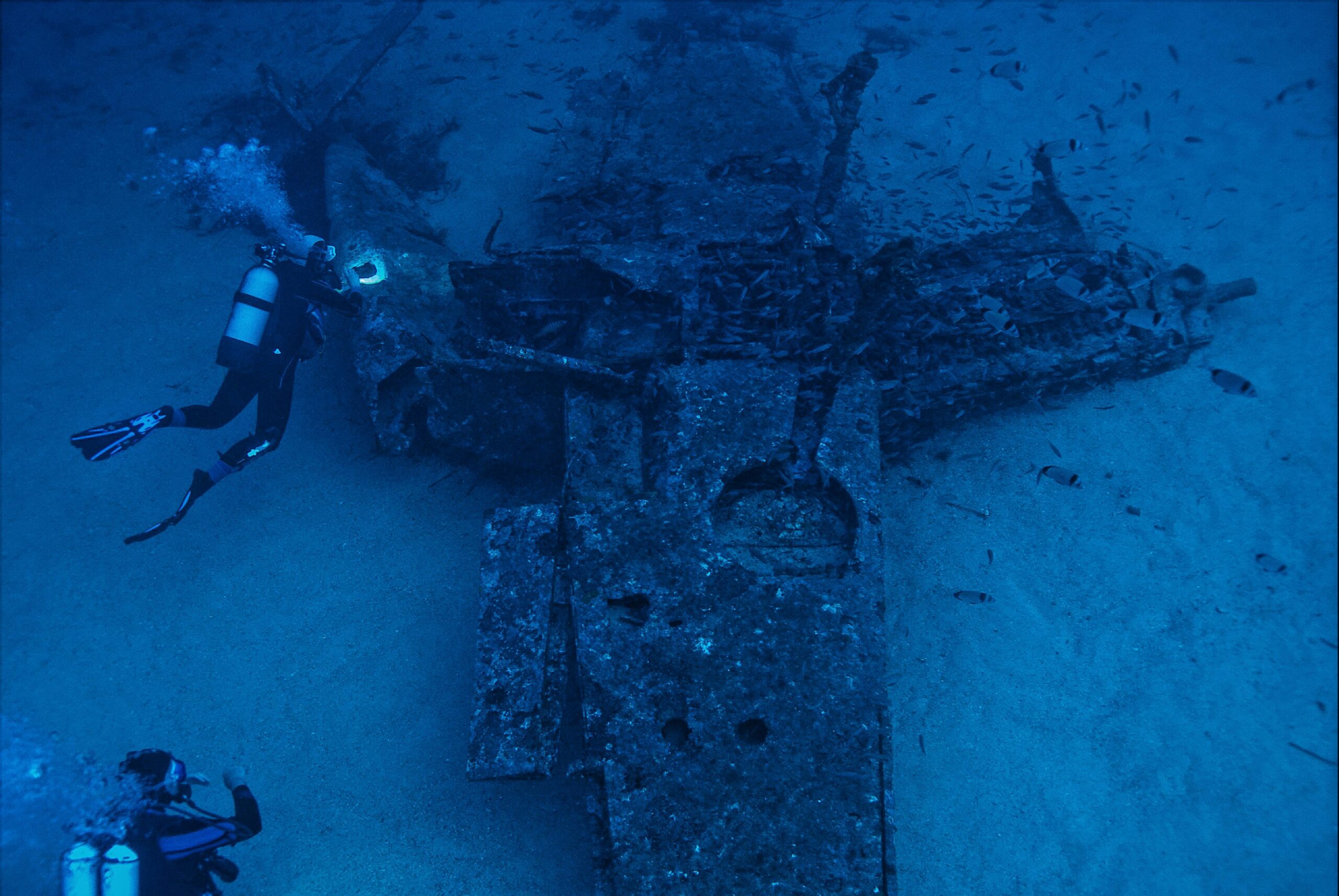
Remotely Operated Vehicles (ROVs) and Autonomous Underwater Vehicles (AUVs) have transformed how researchers conduct underwater surveys. These robotic platforms carry cameras, sonar systems, and other sensors into environments too deep or dangerous for human divers. They can operate for extended periods, collecting vast amounts of data systematically.
Modern AUVs follow pre-programmed survey patterns, maintaining consistent altitude and speed for optimal data collection. They integrate multiple sensors simultaneously, combining photogrammetric imaging with sonar mapping to create comprehensive 3D models. Some advanced systems process data in real-time, adjusting their survey patterns based on what they discover.
Processing and Rendering Underwater 3D Data
Creating 3D models from raw underwater data requires sophisticated software and considerable expertise. Photogrammetry workflows begin with image alignment, where software identifies common features across photographs to determine camera positions and orientations. This creates a sparse point cloud representing the scene’s basic structure.
Dense reconstruction algorithms then analyze pixel information to generate millions of additional points, creating highly detailed three-dimensional representations. Mesh generation converts point clouds into continuous surfaces, while texture mapping applies color information from original photographs. The entire process demands powerful computers and can take hours or days for complex sites.
Essential Software Tools for Underwater 3D Modeling
- Agisoft Metashape for comprehensive photogrammetry workflows
- Pix4D for aerial and underwater survey processing
- CloudCompare for point cloud analysis and comparison
- Meshlab for mesh editing and refinement
- Blender for advanced rendering and visualization
- QGIS for integrating 3D models with geographic data
💎 Case Studies: Famous Underwater Treasures Revealed
The Antikythera Mechanism, an ancient Greek astronomical calculator discovered in a shipwreck, has been extensively studied using advanced 3D imaging. Computed tomography scans revealed internal gear structures impossible to observe otherwise, revolutionizing our understanding of ancient technology.
The Mars Science Laboratory used photogrammetry to document the entire Queen Anne’s Revenge shipwreck site off North Carolina. Researchers created detailed 3D models of the vessel’s remains and artifacts, enabling virtual excavation planning and public engagement through interactive visualizations.
In the Mediterranean, the Phoenician shipwreck at Xlendi Bay was mapped using both photogrammetry and multibeam sonar. The combined approach captured everything from large structural timbers to scattered amphora, creating a comprehensive digital archive of this important archaeological site.
Challenges in Underwater 3D Modeling
Water presents unique obstacles for 3D modeling that don’t exist in terrestrial environments. Light absorption causes colors to disappear at different depths—reds vanish first, followed by oranges and yellows. This color distortion requires careful correction during post-processing to achieve accurate representations.
Refraction bends light as it passes between water and camera lenses, creating geometric distortions that must be mathematically corrected. Specialized calibration procedures account for these effects, but they add complexity to underwater photogrammetry workflows.
Suspended particles scatter light, reducing visibility and creating noise in both optical and acoustic data. Strong currents make it difficult to maintain stable camera positions, potentially degrading model quality. Marine growth on artifacts obscures original surfaces, requiring careful cleaning or digital removal techniques.
🎯 Optimizing Dive Operations for 3D Data Collection
Successful underwater 3D modeling begins with meticulous planning. Survey teams must assess site conditions including depth, visibility, currents, and potential hazards. They determine optimal times for data collection when conditions are most favorable, often requiring multiple dives across different days or seasons.
Camera settings require special attention underwater. Manual focus ensures consistency across image sequences, while appropriate shutter speeds freeze motion despite current movements. Artificial lighting helps maintain color accuracy, though it must be positioned carefully to avoid creating harsh shadows that confuse reconstruction algorithms.
Systematic survey patterns ensure complete coverage of archaeological sites. Grid patterns work well for scattered artifact fields, while circular or spiral paths suit individual objects. Maintaining 60-80% overlap between consecutive images provides sufficient redundancy for reliable 3D reconstruction.
Integrating Multiple Data Sources
The most comprehensive underwater 3D models combine data from multiple technologies. Photogrammetry provides detailed texture information for visible surfaces, while sonar extends coverage into shadowed areas and turbid zones. LiDAR offers rapid wide-area mapping that guides subsequent detailed surveys.
Data fusion requires careful alignment of different coordinate systems and resolution levels. Software tools enable researchers to overlay photogrammetric models onto sonar frameworks, creating hybrid representations that leverage each technology’s strengths. This integrated approach reveals underwater treasures with unprecedented completeness.
🏛️ Digital Preservation and Virtual Museums
Three-dimensional models serve as permanent digital records of underwater cultural heritage. Unlike physical artifacts that deteriorate over time, digital twins remain pristine. They enable future researchers to study sites using analytical techniques not yet invented, preserving information for generations.
Virtual reality platforms transform 3D archaeological data into immersive experiences. Museum visitors can explore shipwrecks without getting wet, examining artifacts from impossible angles and scales. Educational institutions use these models to teach students about maritime history and archaeological methods.
Online repositories make underwater treasures accessible globally. The digital archaeology community shares 3D models through platforms like Sketchfab and Open Heritage, democratizing access to discoveries that were once restricted to specialized researchers and well-funded institutions.
Artificial Intelligence Enhancing Underwater Discovery
Machine learning algorithms are revolutionizing how researchers process underwater imagery. Automated feature detection identifies artifacts within sonar data or photographs, dramatically accelerating survey analysis. Neural networks trained on archaeological datasets recognize object types, helping prioritize investigation areas.
AI-powered image enhancement corrects water-related distortions, restores colors, and removes suspended particle noise. These preprocessing improvements significantly enhance 3D reconstruction quality. Some systems even predict what buried artifacts might look like beneath sediment layers based on partially exposed features.
⚡ Future Innovations in Underwater 3D Modeling
Emerging technologies promise even more powerful tools for exploring underwater treasures. Quantum sensors may achieve unprecedented measurement precision, revealing subtle features invisible to current systems. Improved battery technologies will extend AUV mission durations, enabling surveys of remote deep-water sites.
Real-time 3D reconstruction could allow divers to see developing models during surveys, adjusting their coverage patterns for optimal results. Collaborative robotic swarms might coordinate their movements, capturing multiple viewpoints simultaneously for accelerated data collection.
Augmented reality systems could overlay historical reconstructions onto underwater ruins, helping archaeologists visualize how sites appeared in their prime. These technologies will bridge past and present, bringing ancient underwater worlds back to life through digital innovation.
Environmental Monitoring Through 3D Modeling
Beyond archaeological applications, underwater 3D modeling serves crucial environmental functions. Repeated surveys of coral reefs create temporal datasets showing bleaching progression and recovery. Marine biologists track changes in benthic communities, measuring how ecosystems respond to climate change and human impacts.
Infrastructure inspection benefits from 3D modeling techniques adapted from archaeology. Engineers assess offshore structures, pipelines, and underwater cables using the same photogrammetry and sonar methods. These digital records support maintenance planning and damage assessment following storms or accidents.
🌐 Collaborative Research Networks
The complexity of underwater 3D modeling encourages interdisciplinary collaboration. Computer scientists develop improved algorithms, while archaeologists provide domain expertise for interpreting results. Engineers design better sensors and platforms, and conservators advise on artifact handling during documentation.
International partnerships pool resources for ambitious projects beyond single institutions’ capabilities. Researchers share datasets, methodologies, and processing workflows, accelerating innovation across the field. This collaborative spirit ensures that underwater treasures benefit humanity rather than remaining isolated curiosities.
Making Your Own Underwater 3D Models
Amateur enthusiasts can create impressive underwater 3D models with consumer equipment. Action cameras and underwater housings for smartphones capture sufficient image quality for basic photogrammetry. Free software like Meshroom processes photographs into 3D models without expensive licenses.
Starting with shallow, clear-water subjects builds skills before attempting challenging sites. Simple objects like artificial reefs or modern wrecks provide excellent practice. Online tutorials and forums offer guidance, connecting beginners with experienced practitioners who share technical advice and troubleshooting tips.
As skills develop, hobbyists can contribute valuable data to citizen science projects. Many archaeological initiatives welcome volunteer photographers, expanding coverage of underwater cultural heritage sites. These collaborations bridge professional research and public engagement, fostering appreciation for maritime history.
🎓 Training the Next Generation
Universities worldwide now offer specialized programs combining archaeology, marine science, and digital technologies. Students learn diving skills alongside 3D modeling techniques, preparing them for careers at the intersection of these fields. Hands-on fieldwork provides practical experience with real archaeological sites and research questions.
Workshops and certification programs make advanced techniques accessible to working professionals. Archaeological organizations host training sessions on specific software tools and survey methods. These educational initiatives ensure that knowledge spreads throughout the research community, raising standards for underwater documentation worldwide.
The Lasting Impact of Digital Innovation
Three-dimensional modeling has fundamentally changed underwater archaeology from a destructive process to a preservation-focused discipline. Digital documentation allows researchers to study sites without disturbing fragile remains. Virtual access enables global collaboration and public engagement, transforming how we understand and value underwater cultural heritage.
As technologies continue advancing, we can expect even more remarkable discoveries. Artificial intelligence will help identify promising sites in vast ocean territories. Improved sensors will reveal details previously invisible. Most importantly, these innovations ensure that underwater treasures inspire and educate future generations, connecting us with the rich maritime heritage that shaped human civilization.
The depths of our oceans hold countless stories waiting to be told. Through innovative 3D modeling techniques, we’re developing the tools to listen, preserving these precious narratives for a future that will surely treasure them as much as we do today. 🌊

Toni Santos is a maritime researcher and underwater archaeologist specializing in the study of submerged heritage, ancient port systems, and the cultural landscapes preserved beneath the sea. Through an interdisciplinary and immersive approach, Toni investigates how humanity has left traces of knowledge, commerce, and legend in the underwater world — across oceans, myths, and sunken cities.
His work is grounded in a fascination with wrecks not only as artifacts, but as carriers of hidden meaning. From historic shipwreck discoveries to mythical harbors and lost coastal settlements, Toni uncovers the physical and cultural evidence through which civilizations preserved their relationship with the maritime unknown.
With a background in marine archaeology and underwater survey methods, Toni blends technical analysis with archival research to reveal how oceans were used to shape identity, transmit memory, and encode sacred knowledge.
As the creative mind behind revaltro, Toni curates documented dive studies, speculative harbor maps, and archaeological interpretations that revive the deep cultural ties between water, folklore, and forgotten science.
His work is a tribute to:
The submerged heritage of Historic Shipwrecks and Their Cargoes
The legendary sites of Mythical Harbors and Lost Civilizations
The technical methods of Underwater Exploration Techniques
The natural archiving power of Preservation in Salt and Sediment
Whether you’re a maritime historian, nautical researcher, or curious explorer of forgotten submerged worlds, Toni invites you to explore the hidden depths of oceanic heritage — one wreck, one harbor, one legend at a time.